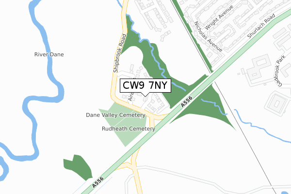
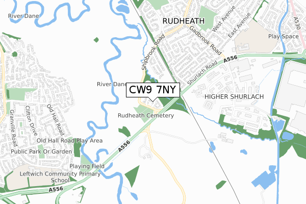
CW9 7NY is located in the Rudheath electoral ward, within the unitary authority of Cheshire West and Chester and the English Parliamentary constituency of Tatton. The Sub Integrated Care Board (ICB) Location is NHS Cheshire and Merseyside ICB - 27D and the police force is Cheshire. This postcode has been in use since May 2019.


GetTheData
Source: OS Open Zoomstack (Ordnance Survey)
Licence: Open Government Licence (requires attribution)
Attribution: Contains OS data © Crown copyright and database right 2025
Source: Open Postcode Geo
Licence: Open Government Licence (requires attribution)
Attribution: Contains OS data © Crown copyright and database right 2025; Contains Royal Mail data © Royal Mail copyright and database right 2025; Source: Office for National Statistics licensed under the Open Government Licence v.3.0
| Easting | 367257 |
| Northing | 372305 |
| Latitude | 53.246761 |
| Longitude | -2.492144 |
GetTheData
Source: Open Postcode Geo
Licence: Open Government Licence
| Country | England |
| Postcode District | CW9 |
➜ See where CW9 is on a map ➜ Where is Rudheath? | |
GetTheData
Source: Land Registry Price Paid Data
Licence: Open Government Licence
| Ward | Rudheath |
| Constituency | Tatton |
GetTheData
Source: ONS Postcode Database
Licence: Open Government Licence
6, LUNE CRESCENT, NORTHWICH, CW9 7NY 2022 21 DEC £411,995 |
1, LUNE CRESCENT, NORTHWICH, CW9 7NY 2022 8 FEB £365,995 |
18, LUNE CRESCENT, NORTHWICH, CW9 7NY 2020 28 FEB £248,995 |
11, LUNE CRESCENT, NORTHWICH, CW9 7NY 2019 9 JUL £242,995 |
2, LUNE CRESCENT, NORTHWICH, CW9 7NY 2019 26 APR £269,995 |
GetTheData
Source: HM Land Registry Price Paid Data
Licence: Contains HM Land Registry data © Crown copyright and database right 2025. This data is licensed under the Open Government Licence v3.0.
| Barclays Bank Ltd (Gadbrook Park) | Gadbrook Park | 453m |
| Gadbrook Business Centre (Gadbrook Park) | Gadbrook Park | 605m |
| Wright Avenue (Gadbrook Road) | Rudheath | 658m |
| Roberts Bakery (Gadbrook Road) | Gadbrook Park | 685m |
| Playground (Old Hall Road) | Leftwich | 777m |
| Northwich Station | 1.7km |
| Greenbank Station | 2.9km |
| Lostock Gralam Station | 2.9km |
GetTheData
Source: NaPTAN
Licence: Open Government Licence
| Percentage of properties with Next Generation Access | 100.0% |
| Percentage of properties with Superfast Broadband | 100.0% |
| Percentage of properties with Ultrafast Broadband | 100.0% |
| Percentage of properties with Full Fibre Broadband | 100.0% |
Superfast Broadband is between 30Mbps and 300Mbps
Ultrafast Broadband is > 300Mbps
| Percentage of properties unable to receive 2Mbps | 0.0% |
| Percentage of properties unable to receive 5Mbps | 0.0% |
| Percentage of properties unable to receive 10Mbps | 0.0% |
| Percentage of properties unable to receive 30Mbps | 0.0% |
GetTheData
Source: Ofcom
Licence: Ofcom Terms of Use (requires attribution)
GetTheData
Source: ONS Postcode Database
Licence: Open Government Licence


➜ Get more ratings from the Food Standards Agency
GetTheData
Source: Food Standards Agency
Licence: FSA terms & conditions
| Last Collection | |||
|---|---|---|---|
| Location | Mon-Fri | Sat | Distance |
| Gadbrook Park | 18:30 | 668m | |
| Gadbrook Park | 17:00 | 11:00 | 668m |
| Rudheath So | 17:00 | 11:30 | 905m |
GetTheData
Source: Dracos
Licence: Creative Commons Attribution-ShareAlike
The below table lists the International Territorial Level (ITL) codes (formerly Nomenclature of Territorial Units for Statistics (NUTS) codes) and Local Administrative Units (LAU) codes for CW9 7NY:
| ITL 1 Code | Name |
|---|---|
| TLD | North West (England) |
| ITL 2 Code | Name |
| TLD6 | Cheshire |
| ITL 3 Code | Name |
| TLD63 | Cheshire West and Chester |
| LAU 1 Code | Name |
| E06000050 | Cheshire West and Chester |
GetTheData
Source: ONS Postcode Directory
Licence: Open Government Licence
The below table lists the Census Output Area (OA), Lower Layer Super Output Area (LSOA), and Middle Layer Super Output Area (MSOA) for CW9 7NY:
| Code | Name | |
|---|---|---|
| OA | E00094488 | |
| LSOA | E01018720 | Cheshire West and Chester 021F |
| MSOA | E02003882 | Cheshire West and Chester 021 |
GetTheData
Source: ONS Postcode Directory
Licence: Open Government Licence
| CW9 7JY | Nicholas Avenue | 282m |
| CW9 7LD | Nicholas Avenue | 302m |
| CW9 7JZ | Roberts Drive | 352m |
| CW9 7LB | Wright Avenue | 393m |
| CW9 7LE | Fletcher Grove | 398m |
| CW9 7JU | Comboy Drive | 408m |
| CW9 7JT | Laburnum Road | 457m |
| CW9 7LA | Malam Drive | 478m |
| CW9 7JX | Shurlach Road | 482m |
| CW9 7LF | Griffiths Drive | 494m |
GetTheData
Source: Open Postcode Geo; Land Registry Price Paid Data
Licence: Open Government Licence