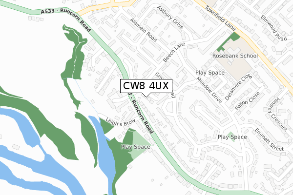
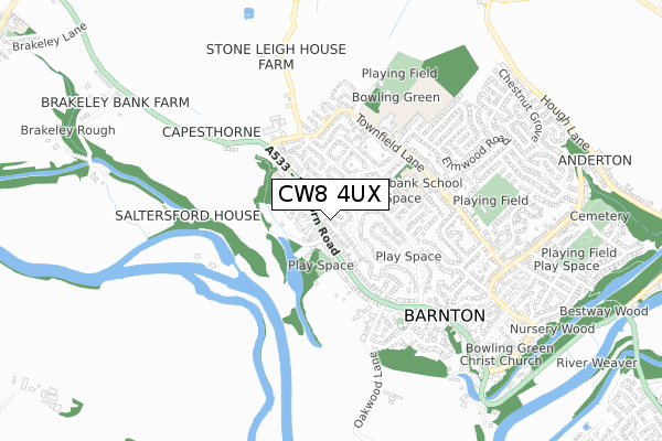
CW8 4UX is located in the Marbury electoral ward, within the unitary authority of Cheshire West and Chester and the English Parliamentary constituency of Tatton. The Sub Integrated Care Board (ICB) Location is NHS Cheshire and Merseyside ICB - 27D and the police force is Cheshire. This postcode has been in use since November 2018.


GetTheData
Source: OS Open Zoomstack (Ordnance Survey)
Licence: Open Government Licence (requires attribution)
Attribution: Contains OS data © Crown copyright and database right 2025
Source: Open Postcode Geo
Licence: Open Government Licence (requires attribution)
Attribution: Contains OS data © Crown copyright and database right 2025; Contains Royal Mail data © Royal Mail copyright and database right 2025; Source: Office for National Statistics licensed under the Open Government Licence v.3.0
| Easting | 363035 |
| Northing | 375334 |
| Latitude | 53.273709 |
| Longitude | -2.555766 |
GetTheData
Source: Open Postcode Geo
Licence: Open Government Licence
| Country | England |
| Postcode District | CW8 |
➜ See where CW8 is on a map ➜ Where is Barnton? | |
GetTheData
Source: Land Registry Price Paid Data
Licence: Open Government Licence
| Ward | Marbury |
| Constituency | Tatton |
GetTheData
Source: ONS Postcode Database
Licence: Open Government Licence
| The Beech Tree Inn (Runcorn Road) | Barnton | 67m |
| Snowdon Street (Runcorn Road) | Barnton | 164m |
| School Drive (Meadow Drive) | Barnton | 167m |
| Beech Lane (Alamein Road) | Barnton | 193m |
| School Drive (Meadow Drive) | Barnton | 196m |
| Greenbank Station | 2.9km |
| Acton Bridge Station | 3.3km |
| Hartford Station | 3.6km |
GetTheData
Source: NaPTAN
Licence: Open Government Licence
| Percentage of properties with Next Generation Access | 100.0% |
| Percentage of properties with Superfast Broadband | 100.0% |
| Percentage of properties with Ultrafast Broadband | 100.0% |
| Percentage of properties with Full Fibre Broadband | 100.0% |
Superfast Broadband is between 30Mbps and 300Mbps
Ultrafast Broadband is > 300Mbps
| Percentage of properties unable to receive 2Mbps | 0.0% |
| Percentage of properties unable to receive 5Mbps | 0.0% |
| Percentage of properties unable to receive 10Mbps | 0.0% |
| Percentage of properties unable to receive 30Mbps | 0.0% |
GetTheData
Source: Ofcom
Licence: Ofcom Terms of Use (requires attribution)
GetTheData
Source: ONS Postcode Database
Licence: Open Government Licence


➜ Get more ratings from the Food Standards Agency
GetTheData
Source: Food Standards Agency
Licence: FSA terms & conditions
| Last Collection | |||
|---|---|---|---|
| Location | Mon-Fri | Sat | Distance |
| Broomfield Lane | 17:30 | 11:30 | 381m |
| Barnton So | 17:30 | 11:30 | 582m |
| Barrymore Road | 17:30 | 11:30 | 1,455m |
GetTheData
Source: Dracos
Licence: Creative Commons Attribution-ShareAlike
The below table lists the International Territorial Level (ITL) codes (formerly Nomenclature of Territorial Units for Statistics (NUTS) codes) and Local Administrative Units (LAU) codes for CW8 4UX:
| ITL 1 Code | Name |
|---|---|
| TLD | North West (England) |
| ITL 2 Code | Name |
| TLD6 | Cheshire |
| ITL 3 Code | Name |
| TLD63 | Cheshire West and Chester |
| LAU 1 Code | Name |
| E06000050 | Cheshire West and Chester |
GetTheData
Source: ONS Postcode Directory
Licence: Open Government Licence
The below table lists the Census Output Area (OA), Lower Layer Super Output Area (LSOA), and Middle Layer Super Output Area (MSOA) for CW8 4UX:
| Code | Name | |
|---|---|---|
| OA | E00094250 | |
| LSOA | E01018672 | Cheshire West and Chester 012B |
| MSOA | E02003876 | Cheshire West and Chester 012 |
GetTheData
Source: ONS Postcode Directory
Licence: Open Government Licence
| CW8 4PF | Grange Road | 66m |
| CW8 4PR | Beech Lane | 88m |
| CW8 4PS | Springfield Crescent | 109m |
| CW8 4PP | Beech Lane | 114m |
| CW8 4HT | Leighs Brow | 115m |
| CW8 4HH | Fair View Close | 118m |
| CW8 4HX | Runcorn Road | 138m |
| CW8 4HS | Runcorn Road | 141m |
| CW8 4HY | Snowdon Street | 143m |
| CW8 4PJ | School Drive | 147m |
GetTheData
Source: Open Postcode Geo; Land Registry Price Paid Data
Licence: Open Government Licence