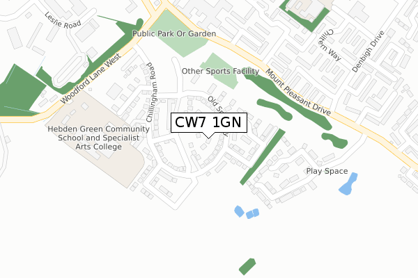
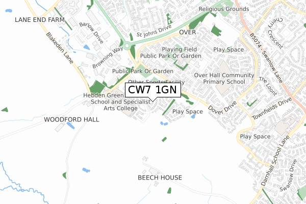
CW7 1GN is located in the Winsford Over & Verdin electoral ward, within the unitary authority of Cheshire West and Chester and the English Parliamentary constituency of Eddisbury. The Sub Integrated Care Board (ICB) Location is NHS Cheshire and Merseyside ICB - 27D and the police force is Cheshire. This postcode has been in use since December 2017.


GetTheData
Source: OS Open Zoomstack (Ordnance Survey)
Licence: Open Government Licence (requires attribution)
Attribution: Contains OS data © Crown copyright and database right 2025
Source: Open Postcode Geo
Licence: Open Government Licence (requires attribution)
Attribution: Contains OS data © Crown copyright and database right 2025; Contains Royal Mail data © Royal Mail copyright and database right 2025; Source: Office for National Statistics licensed under the Open Government Licence v.3.0
| Easting | 363387 |
| Northing | 365069 |
| Latitude | 53.181467 |
| Longitude | -2.549305 |
GetTheData
Source: Open Postcode Geo
Licence: Open Government Licence
| Country | England |
| Postcode District | CW7 |
➜ See where CW7 is on a map ➜ Where is Winsford? | |
GetTheData
Source: Land Registry Price Paid Data
Licence: Open Government Licence
| Ward | Winsford Over & Verdin |
| Constituency | Eddisbury |
GetTheData
Source: ONS Postcode Database
Licence: Open Government Licence
24, ANGUS COURT, WINSFORD, CW7 1GN 2020 16 OCT £192,995 |
2, ANGUS COURT, WINSFORD, CW7 1GN 2017 27 OCT £183,995 |
GetTheData
Source: HM Land Registry Price Paid Data
Licence: Contains HM Land Registry data © Crown copyright and database right 2025. This data is licensed under the Open Government Licence v3.0.
| Playing Fields (Mount Pleasant Drive) | Over | 239m |
| Playing Fields (Mount Pleasant Drive) | Over | 241m |
| Cleveland Way (Denbigh Drive) | Glebe Green | 346m |
| Lulworth Close (Denbigh Drive) | Glebe Green | 368m |
| Montgomery Way (Denbigh Drive) | Glebe Green | 446m |
| Winsford Station | 3.8km |
GetTheData
Source: NaPTAN
Licence: Open Government Licence
| Percentage of properties with Next Generation Access | 100.0% |
| Percentage of properties with Superfast Broadband | 100.0% |
| Percentage of properties with Ultrafast Broadband | 100.0% |
| Percentage of properties with Full Fibre Broadband | 100.0% |
Superfast Broadband is between 30Mbps and 300Mbps
Ultrafast Broadband is > 300Mbps
| Percentage of properties unable to receive 2Mbps | 0.0% |
| Percentage of properties unable to receive 5Mbps | 0.0% |
| Percentage of properties unable to receive 10Mbps | 0.0% |
| Percentage of properties unable to receive 30Mbps | 0.0% |
GetTheData
Source: Ofcom
Licence: Ofcom Terms of Use (requires attribution)
GetTheData
Source: ONS Postcode Database
Licence: Open Government Licence


➜ Get more ratings from the Food Standards Agency
GetTheData
Source: Food Standards Agency
Licence: FSA terms & conditions
| Last Collection | |||
|---|---|---|---|
| Location | Mon-Fri | Sat | Distance |
| St Georges Road | 17:30 | 11:30 | 1,006m |
| Over So | 17:00 | 11:30 | 1,106m |
| Nixon Drive | 16:35 | 11:30 | 1,507m |
GetTheData
Source: Dracos
Licence: Creative Commons Attribution-ShareAlike
The below table lists the International Territorial Level (ITL) codes (formerly Nomenclature of Territorial Units for Statistics (NUTS) codes) and Local Administrative Units (LAU) codes for CW7 1GN:
| ITL 1 Code | Name |
|---|---|
| TLD | North West (England) |
| ITL 2 Code | Name |
| TLD6 | Cheshire |
| ITL 3 Code | Name |
| TLD63 | Cheshire West and Chester |
| LAU 1 Code | Name |
| E06000050 | Cheshire West and Chester |
GetTheData
Source: ONS Postcode Directory
Licence: Open Government Licence
The below table lists the Census Output Area (OA), Lower Layer Super Output Area (LSOA), and Middle Layer Super Output Area (MSOA) for CW7 1GN:
| Code | Name | |
|---|---|---|
| OA | E00094588 | |
| LSOA | E01018739 | Cheshire West and Chester 040C |
| MSOA | E02003889 | Cheshire West and Chester 040 |
GetTheData
Source: ONS Postcode Directory
Licence: Open Government Licence
| CW7 1RJ | Bannister Grove | 186m |
| CW7 1RG | Bannister Court | 228m |
| CW7 1RE | Radcliffe Road | 235m |
| CW7 1TD | Quantock Close | 256m |
| CW7 1RF | Wilkinson Way | 256m |
| CW7 1QN | Cotswold Way | 273m |
| CW7 1RQ | Wilkinson Way | 278m |
| CW7 1QL | Cleveland Way | 288m |
| CW7 1TL | Hambleton Way | 311m |
| CW7 1TN | Hambleton Way | 311m |
GetTheData
Source: Open Postcode Geo; Land Registry Price Paid Data
Licence: Open Government Licence