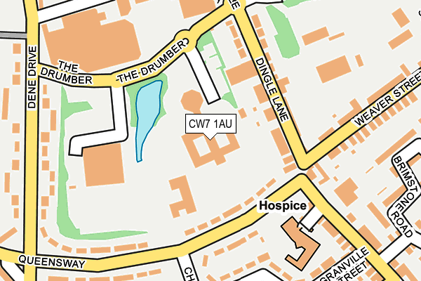
CW7 1AU is located in the Winsford Dene electoral ward, within the unitary authority of Cheshire West and Chester and the English Parliamentary constituency of Eddisbury. The Sub Integrated Care Board (ICB) Location is NHS Cheshire and Merseyside ICB - 27D and the police force is Cheshire. This postcode has been in use since December 1994.


GetTheData
Source: OS OpenMap – Local (Ordnance Survey)
Source: OS VectorMap District (Ordnance Survey)
Licence: Open Government Licence (requires attribution)
| Easting | 364958 |
| Northing | 365940 |
| Latitude | 53.189387 |
| Longitude | -2.525895 |
GetTheData
Source: Open Postcode Geo
Licence: Open Government Licence
| Country | England |
| Postcode District | CW7 |
➜ See where CW7 is on a map ➜ Where is Winsford? | |
GetTheData
Source: Land Registry Price Paid Data
Licence: Open Government Licence
Elevation or altitude of CW7 1AU as distance above sea level:
| Metres | Feet | |
|---|---|---|
| Elevation | 40m | 131ft |
Elevation is measured from the approximate centre of the postcode, to the nearest point on an OS contour line from OS Terrain 50, which has contour spacing of ten vertical metres.
➜ How high above sea level am I? Find the elevation of your current position using your device's GPS.
GetTheData
Source: Open Postcode Elevation
Licence: Open Government Licence
| Ward | Winsford Dene |
| Constituency | Eddisbury |
GetTheData
Source: ONS Postcode Database
Licence: Open Government Licence
| Asda (The Drumber) | Winsford | 154m |
| Queensway (Dene Drive) | Winsford | 265m |
| Queensway (Dene Drive) | Winsford | 278m |
| Siddon Street (High Street) | Winsford | 317m |
| The Queens (Dene Drive) | Winsford | 339m |
| Winsford Station | 2.1km |
GetTheData
Source: NaPTAN
Licence: Open Government Licence
GetTheData
Source: ONS Postcode Database
Licence: Open Government Licence


➜ Get more ratings from the Food Standards Agency
GetTheData
Source: Food Standards Agency
Licence: FSA terms & conditions
| Last Collection | |||
|---|---|---|---|
| Location | Mon-Fri | Sat | Distance |
| Queens Hotel | 17:30 | 11:30 | 371m |
| St Georges Road | 17:30 | 11:30 | 797m |
| Over So | 17:00 | 11:30 | 951m |
GetTheData
Source: Dracos
Licence: Creative Commons Attribution-ShareAlike
The below table lists the International Territorial Level (ITL) codes (formerly Nomenclature of Territorial Units for Statistics (NUTS) codes) and Local Administrative Units (LAU) codes for CW7 1AU:
| ITL 1 Code | Name |
|---|---|
| TLD | North West (England) |
| ITL 2 Code | Name |
| TLD6 | Cheshire |
| ITL 3 Code | Name |
| TLD63 | Cheshire West and Chester |
| LAU 1 Code | Name |
| E06000050 | Cheshire West and Chester |
GetTheData
Source: ONS Postcode Directory
Licence: Open Government Licence
The below table lists the Census Output Area (OA), Lower Layer Super Output Area (LSOA), and Middle Layer Super Output Area (MSOA) for CW7 1AU:
| Code | Name | |
|---|---|---|
| OA | E00094550 | |
| LSOA | E01018731 | Cheshire West and Chester 042A |
| MSOA | E02003890 | Cheshire West and Chester 042 |
GetTheData
Source: ONS Postcode Directory
Licence: Open Government Licence
| CW7 1AB | Dingle Lane | 94m |
| CW7 1BH | Queensway | 101m |
| CW7 1AA | Dingle Lane | 125m |
| CW7 4BE | Grosvenor Street | 175m |
| CW7 4AL | Poole Street | 217m |
| CW7 1BJ | Queensway | 218m |
| CW7 1DW | Granville Square | 218m |
| CW7 4AN | Ways Green | 229m |
| CW7 1BL | Dene Drive | 237m |
| CW7 1DN | Churchill Parkway | 253m |
GetTheData
Source: Open Postcode Geo; Land Registry Price Paid Data
Licence: Open Government Licence