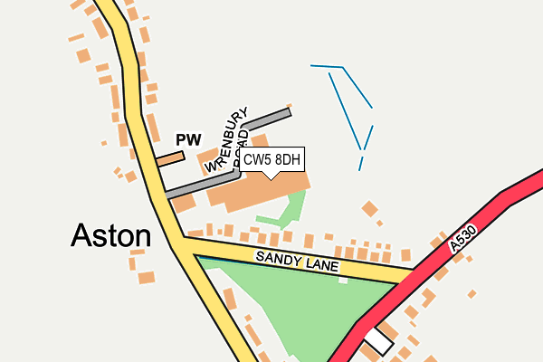
CW5 8DH is located in the Audlem electoral ward, within the unitary authority of Cheshire East and the English Parliamentary constituency of Eddisbury. The Sub Integrated Care Board (ICB) Location is NHS Cheshire and Merseyside ICB - 27D and the police force is Cheshire. This postcode has been in use since January 1980.


GetTheData
Source: OS OpenMap – Local (Ordnance Survey)
Source: OS VectorMap District (Ordnance Survey)
Licence: Open Government Licence (requires attribution)
| Easting | 361198 |
| Northing | 346809 |
| Latitude | 53.017165 |
| Longitude | -2.579846 |
GetTheData
Source: Open Postcode Geo
Licence: Open Government Licence
| Country | England |
| Postcode District | CW5 |
➜ See where CW5 is on a map ➜ Where is Aston? | |
GetTheData
Source: Land Registry Price Paid Data
Licence: Open Government Licence
Elevation or altitude of CW5 8DH as distance above sea level:
| Metres | Feet | |
|---|---|---|
| Elevation | 70m | 230ft |
Elevation is measured from the approximate centre of the postcode, to the nearest point on an OS contour line from OS Terrain 50, which has contour spacing of ten vertical metres.
➜ How high above sea level am I? Find the elevation of your current position using your device's GPS.
GetTheData
Source: Open Postcode Elevation
Licence: Open Government Licence
| Ward | Audlem |
| Constituency | Eddisbury |
GetTheData
Source: ONS Postcode Database
Licence: Open Government Licence
| Crossroads (Whitchurch Road) | Aston | 252m |
| Crossroads (Whitchurch Road) | Aston | 265m |
| Bhurtpore Arms Ph (Wrenbury Road) | Aston | 301m |
| Bhurtpore Arms Ph (Wrenbury Road) | Aston | 302m |
| Sheppenhall Grove (Wrenbury Road) | Aston | 463m |
| Wrenbury Station | 1.1km |
GetTheData
Source: NaPTAN
Licence: Open Government Licence
GetTheData
Source: ONS Postcode Database
Licence: Open Government Licence


➜ Get more ratings from the Food Standards Agency
GetTheData
Source: Food Standards Agency
Licence: FSA terms & conditions
| Last Collection | |||
|---|---|---|---|
| Location | Mon-Fri | Sat | Distance |
| Aston Village | 16:15 | 08:30 | 247m |
| Sheppenhall Grove | 16:15 | 08:30 | 494m |
| Aston | 16:15 | 08:30 | 1,013m |
GetTheData
Source: Dracos
Licence: Creative Commons Attribution-ShareAlike
The below table lists the International Territorial Level (ITL) codes (formerly Nomenclature of Territorial Units for Statistics (NUTS) codes) and Local Administrative Units (LAU) codes for CW5 8DH:
| ITL 1 Code | Name |
|---|---|
| TLD | North West (England) |
| ITL 2 Code | Name |
| TLD6 | Cheshire |
| ITL 3 Code | Name |
| TLD62 | Cheshire East |
| LAU 1 Code | Name |
| E06000049 | Cheshire East |
GetTheData
Source: ONS Postcode Directory
Licence: Open Government Licence
The below table lists the Census Output Area (OA), Lower Layer Super Output Area (LSOA), and Middle Layer Super Output Area (MSOA) for CW5 8DH:
| Code | Name | |
|---|---|---|
| OA | E00093101 | |
| LSOA | E01018450 | Cheshire East 051B |
| MSOA | E02003840 | Cheshire East 051 |
GetTheData
Source: ONS Postcode Directory
Licence: Open Government Licence
| CW5 8DG | Sandy Lane | 80m |
| CW5 8DY | Warwick Gate | 215m |
| CW5 8DZ | Plantation Close | 239m |
| CW5 8DQ | Wrenbury Road | 249m |
| CW5 8DB | Whitchurch Road | 400m |
| CW5 8DF | Sheppenhall Grove | 456m |
| CW5 8BJ | Oaks Close | 543m |
| CW5 8DE | Sheppenhall Lane | 586m |
| CW5 8DJ | Whitchurch Road | 859m |
| CW5 8HA | Wrenbury Road | 1114m |
GetTheData
Source: Open Postcode Geo; Land Registry Price Paid Data
Licence: Open Government Licence