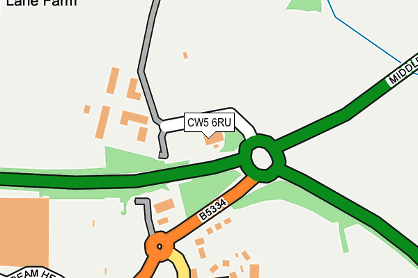
CW5 6RU is located in the Nantwich North and West electoral ward, within the unitary authority of Cheshire East and the English Parliamentary constituency of Crewe and Nantwich. The Sub Integrated Care Board (ICB) Location is NHS Cheshire and Merseyside ICB - 27D and the police force is Cheshire. This postcode has been in use since May 2017.


GetTheData
Source: OS OpenMap – Local (Ordnance Survey)
Source: OS VectorMap District (Ordnance Survey)
Licence: Open Government Licence (requires attribution)
| Easting | 365854 |
| Northing | 353687 |
| Latitude | 53.079325 |
| Longitude | -2.511176 |
GetTheData
Source: Open Postcode Geo
Licence: Open Government Licence
| Country | England |
| Postcode District | CW5 |
➜ See where CW5 is on a map | |
GetTheData
Source: Land Registry Price Paid Data
Licence: Open Government Licence
| Ward | Nantwich North And West |
| Constituency | Crewe And Nantwich |
GetTheData
Source: ONS Postcode Database
Licence: Open Government Licence
| Sainsbury's (Middlewich Road) | Nantwich | 230m |
| Sainsbury's (Middlewich Road) | Nantwich | 239m |
| Brereton Drive | Nantwich | 561m |
| Colleys Lane (Middlewich Road) | Nantwich | 608m |
| Colleys Lane (Middlewich Road) | Nantwich | 612m |
| Nantwich Station | 1.8km |
GetTheData
Source: NaPTAN
Licence: Open Government Licence
GetTheData
Source: ONS Postcode Database
Licence: Open Government Licence


➜ Get more ratings from the Food Standards Agency
GetTheData
Source: Food Standards Agency
Licence: FSA terms & conditions
| Last Collection | |||
|---|---|---|---|
| Location | Mon-Fri | Sat | Distance |
| Whitehouse Lane | 16:45 | 08:30 | 324m |
| Princess Court | 17:00 | 08:30 | 432m |
| Mercer Way | 16:30 | 08:30 | 630m |
GetTheData
Source: Dracos
Licence: Creative Commons Attribution-ShareAlike
The below table lists the International Territorial Level (ITL) codes (formerly Nomenclature of Territorial Units for Statistics (NUTS) codes) and Local Administrative Units (LAU) codes for CW5 6RU:
| ITL 1 Code | Name |
|---|---|
| TLD | North West (England) |
| ITL 2 Code | Name |
| TLD6 | Cheshire |
| ITL 3 Code | Name |
| TLD62 | Cheshire East |
| LAU 1 Code | Name |
| E06000049 | Cheshire East |
GetTheData
Source: ONS Postcode Directory
Licence: Open Government Licence
The below table lists the Census Output Area (OA), Lower Layer Super Output Area (LSOA), and Middle Layer Super Output Area (MSOA) for CW5 6RU:
| Code | Name | |
|---|---|---|
| OA | E00093135 | |
| LSOA | E01018455 | Cheshire East 047C |
| MSOA | E02003836 | Cheshire East 047 |
GetTheData
Source: ONS Postcode Directory
Licence: Open Government Licence
| CW5 6PF | Alvaston Business Park | 131m |
| CW5 6HH | Whitehouse Lane | 206m |
| CW5 6HP | Sycamore Close | 219m |
| CW5 6PG | Cobbs Lane | 362m |
| CW5 6HL | Middlewich Road | 362m |
| CW5 6HJ | Ray Avenue | 381m |
| CW5 6HQ | Whitehouse Lane | 413m |
| CW5 6HW | Willow Court | 481m |
| CW5 5YE | Kingfisher Close | 497m |
| CW5 5YA | Larkspur Close | 503m |
GetTheData
Source: Open Postcode Geo; Land Registry Price Paid Data
Licence: Open Government Licence