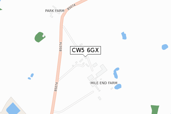
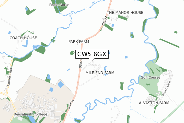
CW5 6GX is located in the Wistaston electoral ward, within the unitary authority of Cheshire East and the English Parliamentary constituency of Crewe and Nantwich. The Sub Integrated Care Board (ICB) Location is NHS Cheshire and Merseyside ICB - 27D and the police force is Cheshire. This postcode has been in use since April 2020.


GetTheData
Source: OS Open Zoomstack (Ordnance Survey)
Licence: Open Government Licence (requires attribution)
Attribution: Contains OS data © Crown copyright and database right 2025
Source: Open Postcode Geo
Licence: Open Government Licence (requires attribution)
Attribution: Contains OS data © Crown copyright and database right 2025; Contains Royal Mail data © Royal Mail copyright and database right 2025; Source: Office for National Statistics licensed under the Open Government Licence v.3.0
| Easting | 367079 |
| Northing | 352739 |
| Latitude | 53.070881 |
| Longitude | -2.492793 |
GetTheData
Source: Open Postcode Geo
Licence: Open Government Licence
| Country | England |
| Postcode District | CW5 |
➜ See where CW5 is on a map | |
GetTheData
Source: Land Registry Price Paid Data
Licence: Open Government Licence
| Ward | Wistaston |
| Constituency | Crewe And Nantwich |
GetTheData
Source: ONS Postcode Database
Licence: Open Government Licence
| Willaston School (Crewe Road) | Willaston | 128m |
| Peacock Hotel (Crewe Road) | Willaston | 302m |
| Peacock Hotel (Crewe Road) | Willaston | 311m |
| Colleys Lane (Crewe Road) | Willaston | 390m |
| Colleys Lane (Crewe Road) | Willaston | 403m |
| Nantwich Station | 1.9km |
| Crewe Station | 4.5km |
GetTheData
Source: NaPTAN
Licence: Open Government Licence
GetTheData
Source: ONS Postcode Database
Licence: Open Government Licence


➜ Get more ratings from the Food Standards Agency
GetTheData
Source: Food Standards Agency
Licence: FSA terms & conditions
| Last Collection | |||
|---|---|---|---|
| Location | Mon-Fri | Sat | Distance |
| Crewe Road | 17:15 | 08:30 | 368m |
| Park Road | 17:00 | 08:30 | 583m |
| Birchin Lane | 17:15 | 08:30 | 852m |
GetTheData
Source: Dracos
Licence: Creative Commons Attribution-ShareAlike
The below table lists the International Territorial Level (ITL) codes (formerly Nomenclature of Territorial Units for Statistics (NUTS) codes) and Local Administrative Units (LAU) codes for CW5 6GX:
| ITL 1 Code | Name |
|---|---|
| TLD | North West (England) |
| ITL 2 Code | Name |
| TLD6 | Cheshire |
| ITL 3 Code | Name |
| TLD62 | Cheshire East |
| LAU 1 Code | Name |
| E06000049 | Cheshire East |
GetTheData
Source: ONS Postcode Directory
Licence: Open Government Licence
The below table lists the Census Output Area (OA), Lower Layer Super Output Area (LSOA), and Middle Layer Super Output Area (MSOA) for CW5 6GX:
| Code | Name | |
|---|---|---|
| OA | E00093310 | |
| LSOA | E01018491 | Cheshire East 046B |
| MSOA | E02003835 | Cheshire East 046 |
GetTheData
Source: ONS Postcode Directory
Licence: Open Government Licence
| CW5 6NY | Brassey Court | 336m |
| CW5 6NA | Hall Drive | 351m |
| CW5 6NS | Colleys Lane | 361m |
| CW5 6NX | Willaston Hall Gardens | 418m |
| CW5 6NR | Crewe Road | 419m |
| CW5 6PL | Park Road | 468m |
| CW5 6NE | Crewe Road | 485m |
| CW5 6NF | Crewe Road | 496m |
| CW5 6RL | Bayley Road | 504m |
| CW5 6RW | Brassey Way | 547m |
GetTheData
Source: Open Postcode Geo; Land Registry Price Paid Data
Licence: Open Government Licence