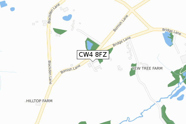
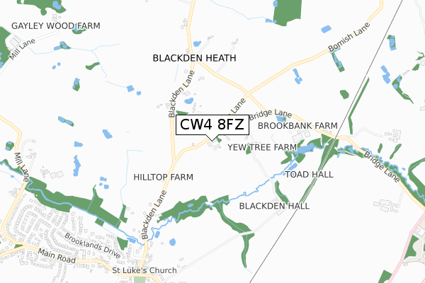
CW4 8FZ is located in the Dane Valley electoral ward, within the unitary authority of Cheshire East and the English Parliamentary constituency of Congleton. The Sub Integrated Care Board (ICB) Location is NHS Cheshire and Merseyside ICB - 27D and the police force is Cheshire. This postcode has been in use since August 2017.


GetTheData
Source: OS Open Zoomstack (Ordnance Survey)
Licence: Open Government Licence (requires attribution)
Attribution: Contains OS data © Crown copyright and database right 2024
Source: Open Postcode Geo
Licence: Open Government Licence (requires attribution)
Attribution: Contains OS data © Crown copyright and database right 2024; Contains Royal Mail data © Royal Mail copyright and database right 2024; Source: Office for National Statistics licensed under the Open Government Licence v.3.0
| Easting | 378349 |
| Northing | 370772 |
| Latitude | 53.233553 |
| Longitude | -2.325818 |
GetTheData
Source: Open Postcode Geo
Licence: Open Government Licence
| Country | England |
| Postcode District | CW4 |
➜ See where CW4 is on a map | |
GetTheData
Source: Land Registry Price Paid Data
Licence: Open Government Licence
| Ward | Dane Valley |
| Constituency | Congleton |
GetTheData
Source: ONS Postcode Database
Licence: Open Government Licence
| St Luke's Church (Main Road) | Goostrey | 883m |
| St Luke's Church (Main Road) | Goostrey | 892m |
| Post Office (Main Road) | Goostrey | 1,145m |
| Post Office (Main Road) | Goostrey | 1,157m |
| Railway Station (Station Road) | Goostrey | 1,206m |
| Goostrey Station | 1.2km |
| Holmes Chapel Station | 4.2km |
| Chelford Station | 5.1km |
GetTheData
Source: NaPTAN
Licence: Open Government Licence
| Percentage of properties with Next Generation Access | 80.0% |
| Percentage of properties with Superfast Broadband | 80.0% |
| Percentage of properties with Ultrafast Broadband | 0.0% |
| Percentage of properties with Full Fibre Broadband | 0.0% |
Superfast Broadband is between 30Mbps and 300Mbps
Ultrafast Broadband is > 300Mbps
| Percentage of properties unable to receive 2Mbps | 0.0% |
| Percentage of properties unable to receive 5Mbps | 20.0% |
| Percentage of properties unable to receive 10Mbps | 20.0% |
| Percentage of properties unable to receive 30Mbps | 20.0% |
GetTheData
Source: Ofcom
Licence: Ofcom Terms of Use (requires attribution)
GetTheData
Source: ONS Postcode Database
Licence: Open Government Licence


➜ Get more ratings from the Food Standards Agency
GetTheData
Source: Food Standards Agency
Licence: FSA terms & conditions
| Last Collection | |||
|---|---|---|---|
| Location | Mon-Fri | Sat | Distance |
| Twemlow Green | 17:00 | 08:45 | 2,100m |
| Booth Bed Lane | 17:00 | 12:00 | 2,116m |
| Bomish Lane | 16:45 | 08:15 | 2,198m |
GetTheData
Source: Dracos
Licence: Creative Commons Attribution-ShareAlike
The below table lists the International Territorial Level (ITL) codes (formerly Nomenclature of Territorial Units for Statistics (NUTS) codes) and Local Administrative Units (LAU) codes for CW4 8FZ:
| ITL 1 Code | Name |
|---|---|
| TLD | North West (England) |
| ITL 2 Code | Name |
| TLD6 | Cheshire |
| ITL 3 Code | Name |
| TLD62 | Cheshire East |
| LAU 1 Code | Name |
| E06000049 | Cheshire East |
GetTheData
Source: ONS Postcode Directory
Licence: Open Government Licence
The below table lists the Census Output Area (OA), Lower Layer Super Output Area (LSOA), and Middle Layer Super Output Area (MSOA) for CW4 8FZ:
| Code | Name | |
|---|---|---|
| OA | E00092908 | |
| LSOA | E01018412 | Cheshire East 022C |
| MSOA | E02003811 | Cheshire East 022 |
GetTheData
Source: ONS Postcode Directory
Licence: Open Government Licence
| CW4 8BY | Blackden | 283m |
| CW4 8DQ | Blackden | 289m |
| CW4 8PH | Blackden Lane | 384m |
| CW4 8DG | Blackden | 606m |
| CW4 8PG | Church Bank | 771m |
| CW4 8PQ | Brookfield Crescent | 861m |
| CW4 8JB | Brooklands Drive | 880m |
| CW4 8DE | Barnshaw | 905m |
| CW4 8PJ | Station Road | 953m |
| CW4 8PE | Main Road | 956m |
GetTheData
Source: Open Postcode Geo; Land Registry Price Paid Data
Licence: Open Government Licence