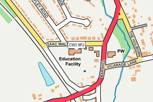
CW3 9PJ is located in the Madeley & Betley electoral ward, within the local authority district of Newcastle-under-Lyme and the English Parliamentary constituency of Stone. The Sub Integrated Care Board (ICB) Location is NHS Staffordshire and Stoke-on-Trent ICB - 05G and the police force is Staffordshire. This postcode has been in use since January 1980.


GetTheData
Source: OS OpenMap – Local (Ordnance Survey)
Source: OS VectorMap District (Ordnance Survey)
Licence: Open Government Licence (requires attribution)
| Easting | 377165 |
| Northing | 344389 |
| Latitude | 52.996335 |
| Longitude | -2.341671 |
GetTheData
Source: Open Postcode Geo
Licence: Open Government Licence
| Country | England |
| Postcode District | CW3 |
➜ See where CW3 is on a map ➜ Where is Madeley? | |
GetTheData
Source: Land Registry Price Paid Data
Licence: Open Government Licence
Elevation or altitude of CW3 9PJ as distance above sea level:
| Metres | Feet | |
|---|---|---|
| Elevation | 110m | 361ft |
Elevation is measured from the approximate centre of the postcode, to the nearest point on an OS contour line from OS Terrain 50, which has contour spacing of ten vertical metres.
➜ How high above sea level am I? Find the elevation of your current position using your device's GPS.
GetTheData
Source: Open Postcode Elevation
Licence: Open Government Licence
| Ward | Madeley & Betley |
| Constituency | Stone |
GetTheData
Source: ONS Postcode Database
Licence: Open Government Licence
| John Offley Road (Walton Way) | Madeley | 77m |
| John Offley Road (Izaac Walton Way) | Madeley | 80m |
| The Holborn (Poolside) | Madeley | 255m |
| Railway Foot Bridge (Moss Lane) | Madeley | 266m |
| Railway Foot Bridge (Moss Lane) | Madeley | 268m |
GetTheData
Source: NaPTAN
Licence: Open Government Licence
GetTheData
Source: ONS Postcode Database
Licence: Open Government Licence


➜ Get more ratings from the Food Standards Agency
GetTheData
Source: Food Standards Agency
Licence: FSA terms & conditions
| Last Collection | |||
|---|---|---|---|
| Location | Mon-Fri | Sat | Distance |
| Station Road | 17:00 | 09:00 | 3,334m |
| Keele Services | 16:45 | 11:00 | 3,471m |
| Keele Post Office | 17:00 | 09:00 | 3,743m |
GetTheData
Source: Dracos
Licence: Creative Commons Attribution-ShareAlike
The below table lists the International Territorial Level (ITL) codes (formerly Nomenclature of Territorial Units for Statistics (NUTS) codes) and Local Administrative Units (LAU) codes for CW3 9PJ:
| ITL 1 Code | Name |
|---|---|
| TLG | West Midlands (England) |
| ITL 2 Code | Name |
| TLG2 | Shropshire and Staffordshire |
| ITL 3 Code | Name |
| TLG24 | Staffordshire CC |
| LAU 1 Code | Name |
| E07000195 | Newcastle-under-Lyme |
GetTheData
Source: ONS Postcode Directory
Licence: Open Government Licence
The below table lists the Census Output Area (OA), Lower Layer Super Output Area (LSOA), and Middle Layer Super Output Area (MSOA) for CW3 9PJ:
| Code | Name | |
|---|---|---|
| OA | E00150701 | |
| LSOA | E01029574 | Newcastle-under-Lyme 013C |
| MSOA | E02006170 | Newcastle-under-Lyme 013 |
GetTheData
Source: ONS Postcode Directory
Licence: Open Government Licence
| CW3 9NA | Izaac Walton Way | 58m |
| CW3 9NE | Izaac Walton Way | 105m |
| CW3 9PR | Moss Lane | 112m |
| CW3 9PL | Woore Road | 144m |
| CW3 9NJ | Morningside | 162m |
| CW3 9QR | Mallard Close | 183m |
| CW3 9GL | Haywood Court | 193m |
| CW3 9NS | Birch Dale | 211m |
| CW3 9PQ | Vicarage Lane | 220m |
| CW3 9NB | John Offley Road | 228m |
GetTheData
Source: Open Postcode Geo; Land Registry Price Paid Data
Licence: Open Government Licence