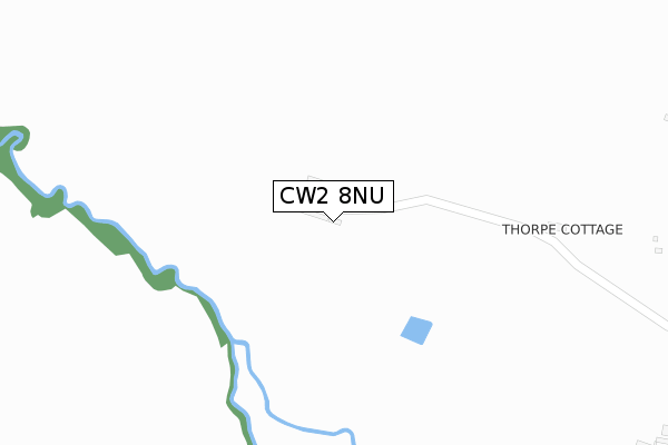
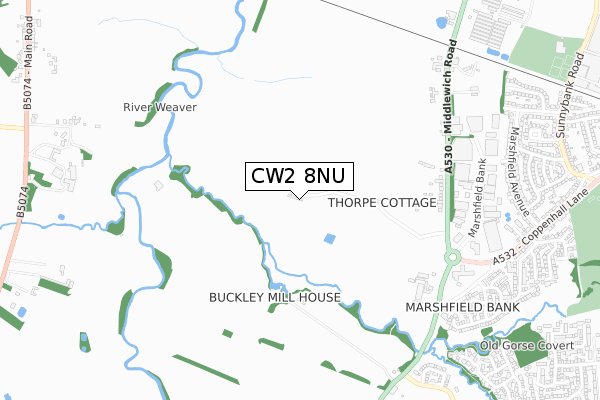
CW2 8NU is located in the Wistaston electoral ward, within the unitary authority of Cheshire East and the English Parliamentary constituency of Crewe and Nantwich. The Sub Integrated Care Board (ICB) Location is NHS Cheshire and Merseyside ICB - 27D and the police force is Cheshire. This postcode has been in use since October 2017.


GetTheData
Source: OS Open Zoomstack (Ordnance Survey)
Licence: Open Government Licence (requires attribution)
Attribution: Contains OS data © Crown copyright and database right 2025
Source: Open Postcode Geo
Licence: Open Government Licence (requires attribution)
Attribution: Contains OS data © Crown copyright and database right 2025; Contains Royal Mail data © Royal Mail copyright and database right 2025; Source: Office for National Statistics licensed under the Open Government Licence v.3.0
| Easting | 366945 |
| Northing | 355813 |
| Latitude | 53.098504 |
| Longitude | -2.495110 |
GetTheData
Source: Open Postcode Geo
Licence: Open Government Licence
| Country | England |
| Postcode District | CW2 |
➜ See where CW2 is on a map | |
GetTheData
Source: Land Registry Price Paid Data
Licence: Open Government Licence
| Ward | Wistaston |
| Constituency | Crewe And Nantwich |
GetTheData
Source: ONS Postcode Database
Licence: Open Government Licence
| Motorsave Direct (Middlewich Road) | Marshfield Bank | 753m |
| The Beefeater (Coppenhall Lane) | Woolstanwood | 797m |
| The Beefeater (Coppenhall Lane) | Woolstanwood | 897m |
| Tarvin Avenue (Marshfield Avenue) | Marshfield | 904m |
| Tarvin Avenue (Marshfield Avenue) | Marshfield | 906m |
| Nantwich Station | 4.2km |
| Crewe Station | 4.3km |
GetTheData
Source: NaPTAN
Licence: Open Government Licence
GetTheData
Source: ONS Postcode Database
Licence: Open Government Licence


➜ Get more ratings from the Food Standards Agency
GetTheData
Source: Food Standards Agency
Licence: FSA terms & conditions
| Last Collection | |||
|---|---|---|---|
| Location | Mon-Fri | Sat | Distance |
| Alvaston | 16:45 | 08:30 | 1,122m |
| Marshfield Bank | 17:30 | 12:15 | 1,259m |
| Worleston So | 17:00 | 10:30 | 1,358m |
GetTheData
Source: Dracos
Licence: Creative Commons Attribution-ShareAlike
The below table lists the International Territorial Level (ITL) codes (formerly Nomenclature of Territorial Units for Statistics (NUTS) codes) and Local Administrative Units (LAU) codes for CW2 8NU:
| ITL 1 Code | Name |
|---|---|
| TLD | North West (England) |
| ITL 2 Code | Name |
| TLD6 | Cheshire |
| ITL 3 Code | Name |
| TLD62 | Cheshire East |
| LAU 1 Code | Name |
| E06000049 | Cheshire East |
GetTheData
Source: ONS Postcode Directory
Licence: Open Government Licence
The below table lists the Census Output Area (OA), Lower Layer Super Output Area (LSOA), and Middle Layer Super Output Area (MSOA) for CW2 8NU:
| Code | Name | |
|---|---|---|
| OA | E00093290 | |
| LSOA | E01018482 | Cheshire East 037A |
| MSOA | E02003828 | Cheshire East 037 |
GetTheData
Source: ONS Postcode Directory
Licence: Open Government Licence
| CW2 8SD | Middlewich Road | 343m |
| CW2 8UY | Marshfield Bank | 710m |
| CW2 8UF | Middlewich Road | 773m |
| CW2 8UE | Coppenhall Lane | 775m |
| CW2 8UQ | Arran Close | 807m |
| CW2 8SB | Middlewich Road | 817m |
| CW2 8TF | Rowton Road | 869m |
| CW2 8UG | Snowdon Drive | 878m |
| CW2 8TQ | Tarvin Avenue | 882m |
| CW2 8UH | Nevis Drive | 883m |
GetTheData
Source: Open Postcode Geo; Land Registry Price Paid Data
Licence: Open Government Licence