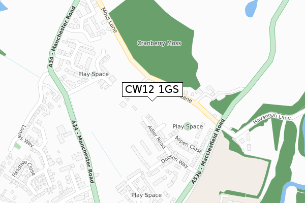
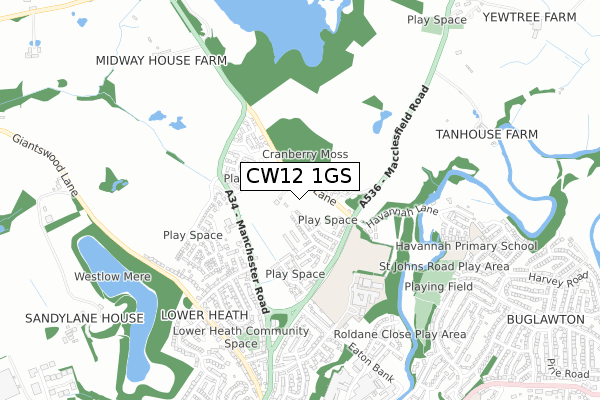
CW12 1GS is located in the Congleton East electoral ward, within the unitary authority of Cheshire East and the English Parliamentary constituency of Congleton. The Sub Integrated Care Board (ICB) Location is NHS Cheshire and Merseyside ICB - 27D and the police force is Cheshire. This postcode has been in use since July 2019.


GetTheData
Source: OS Open Zoomstack (Ordnance Survey)
Licence: Open Government Licence (requires attribution)
Attribution: Contains OS data © Crown copyright and database right 2025
Source: Open Postcode Geo
Licence: Open Government Licence (requires attribution)
Attribution: Contains OS data © Crown copyright and database right 2025; Contains Royal Mail data © Royal Mail copyright and database right 2025; Source: Office for National Statistics licensed under the Open Government Licence v.3.0
| Easting | 386476 |
| Northing | 363075 |
| Latitude | 53.164638 |
| Longitude | -2.203738 |
GetTheData
Source: Open Postcode Geo
Licence: Open Government Licence
| Country | England |
| Postcode District | CW12 |
➜ See where CW12 is on a map ➜ Where is Congleton? | |
GetTheData
Source: Land Registry Price Paid Data
Licence: Open Government Licence
| Ward | Congleton East |
| Constituency | Congleton |
GetTheData
Source: ONS Postcode Database
Licence: Open Government Licence
| Spindle Street (Bromley Road) | Congleton | 110m |
| Spindle Street (Bromley Road) | Congleton | 124m |
| Fox Street (Brook Street) | Congleton | 173m |
| Spragg Street (Willow Street) | Congleton | 193m |
| Fox Street (Brook Street) | Congleton | 193m |
| Congleton Station | 1.1km |
GetTheData
Source: NaPTAN
Licence: Open Government Licence
GetTheData
Source: ONS Postcode Database
Licence: Open Government Licence


➜ Get more ratings from the Food Standards Agency
GetTheData
Source: Food Standards Agency
Licence: FSA terms & conditions
| Last Collection | |||
|---|---|---|---|
| Location | Mon-Fri | Sat | Distance |
| Moor Street | 17:15 | 11:15 | 205m |
| Bromley Road So | 17:15 | 10:00 | 402m |
| Highcroft Avenue | 17:00 | 11:00 | 548m |
GetTheData
Source: Dracos
Licence: Creative Commons Attribution-ShareAlike
The below table lists the International Territorial Level (ITL) codes (formerly Nomenclature of Territorial Units for Statistics (NUTS) codes) and Local Administrative Units (LAU) codes for CW12 1GS:
| ITL 1 Code | Name |
|---|---|
| TLD | North West (England) |
| ITL 2 Code | Name |
| TLD6 | Cheshire |
| ITL 3 Code | Name |
| TLD62 | Cheshire East |
| LAU 1 Code | Name |
| E06000049 | Cheshire East |
GetTheData
Source: ONS Postcode Directory
Licence: Open Government Licence
The below table lists the Census Output Area (OA), Lower Layer Super Output Area (LSOA), and Middle Layer Super Output Area (MSOA) for CW12 1GS:
| Code | Name | |
|---|---|---|
| OA | E00092848 | |
| LSOA | E01018400 | Cheshire East 026C |
| MSOA | E02003815 | Cheshire East 026 |
GetTheData
Source: ONS Postcode Directory
Licence: Open Government Licence
| CW12 1QQ | Hatter Street | 15m |
| CW12 1QR | Spragg Street | 50m |
| CW12 1QN | Spindle Street | 102m |
| CW12 1RE | Herbert Street | 105m |
| CW12 1PT | Bromley Road | 120m |
| CW12 1PS | Roe Street | 143m |
| CW12 1RL | Willow Street | 169m |
| CW12 1RF | Fox Street | 172m |
| CW12 1RD | Brook Street | 186m |
| CW12 3EX | Nursery Lane | 190m |
GetTheData
Source: Open Postcode Geo; Land Registry Price Paid Data
Licence: Open Government Licence