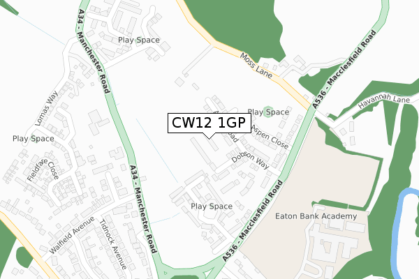
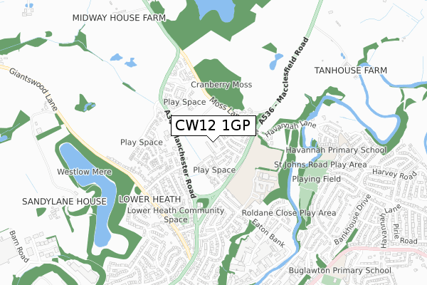
CW12 1GP is located in the Congleton West electoral ward, within the unitary authority of Cheshire East and the English Parliamentary constituency of Congleton. The Sub Integrated Care Board (ICB) Location is NHS Cheshire and Merseyside ICB - 27D and the police force is Cheshire. This postcode has been in use since May 2018.


GetTheData
Source: OS Open Zoomstack (Ordnance Survey)
Licence: Open Government Licence (requires attribution)
Attribution: Contains OS data © Crown copyright and database right 2024
Source: Open Postcode Geo
Licence: Open Government Licence (requires attribution)
Attribution: Contains OS data © Crown copyright and database right 2024; Contains Royal Mail data © Royal Mail copyright and database right 2024; Source: Office for National Statistics licensed under the Open Government Licence v.3.0
| Easting | 386289 |
| Northing | 364501 |
| Latitude | 53.177452 |
| Longitude | -2.206596 |
GetTheData
Source: Open Postcode Geo
Licence: Open Government Licence
| Country | England |
| Postcode District | CW12 |
➜ See where CW12 is on a map ➜ Where is Congleton? | |
GetTheData
Source: Land Registry Price Paid Data
Licence: Open Government Licence
| Ward | Congleton West |
| Constituency | Congleton |
GetTheData
Source: ONS Postcode Database
Licence: Open Government Licence
2024 17 JAN £300,000 |
2023 16 JUN £395,000 |
2023 19 MAY £450,000 |
82, DOBSON WAY, CONGLETON, CW12 1GP 2022 1 JUN £322,995 |
80, DOBSON WAY, CONGLETON, CW12 1GP 2022 27 MAY £285,995 |
86, DOBSON WAY, CONGLETON, CW12 1GP 2022 27 MAY £374,995 |
84, DOBSON WAY, CONGLETON, CW12 1GP 2022 27 MAY £338,995 |
66, DOBSON WAY, CONGLETON, CW12 1GP 2021 17 DEC £318,995 |
60, DOBSON WAY, CONGLETON, CW12 1GP 2021 23 JUL £329,995 |
58, DOBSON WAY, CONGLETON, CW12 1GP 2021 16 JUL £287,995 |
GetTheData
Source: HM Land Registry Price Paid Data
Licence: Contains HM Land Registry data © Crown copyright and database right 2024. This data is licensed under the Open Government Licence v3.0.
| Moss Lane (Macclesfield Road) | Eaton | 237m |
| Havannah Lane (Macclesfield Road) | Eaton | 248m |
| Jackson Road (Macclesfield Road) | Lower Heath | 282m |
| Tidnock Avenue (Walfield Avenue) | Lower Heath | 344m |
| Eaton Bank School (Off Jackson Road) | Congleton | 388m |
| Congleton Station | 2.4km |
GetTheData
Source: NaPTAN
Licence: Open Government Licence
| Percentage of properties with Next Generation Access | 100.0% |
| Percentage of properties with Superfast Broadband | 100.0% |
| Percentage of properties with Ultrafast Broadband | 100.0% |
| Percentage of properties with Full Fibre Broadband | 100.0% |
Superfast Broadband is between 30Mbps and 300Mbps
Ultrafast Broadband is > 300Mbps
| Percentage of properties unable to receive 2Mbps | 0.0% |
| Percentage of properties unable to receive 5Mbps | 0.0% |
| Percentage of properties unable to receive 10Mbps | 0.0% |
| Percentage of properties unable to receive 30Mbps | 0.0% |
GetTheData
Source: Ofcom
Licence: Ofcom Terms of Use (requires attribution)
GetTheData
Source: ONS Postcode Database
Licence: Open Government Licence


➜ Get more ratings from the Food Standards Agency
GetTheData
Source: Food Standards Agency
Licence: FSA terms & conditions
| Last Collection | |||
|---|---|---|---|
| Location | Mon-Fri | Sat | Distance |
| Jackson Road | 16:45 | 10:00 | 430m |
| Giantswood Lane | 16:30 | 11:00 | 488m |
| Hoods Shop | 16:45 | 11:00 | 536m |
GetTheData
Source: Dracos
Licence: Creative Commons Attribution-ShareAlike
The below table lists the International Territorial Level (ITL) codes (formerly Nomenclature of Territorial Units for Statistics (NUTS) codes) and Local Administrative Units (LAU) codes for CW12 1GP:
| ITL 1 Code | Name |
|---|---|
| TLD | North West (England) |
| ITL 2 Code | Name |
| TLD6 | Cheshire |
| ITL 3 Code | Name |
| TLD62 | Cheshire East |
| LAU 1 Code | Name |
| E06000049 | Cheshire East |
GetTheData
Source: ONS Postcode Directory
Licence: Open Government Licence
The below table lists the Census Output Area (OA), Lower Layer Super Output Area (LSOA), and Middle Layer Super Output Area (MSOA) for CW12 1GP:
| Code | Name | |
|---|---|---|
| OA | E00092859 | |
| LSOA | E01018403 | Cheshire East 027D |
| MSOA | E02003816 | Cheshire East 027 |
GetTheData
Source: ONS Postcode Directory
Licence: Open Government Licence
| CW12 1LW | Whittaker Close | 97m |
| CW12 1LY | Galloway Green | 148m |
| CW12 1LZ | Biggs Way | 244m |
| CW12 2NA | Moss Lane | 257m |
| CW12 2HT | Manchester Road | 272m |
| CW12 2HS | Marton Close | 274m |
| CW12 2NB | Havannah Lane | 340m |
| CW12 2HN | Tidnock Avenue | 346m |
| CW12 2HP | Walfield Avenue | 351m |
| CW12 2HX | Manchester Road | 364m |
GetTheData
Source: Open Postcode Geo; Land Registry Price Paid Data
Licence: Open Government Licence