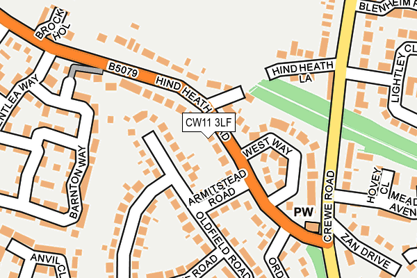
CW11 3LF is located in the Sandbach Elworth electoral ward, within the unitary authority of Cheshire East and the English Parliamentary constituency of Congleton. The Sub Integrated Care Board (ICB) Location is NHS Cheshire and Merseyside ICB - 27D and the police force is Cheshire. This postcode has been in use since May 2017.


GetTheData
Source: OS OpenMap – Local (Ordnance Survey)
Source: OS VectorMap District (Ordnance Survey)
Licence: Open Government Licence (requires attribution)
| Easting | 373820 |
| Northing | 361445 |
| Latitude | 53.149511 |
| Longitude | -2.392901 |
GetTheData
Source: Open Postcode Geo
Licence: Open Government Licence
| Country | England |
| Postcode District | CW11 |
➜ See where CW11 is on a map ➜ Where is Elworth? | |
GetTheData
Source: Land Registry Price Paid Data
Licence: Open Government Licence
| Ward | Sandbach Elworth |
| Constituency | Congleton |
GetTheData
Source: ONS Postcode Database
Licence: Open Government Licence
| Railway Station (Station Road) | Elworth | 31m |
| Railway Station (Station Road) | Elworth | 84m |
| Railway Station (London Road) | Elworth | 124m |
| Railway Station (London Road) | Elworth | 151m |
| Primary School (Middlewich Road) | Elworth | 291m |
| Sandbach Station | 0.1km |
GetTheData
Source: NaPTAN
Licence: Open Government Licence
| Percentage of properties with Next Generation Access | 100.0% |
| Percentage of properties with Superfast Broadband | 100.0% |
| Percentage of properties with Ultrafast Broadband | 15.4% |
| Percentage of properties with Full Fibre Broadband | 0.0% |
Superfast Broadband is between 30Mbps and 300Mbps
Ultrafast Broadband is > 300Mbps
| Median download speed | 24.1Mbps |
| Average download speed | 30.6Mbps |
| Maximum download speed | 80.00Mbps |
| Median upload speed | 5.3Mbps |
| Average upload speed | 7.6Mbps |
| Maximum upload speed | 20.00Mbps |
| Percentage of properties unable to receive 2Mbps | 0.0% |
| Percentage of properties unable to receive 5Mbps | 0.0% |
| Percentage of properties unable to receive 10Mbps | 0.0% |
| Percentage of properties unable to receive 30Mbps | 0.0% |
GetTheData
Source: Ofcom
Licence: Ofcom Terms of Use (requires attribution)
GetTheData
Source: ONS Postcode Database
Licence: Open Government Licence


➜ Get more ratings from the Food Standards Agency
GetTheData
Source: Food Standards Agency
Licence: FSA terms & conditions
| Last Collection | |||
|---|---|---|---|
| Location | Mon-Fri | Sat | Distance |
| Elworth So | 17:00 | 11:00 | 179m |
| The Avenue | 17:00 | 11:30 | 371m |
| St Peters Rise | 17:30 | 11:30 | 566m |
GetTheData
Source: Dracos
Licence: Creative Commons Attribution-ShareAlike
The below table lists the International Territorial Level (ITL) codes (formerly Nomenclature of Territorial Units for Statistics (NUTS) codes) and Local Administrative Units (LAU) codes for CW11 3LF:
| ITL 1 Code | Name |
|---|---|
| TLD | North West (England) |
| ITL 2 Code | Name |
| TLD6 | Cheshire |
| ITL 3 Code | Name |
| TLD62 | Cheshire East |
| LAU 1 Code | Name |
| E06000049 | Cheshire East |
GetTheData
Source: ONS Postcode Directory
Licence: Open Government Licence
The below table lists the Census Output Area (OA), Lower Layer Super Output Area (LSOA), and Middle Layer Super Output Area (MSOA) for CW11 3LF:
| Code | Name | |
|---|---|---|
| OA | E00093059 | |
| LSOA | E01018440 | Cheshire East 031A |
| MSOA | E02003820 | Cheshire East 031 |
GetTheData
Source: ONS Postcode Directory
Licence: Open Government Licence
| CW11 3JF | New Street | 74m |
| CW11 3JG | Station Road | 88m |
| CW11 3JE | Hill Street | 96m |
| CW11 3GD | Kingsley Court | 114m |
| CW11 3FT | Elizabeth Close | 115m |
| CW11 3BD | London Road | 115m |
| CW11 3JJ | Clifton Road | 153m |
| CW11 3BB | London Road | 172m |
| CW11 3FU | Cestria Close | 196m |
| CW11 3FZ | Elanor Road | 203m |
GetTheData
Source: Open Postcode Geo; Land Registry Price Paid Data
Licence: Open Government Licence