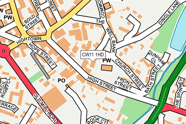
CW11 1HD is located in the Sandbach Town electoral ward, within the unitary authority of Cheshire East and the English Parliamentary constituency of Congleton. The Sub Integrated Care Board (ICB) Location is NHS Cheshire and Merseyside ICB - 27D and the police force is Cheshire. This postcode has been in use since December 1995.


GetTheData
Source: OS OpenMap – Local (Ordnance Survey)
Source: OS VectorMap District (Ordnance Survey)
Licence: Open Government Licence (requires attribution)
| Easting | 375910 |
| Northing | 360793 |
| Latitude | 53.143733 |
| Longitude | -2.361603 |
GetTheData
Source: Open Postcode Geo
Licence: Open Government Licence
| Country | England |
| Postcode District | CW11 |
➜ See where CW11 is on a map ➜ Where is Sandbach? | |
GetTheData
Source: Land Registry Price Paid Data
Licence: Open Government Licence
Elevation or altitude of CW11 1HD as distance above sea level:
| Metres | Feet | |
|---|---|---|
| Elevation | 60m | 197ft |
Elevation is measured from the approximate centre of the postcode, to the nearest point on an OS contour line from OS Terrain 50, which has contour spacing of ten vertical metres.
➜ How high above sea level am I? Find the elevation of your current position using your device's GPS.
GetTheData
Source: Open Postcode Elevation
Licence: Open Government Licence
| Ward | Sandbach Town |
| Constituency | Congleton |
GetTheData
Source: ONS Postcode Database
Licence: Open Government Licence
| Top 'o' Hill (High Street) | Sandbach | 149m |
| Common (The Commons) | Sandbach | 150m |
| Top 'o' Hill (High Street) | Sandbach | 165m |
| Military Arms Ph (Congleton Road) | Sandbach | 183m |
| Waitrose (Old Mill Road) | Sandbach | 207m |
| Sandbach Station | 2.3km |
GetTheData
Source: NaPTAN
Licence: Open Government Licence
GetTheData
Source: ONS Postcode Database
Licence: Open Government Licence


➜ Get more ratings from the Food Standards Agency
GetTheData
Source: Food Standards Agency
Licence: FSA terms & conditions
| Last Collection | |||
|---|---|---|---|
| Location | Mon-Fri | Sat | Distance |
| Sandbach Post Office | 18:15 | 12:30 | 91m |
| St Georges Walk | 18:30 | 93m | |
| Bradwall Road | 18:05 | 12:15 | 406m |
GetTheData
Source: Dracos
Licence: Creative Commons Attribution-ShareAlike
The below table lists the International Territorial Level (ITL) codes (formerly Nomenclature of Territorial Units for Statistics (NUTS) codes) and Local Administrative Units (LAU) codes for CW11 1HD:
| ITL 1 Code | Name |
|---|---|
| TLD | North West (England) |
| ITL 2 Code | Name |
| TLD6 | Cheshire |
| ITL 3 Code | Name |
| TLD62 | Cheshire East |
| LAU 1 Code | Name |
| E06000049 | Cheshire East |
GetTheData
Source: ONS Postcode Directory
Licence: Open Government Licence
The below table lists the Census Output Area (OA), Lower Layer Super Output Area (LSOA), and Middle Layer Super Output Area (MSOA) for CW11 1HD:
| Code | Name | |
|---|---|---|
| OA | E00093015 | |
| LSOA | E01018435 | Cheshire East 032D |
| MSOA | E02003821 | Cheshire East 032 |
GetTheData
Source: ONS Postcode Directory
Licence: Open Government Licence
| CW11 1AP | Market Square | 26m |
| CW11 1AN | High Street | 40m |
| CW11 1AL | High Street | 87m |
| CW11 1FL | Hawk Street | 87m |
| CW11 1GS | Penda Way | 94m |
| CW11 1FQ | Well Bank | 109m |
| CW11 1AF | Georges Walk | 113m |
| CW11 1AH | High Street | 114m |
| CW11 1AX | High Street | 115m |
| CW11 1EG | The Commons | 126m |
GetTheData
Source: Open Postcode Geo; Land Registry Price Paid Data
Licence: Open Government Licence