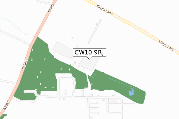
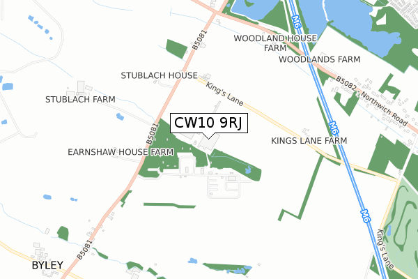
CW10 9RJ is located in the Shakerley electoral ward, within the unitary authority of Cheshire West and Chester and the English Parliamentary constituency of Tatton. The Sub Integrated Care Board (ICB) Location is NHS Cheshire and Merseyside ICB - 27D and the police force is Cheshire. This postcode has been in use since February 2018.


GetTheData
Source: OS Open Zoomstack (Ordnance Survey)
Licence: Open Government Licence (requires attribution)
Attribution: Contains OS data © Crown copyright and database right 2024
Source: Open Postcode Geo
Licence: Open Government Licence (requires attribution)
Attribution: Contains OS data © Crown copyright and database right 2024; Contains Royal Mail data © Royal Mail copyright and database right 2024; Source: Office for National Statistics licensed under the Open Government Licence v.3.0
| Easting | 372936 |
| Northing | 370203 |
| Latitude | 53.228189 |
| Longitude | -2.406862 |
GetTheData
Source: Open Postcode Geo
Licence: Open Government Licence
| Country | England |
| Postcode District | CW10 |
➜ See where CW10 is on a map | |
GetTheData
Source: Land Registry Price Paid Data
Licence: Open Government Licence
| Ward | Shakerley |
| Constituency | Tatton |
GetTheData
Source: ONS Postcode Database
Licence: Open Government Licence
| Garage (Byley Lane) | Byley | 947m |
| Pine View Farm (Northwich Road) | Cranage | 1,010m |
| Holly Bank (Byley Lane) | Cranage | 1,515m |
| Holmes Chapel Station | 4.9km |
| Lostock Gralam Station | 5.9km |
GetTheData
Source: NaPTAN
Licence: Open Government Licence
GetTheData
Source: ONS Postcode Database
Licence: Open Government Licence


➜ Get more ratings from the Food Standards Agency
GetTheData
Source: Food Standards Agency
Licence: FSA terms & conditions
| Last Collection | |||
|---|---|---|---|
| Location | Mon-Fri | Sat | Distance |
| Three Greyhounds | 16:00 | 08:30 | 778m |
| Wash Lane | 16:00 | 08:15 | 1,675m |
| Chapel Lane | 16:00 | 09:30 | 1,871m |
GetTheData
Source: Dracos
Licence: Creative Commons Attribution-ShareAlike
The below table lists the International Territorial Level (ITL) codes (formerly Nomenclature of Territorial Units for Statistics (NUTS) codes) and Local Administrative Units (LAU) codes for CW10 9RJ:
| ITL 1 Code | Name |
|---|---|
| TLD | North West (England) |
| ITL 2 Code | Name |
| TLD6 | Cheshire |
| ITL 3 Code | Name |
| TLD63 | Cheshire West and Chester |
| LAU 1 Code | Name |
| E06000050 | Cheshire West and Chester |
GetTheData
Source: ONS Postcode Directory
Licence: Open Government Licence
The below table lists the Census Output Area (OA), Lower Layer Super Output Area (LSOA), and Middle Layer Super Output Area (MSOA) for CW10 9RJ:
| Code | Name | |
|---|---|---|
| OA | E00094510 | |
| LSOA | E01018722 | Cheshire West and Chester 017E |
| MSOA | E02003878 | Cheshire West and Chester 017 |
GetTheData
Source: ONS Postcode Directory
Licence: Open Government Licence
| CW10 9NB | Kings Lane | 352m |
| CW10 9NE | Byley Lane | 484m |
| CW10 9ND | 564m | |
| WA16 9LB | Holmes Chapel Road | 713m |
| CW10 9NF | 825m | |
| WA16 9LA | Holmes Chapel Road | 992m |
| WA16 9JX | Middlewich Road | 994m |
| WA16 9LE | Northwich Road | 1023m |
| WA16 9LD | Northwich Road | 1043m |
| CW4 8HN | Sandy Lane | 1200m |
GetTheData
Source: Open Postcode Geo; Land Registry Price Paid Data
Licence: Open Government Licence