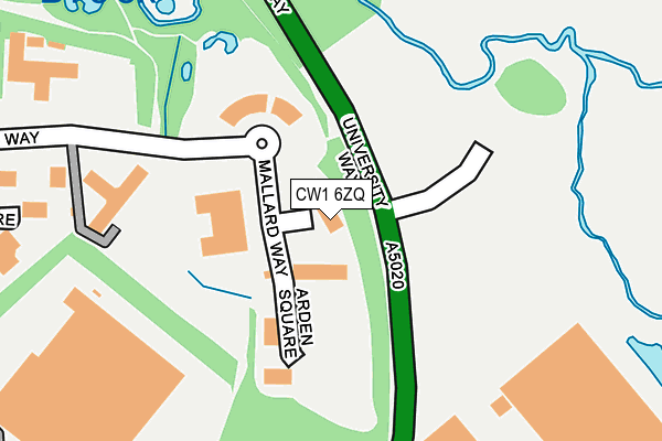
CW1 6ZQ lies on Mallard Way in Crewe. CW1 6ZQ is located in the Crewe East electoral ward, within the unitary authority of Cheshire East and the English Parliamentary constituency of Crewe and Nantwich. The Sub Integrated Care Board (ICB) Location is NHS Cheshire and Merseyside ICB - 27D and the police force is Cheshire. This postcode has been in use since December 2000.


GetTheData
Source: OS OpenMap – Local (Ordnance Survey)
Source: OS VectorMap District (Ordnance Survey)
Licence: Open Government Licence (requires attribution)
| Easting | 372493 |
| Northing | 354916 |
| Latitude | 53.090756 |
| Longitude | -2.412180 |
GetTheData
Source: Open Postcode Geo
Licence: Open Government Licence
| Street | Mallard Way |
| Town/City | Crewe |
| Country | England |
| Postcode District | CW1 |
➜ See where CW1 is on a map ➜ Where is Crewe? | |
GetTheData
Source: Land Registry Price Paid Data
Licence: Open Government Licence
Elevation or altitude of CW1 6ZQ as distance above sea level:
| Metres | Feet | |
|---|---|---|
| Elevation | 50m | 164ft |
Elevation is measured from the approximate centre of the postcode, to the nearest point on an OS contour line from OS Terrain 50, which has contour spacing of ten vertical metres.
➜ How high above sea level am I? Find the elevation of your current position using your device's GPS.
GetTheData
Source: Open Postcode Elevation
Licence: Open Government Licence
| Ward | Crewe East |
| Constituency | Crewe And Nantwich |
GetTheData
Source: ONS Postcode Database
Licence: Open Government Licence
| Business Park (Electra Way) | Crewe | 133m |
| Wulvern House (Electra Way) | Crewe | 293m |
| Wulvern House (Electra Way) | Crewe | 299m |
| Narrow Lane (Crewe Road) | Crewe Green | 453m |
| Narrow Lane (Crewe Road) | Crewe Green | 533m |
| Crewe Station | 1.4km |
GetTheData
Source: NaPTAN
Licence: Open Government Licence
| Median download speed | 49.0Mbps |
| Average download speed | 49.6Mbps |
| Maximum download speed | 60.12Mbps |
| Median upload speed | 12.2Mbps |
| Average upload speed | 12.3Mbps |
| Maximum upload speed | 17.13Mbps |
GetTheData
Source: Ofcom
Licence: Ofcom Terms of Use (requires attribution)
GetTheData
Source: ONS Postcode Database
Licence: Open Government Licence


➜ Get more ratings from the Food Standards Agency
GetTheData
Source: Food Standards Agency
Licence: FSA terms & conditions
| Last Collection | |||
|---|---|---|---|
| Location | Mon-Fri | Sat | Distance |
| Crewe Gates Ind Estate | 18:30 | 575m | |
| Crewe Gates Ind Estate | 18:30 | 11:00 | 575m |
| The College | 17:30 | 12:30 | 686m |
GetTheData
Source: Dracos
Licence: Creative Commons Attribution-ShareAlike
The below table lists the International Territorial Level (ITL) codes (formerly Nomenclature of Territorial Units for Statistics (NUTS) codes) and Local Administrative Units (LAU) codes for CW1 6ZQ:
| ITL 1 Code | Name |
|---|---|
| TLD | North West (England) |
| ITL 2 Code | Name |
| TLD6 | Cheshire |
| ITL 3 Code | Name |
| TLD62 | Cheshire East |
| LAU 1 Code | Name |
| E06000049 | Cheshire East |
GetTheData
Source: ONS Postcode Directory
Licence: Open Government Licence
The below table lists the Census Output Area (OA), Lower Layer Super Output Area (LSOA), and Middle Layer Super Output Area (MSOA) for CW1 6ZQ:
| Code | Name | |
|---|---|---|
| OA | E00174394 | |
| LSOA | E01018502 | Cheshire East 038D |
| MSOA | E02003829 | Cheshire East 038 |
GetTheData
Source: ONS Postcode Directory
Licence: Open Government Licence
| CW1 6GU | Southmere Court | 289m |
| CW1 6GZ | Electra Way | 290m |
| CW1 5NP | Beswick Drive | 341m |
| CW1 5NR | Crewe Road | 447m |
| CW1 5UN | Narrow Lane | 455m |
| CW1 6FF | Lancaster Fields | 471m |
| CW1 6FA | Quakers Coppice | 475m |
| CW1 6NG | Orion Way | 506m |
| CW1 5NS | Crewe Road | 577m |
| CW1 5NW | Crewe Green Road | 611m |
GetTheData
Source: Open Postcode Geo; Land Registry Price Paid Data
Licence: Open Government Licence