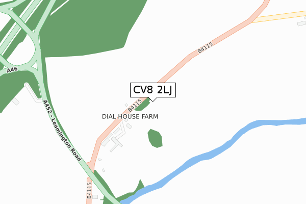
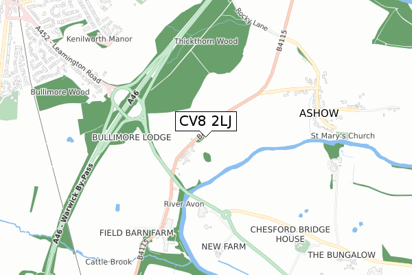
CV8 2LJ is located in the Cubbington & Leek Wootton electoral ward, within the local authority district of Warwick and the English Parliamentary constituency of Kenilworth and Southam. The Sub Integrated Care Board (ICB) Location is NHS Coventry and Warwickshire ICB - B2M3M and the police force is Warwickshire. This postcode has been in use since August 2018.


GetTheData
Source: OS Open Zoomstack (Ordnance Survey)
Licence: Open Government Licence (requires attribution)
Attribution: Contains OS data © Crown copyright and database right 2025
Source: Open Postcode Geo
Licence: Open Government Licence (requires attribution)
Attribution: Contains OS data © Crown copyright and database right 2025; Contains Royal Mail data © Royal Mail copyright and database right 2025; Source: Office for National Statistics licensed under the Open Government Licence v.3.0
| Easting | 430409 |
| Northing | 270207 |
| Latitude | 52.329133 |
| Longitude | -1.555190 |
GetTheData
Source: Open Postcode Geo
Licence: Open Government Licence
| Country | England |
| Postcode District | CV8 |
➜ See where CV8 is on a map | |
GetTheData
Source: Land Registry Price Paid Data
Licence: Open Government Licence
| Ward | Cubbington & Leek Wootton |
| Constituency | Kenilworth And Southam |
GetTheData
Source: ONS Postcode Database
Licence: Open Government Licence
| Chesford Crossroads (Leamington Road) | Kenilworth | 308m |
| Chesford Crossroads (Leamington Road) | Kenilworth | 357m |
| Ramada Hotel (Kenilworth Road) | Leamington Spa | 424m |
| Ramada Hotel (Kenilworth Road) | Leamington Spa | 431m |
| Rocky Lane | Ashow | 689m |
| Warwick Station | 5.1km |
| Leamington Spa Station | 5.1km |
| Warwick Parkway Station | 6.2km |
GetTheData
Source: NaPTAN
Licence: Open Government Licence
GetTheData
Source: ONS Postcode Database
Licence: Open Government Licence


➜ Get more ratings from the Food Standards Agency
GetTheData
Source: Food Standards Agency
Licence: FSA terms & conditions
| Last Collection | |||
|---|---|---|---|
| Location | Mon-Fri | Sat | Distance |
| Ashow | 16:00 | 08:00 | 734m |
| Leamington Road | 16:00 | 07:00 | 813m |
| Windy Arbour Post Office | 17:00 | 12:00 | 1,164m |
GetTheData
Source: Dracos
Licence: Creative Commons Attribution-ShareAlike
The below table lists the International Territorial Level (ITL) codes (formerly Nomenclature of Territorial Units for Statistics (NUTS) codes) and Local Administrative Units (LAU) codes for CV8 2LJ:
| ITL 1 Code | Name |
|---|---|
| TLG | West Midlands (England) |
| ITL 2 Code | Name |
| TLG1 | Herefordshire, Worcestershire and Warwickshire |
| ITL 3 Code | Name |
| TLG13 | Warwickshire CC |
| LAU 1 Code | Name |
| E07000222 | Warwick |
GetTheData
Source: ONS Postcode Directory
Licence: Open Government Licence
The below table lists the Census Output Area (OA), Lower Layer Super Output Area (LSOA), and Middle Layer Super Output Area (MSOA) for CV8 2LJ:
| Code | Name | |
|---|---|---|
| OA | E00159639 | |
| LSOA | E01031308 | Warwick 005G |
| MSOA | E02006523 | Warwick 005 |
GetTheData
Source: ONS Postcode Directory
Licence: Open Government Licence
| CV8 2LD | 371m | |
| CV8 2LT | Leamington Road | 457m |
| CV8 2LN | Chesford Bridge | 550m |
| CV8 2LE | 711m | |
| CV8 2SH | Thickthorn Orchard | 828m |
| CV8 2LB | 864m | |
| CV8 2SQ | Thickthorn Mews | 871m |
| CV8 2AA | Leamington Road | 878m |
| CV8 2AF | Thickthorn Close | 1020m |
| CV8 2BF | The Conifers | 1022m |
GetTheData
Source: Open Postcode Geo; Land Registry Price Paid Data
Licence: Open Government Licence