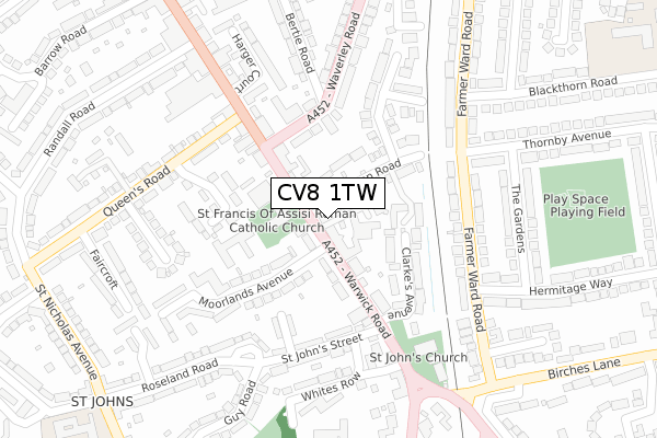
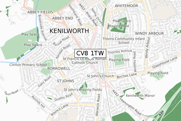
CV8 1TW is located in the Kenilworth St John's electoral ward, within the local authority district of Warwick and the English Parliamentary constituency of Kenilworth and Southam. The Sub Integrated Care Board (ICB) Location is NHS Coventry and Warwickshire ICB - B2M3M and the police force is Warwickshire. This postcode has been in use since January 2020.


GetTheData
Source: OS Open Zoomstack (Ordnance Survey)
Licence: Open Government Licence (requires attribution)
Attribution: Contains OS data © Crown copyright and database right 2024
Source: Open Postcode Geo
Licence: Open Government Licence (requires attribution)
Attribution: Contains OS data © Crown copyright and database right 2024; Contains Royal Mail data © Royal Mail copyright and database right 2024; Source: Office for National Statistics licensed under the Open Government Licence v.3.0
| Easting | 429065 |
| Northing | 271282 |
| Latitude | 52.338870 |
| Longitude | -1.574818 |
GetTheData
Source: Open Postcode Geo
Licence: Open Government Licence
| Country | England |
| Postcode District | CV8 |
➜ See where CV8 is on a map ➜ Where is Kenilworth? | |
GetTheData
Source: Land Registry Price Paid Data
Licence: Open Government Licence
| Ward | Kenilworth St John's |
| Constituency | Kenilworth And Southam |
GetTheData
Source: ONS Postcode Database
Licence: Open Government Licence
| Earl Of Clarendon (Warwick Road) | Kenilworth | 13m |
| St Johns Street (Warwick Road) | Kenilworth | 106m |
| Warwick Road (Waverley Road) | Kenilworth | 154m |
| St Johns Church (Warwick Road) | Kenilworth | 234m |
| The Gardens (Thornby Avenue) | Kenilworth | 267m |
GetTheData
Source: NaPTAN
Licence: Open Government Licence
GetTheData
Source: ONS Postcode Database
Licence: Open Government Licence


➜ Get more ratings from the Food Standards Agency
GetTheData
Source: Food Standards Agency
Licence: FSA terms & conditions
| Last Collection | |||
|---|---|---|---|
| Location | Mon-Fri | Sat | Distance |
| Waverley Road | 18:00 | 07:45 | 389m |
| Barrow Road Business Box | 432m | ||
| Kenilworth Delivery Office | 19:00 | 12:30 | 433m |
GetTheData
Source: Dracos
Licence: Creative Commons Attribution-ShareAlike
The below table lists the International Territorial Level (ITL) codes (formerly Nomenclature of Territorial Units for Statistics (NUTS) codes) and Local Administrative Units (LAU) codes for CV8 1TW:
| ITL 1 Code | Name |
|---|---|
| TLG | West Midlands (England) |
| ITL 2 Code | Name |
| TLG1 | Herefordshire, Worcestershire and Warwickshire |
| ITL 3 Code | Name |
| TLG13 | Warwickshire CC |
| LAU 1 Code | Name |
| E07000222 | Warwick |
GetTheData
Source: ONS Postcode Directory
Licence: Open Government Licence
The below table lists the Census Output Area (OA), Lower Layer Super Output Area (LSOA), and Middle Layer Super Output Area (MSOA) for CV8 1TW:
| Code | Name | |
|---|---|---|
| OA | E00159633 | |
| LSOA | E01031306 | Warwick 003D |
| MSOA | E02006521 | Warwick 003 |
GetTheData
Source: ONS Postcode Directory
Licence: Open Government Licence
| CV8 1HQ | Clarendon Mews | 38m |
| CV8 1HY | Warwick Road | 61m |
| CV8 1HZ | Clarendon Road | 73m |
| CV8 1HS | Warwick Road | 108m |
| CV8 1HA | Grafton Close | 113m |
| CV8 1HR | Moorlands Avenue | 121m |
| CV8 1HP | Warwick Road | 124m |
| CV8 1HX | Clarkes Avenue | 125m |
| CV8 1HL | Warwick Road | 129m |
| CV8 1RJ | John Nash Square | 169m |
GetTheData
Source: Open Postcode Geo; Land Registry Price Paid Data
Licence: Open Government Licence