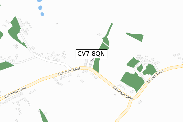
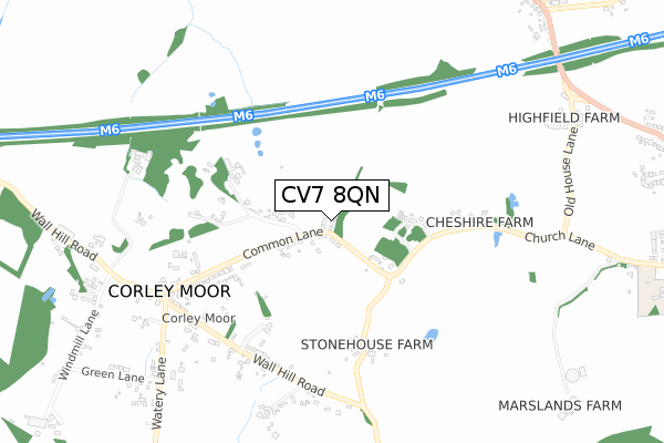
CV7 8QN is located in the Fillongley electoral ward, within the local authority district of North Warwickshire and the English Parliamentary constituency of North Warwickshire. The Sub Integrated Care Board (ICB) Location is NHS Coventry and Warwickshire ICB - B2M3M and the police force is Warwickshire. This postcode has been in use since February 2018.


GetTheData
Source: OS Open Zoomstack (Ordnance Survey)
Licence: Open Government Licence (requires attribution)
Attribution: Contains OS data © Crown copyright and database right 2025
Source: Open Postcode Geo
Licence: Open Government Licence (requires attribution)
Attribution: Contains OS data © Crown copyright and database right 2025; Contains Royal Mail data © Royal Mail copyright and database right 2025; Source: Office for National Statistics licensed under the Open Government Licence v.3.0
| Easting | 428578 |
| Northing | 285258 |
| Latitude | 52.464538 |
| Longitude | -1.580781 |
GetTheData
Source: Open Postcode Geo
Licence: Open Government Licence
| Country | England |
| Postcode District | CV7 |
➜ See where CV7 is on a map ➜ Where is Corley Moor? | |
GetTheData
Source: Land Registry Price Paid Data
Licence: Open Government Licence
| Ward | Fillongley |
| Constituency | North Warwickshire |
GetTheData
Source: ONS Postcode Database
Licence: Open Government Licence
9, THE OAKS, CORLEY, COVENTRY, CV7 8QN 2019 30 SEP £500,000 |
8, THE OAKS, CORLEY, COVENTRY, CV7 8QN 2019 21 MAY £540,000 |
3, THE OAKS, CORLEY, COVENTRY, CV7 8QN 2018 16 NOV £550,000 |
2, THE OAKS, CORLEY, COVENTRY, CV7 8QN 2018 7 NOV £525,000 |
10, THE OAKS, CORLEY, COVENTRY, CV7 8QN 2018 20 SEP £560,000 |
1, THE OAKS, CORLEY, COVENTRY, CV7 8QN 2018 20 AUG £530,000 |
GetTheData
Source: HM Land Registry Price Paid Data
Licence: Contains HM Land Registry data © Crown copyright and database right 2025. This data is licensed under the Open Government Licence v3.0.
| Cheshiire Farm (Church Lane) | Corley | 567m |
| Bull & Butcher (Common Lane) | Corley Moor | 590m |
| Cheshire Farm (Church Lane) | Corley | 642m |
| Bull & Butcher (Common Lane) | Corley Moor | 662m |
| Saracens Head (Coventry Road) | Corley Ash | 1,129m |
GetTheData
Source: NaPTAN
Licence: Open Government Licence
| Percentage of properties with Next Generation Access | 100.0% |
| Percentage of properties with Superfast Broadband | 0.0% |
| Percentage of properties with Ultrafast Broadband | 0.0% |
| Percentage of properties with Full Fibre Broadband | 0.0% |
Superfast Broadband is between 30Mbps and 300Mbps
Ultrafast Broadband is > 300Mbps
| Percentage of properties unable to receive 2Mbps | 0.0% |
| Percentage of properties unable to receive 5Mbps | 0.0% |
| Percentage of properties unable to receive 10Mbps | 16.7% |
| Percentage of properties unable to receive 30Mbps | 100.0% |
GetTheData
Source: Ofcom
Licence: Ofcom Terms of Use (requires attribution)
GetTheData
Source: ONS Postcode Database
Licence: Open Government Licence


➜ Get more ratings from the Food Standards Agency
GetTheData
Source: Food Standards Agency
Licence: FSA terms & conditions
| Last Collection | |||
|---|---|---|---|
| Location | Mon-Fri | Sat | Distance |
| Corley Post Office | 17:15 | 11:00 | 589m |
| Tamworth Road | 17:30 | 11:15 | 1,559m |
| Fillongley Post Office | 17:00 | 10:45 | 1,908m |
GetTheData
Source: Dracos
Licence: Creative Commons Attribution-ShareAlike
The below table lists the International Territorial Level (ITL) codes (formerly Nomenclature of Territorial Units for Statistics (NUTS) codes) and Local Administrative Units (LAU) codes for CV7 8QN:
| ITL 1 Code | Name |
|---|---|
| TLG | West Midlands (England) |
| ITL 2 Code | Name |
| TLG1 | Herefordshire, Worcestershire and Warwickshire |
| ITL 3 Code | Name |
| TLG13 | Warwickshire CC |
| LAU 1 Code | Name |
| E07000218 | North Warwickshire |
GetTheData
Source: ONS Postcode Directory
Licence: Open Government Licence
The below table lists the Census Output Area (OA), Lower Layer Super Output Area (LSOA), and Middle Layer Super Output Area (MSOA) for CV7 8QN:
| Code | Name | |
|---|---|---|
| OA | E00158168 | |
| LSOA | E01031027 | North Warwickshire 007C |
| MSOA | E02006474 | North Warwickshire 007 |
GetTheData
Source: ONS Postcode Directory
Licence: Open Government Licence
| CV7 8AR | The Common | 306m |
| CV7 8AQ | Common Lane | 436m |
| CV7 8AG | Stonehouse Lane | 483m |
| CV7 8BA | Church Lane | 584m |
| CV7 8AH | Wall Hill Road | 611m |
| CV7 8AP | Wall Hill Road | 877m |
| CV7 8AL | Green Lane | 950m |
| CV7 8AJ | Watery Lane | 959m |
| CV7 8RA | Wall Hill Court | 971m |
| CV7 8AN | Windmill Lane | 1038m |
GetTheData
Source: Open Postcode Geo; Land Registry Price Paid Data
Licence: Open Government Licence