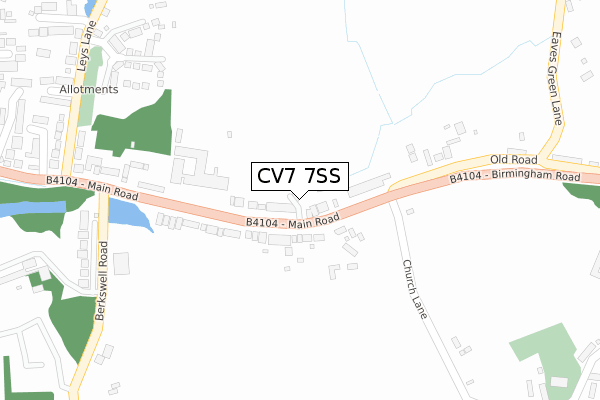
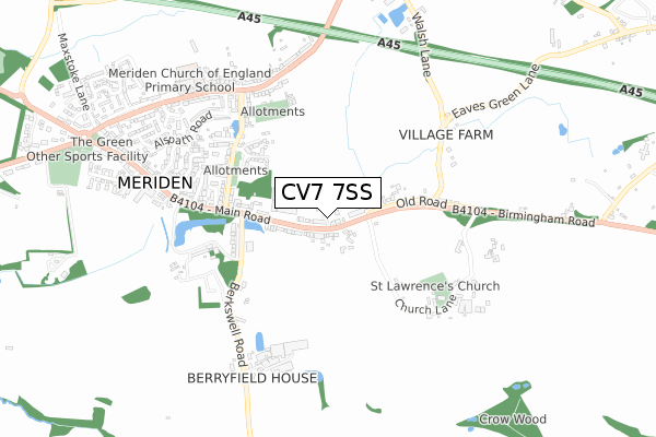
CV7 7SS is located in the Meriden electoral ward, within the metropolitan district of Solihull and the English Parliamentary constituency of Meriden. The Sub Integrated Care Board (ICB) Location is NHS Birmingham and Solihull ICB - 15E and the police force is West Midlands. This postcode has been in use since October 2019.


GetTheData
Source: OS Open Zoomstack (Ordnance Survey)
Licence: Open Government Licence (requires attribution)
Attribution: Contains OS data © Crown copyright and database right 2025
Source: Open Postcode Geo
Licence: Open Government Licence (requires attribution)
Attribution: Contains OS data © Crown copyright and database right 2025; Contains Royal Mail data © Royal Mail copyright and database right 2025; Source: Office for National Statistics licensed under the Open Government Licence v.3.0
| Easting | 424784 |
| Northing | 281979 |
| Latitude | 52.435244 |
| Longitude | -1.636866 |
GetTheData
Source: Open Postcode Geo
Licence: Open Government Licence
| Country | England |
| Postcode District | CV7 |
➜ See where CV7 is on a map ➜ Where is Meriden? | |
GetTheData
Source: Land Registry Price Paid Data
Licence: Open Government Licence
| Ward | Meriden |
| Constituency | Meriden |
GetTheData
Source: ONS Postcode Database
Licence: Open Government Licence
| Church Lane (Birmingham Rd) | Meriden | 79m |
| Church Lane (Birmingham Rd) | Meriden | 131m |
| Leys Lane (Main Rd) | Meriden | 356m |
| Leys Lane (Main Rd) | Meriden | 414m |
| Meriden Green (Main Rd) | Meriden | 777m |
| Hampton-in-Arden Station | 4.3km |
| Berkswell Station | 4.4km |
| Tile Hill Station | 5.2km |
GetTheData
Source: NaPTAN
Licence: Open Government Licence
GetTheData
Source: ONS Postcode Database
Licence: Open Government Licence


➜ Get more ratings from the Food Standards Agency
GetTheData
Source: Food Standards Agency
Licence: FSA terms & conditions
| Last Collection | |||
|---|---|---|---|
| Location | Mon-Fri | Sat | Distance |
| Meriden Hill | 17:00 | 09:45 | 278m |
| Meriden East | 17:00 | 10:30 | 370m |
| Leys Lane | 16:30 | 10:30 | 549m |
GetTheData
Source: Dracos
Licence: Creative Commons Attribution-ShareAlike
The below table lists the International Territorial Level (ITL) codes (formerly Nomenclature of Territorial Units for Statistics (NUTS) codes) and Local Administrative Units (LAU) codes for CV7 7SS:
| ITL 1 Code | Name |
|---|---|
| TLG | West Midlands (England) |
| ITL 2 Code | Name |
| TLG3 | West Midlands |
| ITL 3 Code | Name |
| TLG32 | Solihull |
| LAU 1 Code | Name |
| E08000029 | Solihull |
GetTheData
Source: ONS Postcode Directory
Licence: Open Government Licence
The below table lists the Census Output Area (OA), Lower Layer Super Output Area (LSOA), and Middle Layer Super Output Area (MSOA) for CV7 7SS:
| Code | Name | |
|---|---|---|
| OA | E00051413 | |
| LSOA | E01010165 | Solihull 017C |
| MSOA | E02002097 | Solihull 017 |
GetTheData
Source: ONS Postcode Directory
Licence: Open Government Licence
| CV7 7NH | Main Road | 62m |
| CV7 7NG | Main Road | 95m |
| CV7 7NJ | Main Road | 248m |
| CV7 7QQ | St Laurence Close | 325m |
| CV7 7PF | Mons Avenue | 359m |
| CV7 7PW | Centenary Drive | 377m |
| CV7 7JP | Old Road | 379m |
| CV7 7LR | Whichcote Avenue | 423m |
| CV7 7NW | Waterfall Close | 440m |
| CV7 7LQ | Leys Lane | 445m |
GetTheData
Source: Open Postcode Geo; Land Registry Price Paid Data
Licence: Open Government Licence