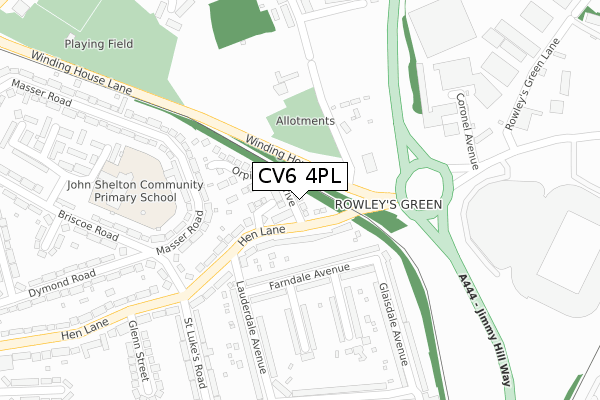
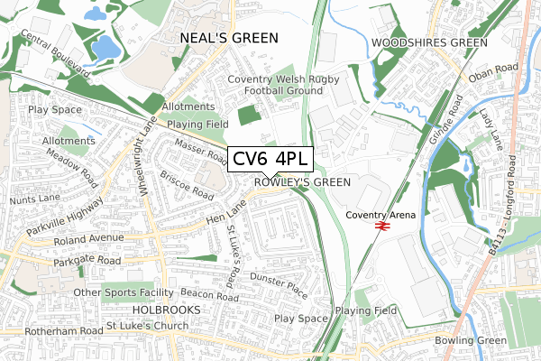
CV6 4PL is located in the Holbrook electoral ward, within the metropolitan district of Coventry and the English Parliamentary constituency of Coventry North West. The Sub Integrated Care Board (ICB) Location is NHS Coventry and Warwickshire ICB - B2M3M and the police force is West Midlands. This postcode has been in use since November 2018.


GetTheData
Source: OS Open Zoomstack (Ordnance Survey)
Licence: Open Government Licence (requires attribution)
Attribution: Contains OS data © Crown copyright and database right 2025
Source: Open Postcode Geo
Licence: Open Government Licence (requires attribution)
Attribution: Contains OS data © Crown copyright and database right 2025; Contains Royal Mail data © Royal Mail copyright and database right 2025; Source: Office for National Statistics licensed under the Open Government Licence v.3.0
| Easting | 433925 |
| Northing | 283548 |
| Latitude | 52.448861 |
| Longitude | -1.502255 |
GetTheData
Source: Open Postcode Geo
Licence: Open Government Licence
| Country | England |
| Postcode District | CV6 |
➜ See where CV6 is on a map ➜ Where is Coventry? | |
GetTheData
Source: Land Registry Price Paid Data
Licence: Open Government Licence
| Ward | Holbrook |
| Constituency | Coventry North West |
GetTheData
Source: ONS Postcode Database
Licence: Open Government Licence
6, KRYSTLE TERRACE, COVENTRY, CV6 4PL 2019 6 DEC £215,500 |
1, KRYSTLE TERRACE, COVENTRY, CV6 4PL 2019 10 MAY £220,000 |
GetTheData
Source: HM Land Registry Price Paid Data
Licence: Contains HM Land Registry data © Crown copyright and database right 2025. This data is licensed under the Open Government Licence v3.0.
| Lauderdale Avenue (Hen Lane) | Rowley's Green | 98m |
| Lauderdale Avenue (Hen Lane) | Rowley's Green | 131m |
| Briscoe Rd (Hen Lane) | Holbrooks | 231m |
| Briscoe Rd (Hen Lane) | Holbrooks | 323m |
| Ricoh Arena (Judds Lane) | Rowley's Green | 408m |
| Coventry Arena Station | 0.6km |
| Bedworth Station | 4.1km |
GetTheData
Source: NaPTAN
Licence: Open Government Licence
| Percentage of properties with Next Generation Access | 100.0% |
| Percentage of properties with Superfast Broadband | 100.0% |
| Percentage of properties with Ultrafast Broadband | 0.0% |
| Percentage of properties with Full Fibre Broadband | 0.0% |
Superfast Broadband is between 30Mbps and 300Mbps
Ultrafast Broadband is > 300Mbps
| Percentage of properties unable to receive 2Mbps | 0.0% |
| Percentage of properties unable to receive 5Mbps | 0.0% |
| Percentage of properties unable to receive 10Mbps | 0.0% |
| Percentage of properties unable to receive 30Mbps | 0.0% |
GetTheData
Source: Ofcom
Licence: Ofcom Terms of Use (requires attribution)
GetTheData
Source: ONS Postcode Database
Licence: Open Government Licence


➜ Get more ratings from the Food Standards Agency
GetTheData
Source: Food Standards Agency
Licence: FSA terms & conditions
| Last Collection | |||
|---|---|---|---|
| Location | Mon-Fri | Sat | Distance |
| Whitmore Park Road P.o. | 18:45 | 11:00 | 491m |
| Wheelwright Lane | 16:45 | 10:45 | 627m |
| Burbages Lane | 16:45 | 10:30 | 640m |
GetTheData
Source: Dracos
Licence: Creative Commons Attribution-ShareAlike
The below table lists the International Territorial Level (ITL) codes (formerly Nomenclature of Territorial Units for Statistics (NUTS) codes) and Local Administrative Units (LAU) codes for CV6 4PL:
| ITL 1 Code | Name |
|---|---|
| TLG | West Midlands (England) |
| ITL 2 Code | Name |
| TLG3 | West Midlands |
| ITL 3 Code | Name |
| TLG33 | Coventry |
| LAU 1 Code | Name |
| E08000026 | Coventry |
GetTheData
Source: ONS Postcode Directory
Licence: Open Government Licence
The below table lists the Census Output Area (OA), Lower Layer Super Output Area (LSOA), and Middle Layer Super Output Area (MSOA) for CV6 4PL:
| Code | Name | |
|---|---|---|
| OA | E00048542 | |
| LSOA | E01009589 | Coventry 001A |
| MSOA | E02001958 | Coventry 001 |
GetTheData
Source: ONS Postcode Directory
Licence: Open Government Licence
| CV6 4LH | Hen Lane | 59m |
| CV6 4NN | Alder Meadow Close | 65m |
| CV6 4LT | Farndale Avenue | 99m |
| CV6 4NH | Redcap Croft | 123m |
| CV6 4LF | Hen Lane | 124m |
| CV6 4LS | Farndale Avenue | 133m |
| CV6 4NJ | Orpington Drive | 140m |
| CV6 4JY | Masser Road | 159m |
| CV6 4LU | Langdale Avenue | 204m |
| CV6 4LG | Hen Lane | 206m |
GetTheData
Source: Open Postcode Geo; Land Registry Price Paid Data
Licence: Open Government Licence