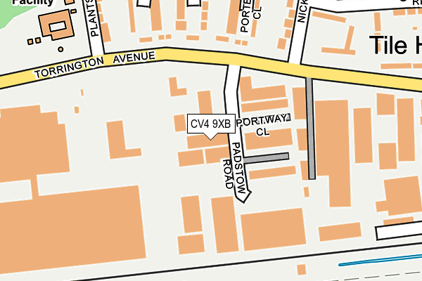
CV4 9XB is located in the Westwood electoral ward, within the metropolitan district of Coventry and the English Parliamentary constituency of Coventry South. The Sub Integrated Care Board (ICB) Location is NHS Coventry and Warwickshire ICB - B2M3M and the police force is West Midlands. This postcode has been in use since August 1993.


GetTheData
Source: OS OpenMap – Local (Ordnance Survey)
Source: OS VectorMap District (Ordnance Survey)
Licence: Open Government Licence (requires attribution)
| Easting | 428179 |
| Northing | 277792 |
| Latitude | 52.397425 |
| Longitude | -1.587289 |
GetTheData
Source: Open Postcode Geo
Licence: Open Government Licence
| Country | England |
| Postcode District | CV4 |
➜ See where CV4 is on a map ➜ Where is Coventry? | |
GetTheData
Source: Land Registry Price Paid Data
Licence: Open Government Licence
Elevation or altitude of CV4 9XB as distance above sea level:
| Metres | Feet | |
|---|---|---|
| Elevation | 110m | 361ft |
Elevation is measured from the approximate centre of the postcode, to the nearest point on an OS contour line from OS Terrain 50, which has contour spacing of ten vertical metres.
➜ How high above sea level am I? Find the elevation of your current position using your device's GPS.
GetTheData
Source: Open Postcode Elevation
Licence: Open Government Licence
| Ward | Westwood |
| Constituency | Coventry South |
GetTheData
Source: ONS Postcode Database
Licence: Open Government Licence
| Plants Hill Crescent (Torrington Ave) | Tile Hill North | 166m |
| Nickson Rd (Torrington Ave) | Tile Hill North | 172m |
| Plants Hill Crescent (Torrington Ave) | Tile Hill North | 174m |
| Nickson Rd (Torrington Ave) | Tile Hill North | 191m |
| Tile Hill Wood School (Tile Hill Lane) | Tile Hill North | 466m |
| Tile Hill Station | 0.7km |
| Canley Station | 2.7km |
| Berkswell Station | 3.8km |
GetTheData
Source: NaPTAN
Licence: Open Government Licence
GetTheData
Source: ONS Postcode Database
Licence: Open Government Licence

➜ Get more ratings from the Food Standards Agency
GetTheData
Source: Food Standards Agency
Licence: FSA terms & conditions
| Last Collection | |||
|---|---|---|---|
| Location | Mon-Fri | Sat | Distance |
| Curriers Close Business Box | 18:30 | 540m | |
| Curriers Close | 18:30 | 11:30 | 565m |
| Torrington Avenue | 16:30 | 09:45 | 630m |
GetTheData
Source: Dracos
Licence: Creative Commons Attribution-ShareAlike
The below table lists the International Territorial Level (ITL) codes (formerly Nomenclature of Territorial Units for Statistics (NUTS) codes) and Local Administrative Units (LAU) codes for CV4 9XB:
| ITL 1 Code | Name |
|---|---|
| TLG | West Midlands (England) |
| ITL 2 Code | Name |
| TLG3 | West Midlands |
| ITL 3 Code | Name |
| TLG33 | Coventry |
| LAU 1 Code | Name |
| E08000026 | Coventry |
GetTheData
Source: ONS Postcode Directory
Licence: Open Government Licence
The below table lists the Census Output Area (OA), Lower Layer Super Output Area (LSOA), and Middle Layer Super Output Area (MSOA) for CV4 9XB:
| Code | Name | |
|---|---|---|
| OA | E00048955 | |
| LSOA | E01032532 | Coventry 036F |
| MSOA | E02001993 | Coventry 036 |
GetTheData
Source: ONS Postcode Directory
Licence: Open Government Licence
| CV4 9HL | Torrington Avenue | 148m |
| CV4 9RP | Sorrel Close | 187m |
| CV4 9RR | Porter Close | 192m |
| CV4 9RN | Wood End Croft | 207m |
| CV4 9HJ | Torrington Avenue | 215m |
| CV4 9RL | Plants Hill Crescent | 233m |
| CV4 9JZ | Ridgley Road | 254m |
| CV4 9RS | Plants Hill Crescent | 267m |
| CV4 9RQ | Plants Hill Crescent | 272m |
| CV4 8BL | Kebull Green | 283m |
GetTheData
Source: Open Postcode Geo; Land Registry Price Paid Data
Licence: Open Government Licence