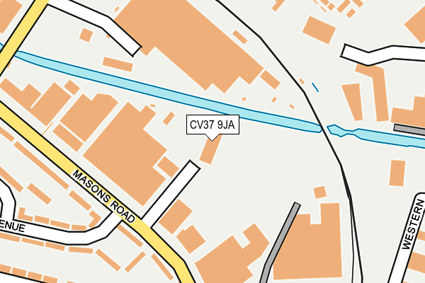
CV37 9JA is located in the Stratford Hathaway electoral ward, within the local authority district of Stratford-on-Avon and the English Parliamentary constituency of Stratford-on-Avon. The Sub Integrated Care Board (ICB) Location is NHS Coventry and Warwickshire ICB - B2M3M and the police force is Warwickshire. This postcode has been in use since June 1981.


GetTheData
Source: OS OpenMap – Local (Ordnance Survey)
Source: OS VectorMap District (Ordnance Survey)
Licence: Open Government Licence (requires attribution)
| Easting | 419281 |
| Northing | 255503 |
| Latitude | 52.197428 |
| Longitude | -1.719326 |
GetTheData
Source: Open Postcode Geo
Licence: Open Government Licence
| Country | England |
| Postcode District | CV37 |
➜ See where CV37 is on a map ➜ Where is Stratford-upon-Avon? | |
GetTheData
Source: Land Registry Price Paid Data
Licence: Open Government Licence
Elevation or altitude of CV37 9JA as distance above sea level:
| Metres | Feet | |
|---|---|---|
| Elevation | 50m | 164ft |
Elevation is measured from the approximate centre of the postcode, to the nearest point on an OS contour line from OS Terrain 50, which has contour spacing of ten vertical metres.
➜ How high above sea level am I? Find the elevation of your current position using your device's GPS.
GetTheData
Source: Open Postcode Elevation
Licence: Open Government Licence
| Ward | Stratford Hathaway |
| Constituency | Stratford-on-avon |
GetTheData
Source: ONS Postcode Database
Licence: Open Government Licence
| Masons Road (Bakers Avenue) | Stratford-upon-avon | 206m |
| Masons Road (Bakers Avenue) | Stratford-upon-avon | 209m |
| Morrisons (Private Road) | Stratford-upon-avon | 222m |
| Timothys Bridge Road (Masons Road) | Stratford-upon-avon | 259m |
| Timothys Bridge Road (Masons Road) | Stratford-upon-avon | 269m |
| Stratford-upon-Avon Station | 0.4km |
| Stratford-upon-Avon Parkway Station | 1.3km |
| Wilmcote Station | 3.8km |
GetTheData
Source: NaPTAN
Licence: Open Government Licence
GetTheData
Source: ONS Postcode Database
Licence: Open Government Licence


➜ Get more ratings from the Food Standards Agency
GetTheData
Source: Food Standards Agency
Licence: FSA terms & conditions
| Last Collection | |||
|---|---|---|---|
| Location | Mon-Fri | Sat | Distance |
| Mason Road Business Box | 18:30 | 166m | |
| Mason Road | 17:30 | 12:15 | 178m |
| Safeways | 16:15 | 12:15 | 222m |
GetTheData
Source: Dracos
Licence: Creative Commons Attribution-ShareAlike
The below table lists the International Territorial Level (ITL) codes (formerly Nomenclature of Territorial Units for Statistics (NUTS) codes) and Local Administrative Units (LAU) codes for CV37 9JA:
| ITL 1 Code | Name |
|---|---|
| TLG | West Midlands (England) |
| ITL 2 Code | Name |
| TLG1 | Herefordshire, Worcestershire and Warwickshire |
| ITL 3 Code | Name |
| TLG13 | Warwickshire CC |
| LAU 1 Code | Name |
| E07000221 | Stratford-on-Avon |
GetTheData
Source: ONS Postcode Directory
Licence: Open Government Licence
The below table lists the Census Output Area (OA), Lower Layer Super Output Area (LSOA), and Middle Layer Super Output Area (MSOA) for CV37 9JA:
| Code | Name | |
|---|---|---|
| OA | E00159271 | |
| LSOA | E01031238 | Stratford-on-Avon 009F |
| MSOA | E02006512 | Stratford-on-Avon 009 |
GetTheData
Source: ONS Postcode Directory
Licence: Open Government Licence
| CV37 0AW | The Waterways | 243m |
| CV37 9NE | Masons Road | 248m |
| CV37 0AR | Portia Road | 251m |
| CV37 9PW | Baker Avenue | 254m |
| CV37 9NG | Mossop Court | 255m |
| CV37 9DW | Lodge Road | 257m |
| CV37 0BL | Ophelia Drive | 274m |
| CV37 0AU | Park Court | 274m |
| CV37 9NF | Masons Road | 291m |
| CV37 9NA | Masons Road | 299m |
GetTheData
Source: Open Postcode Geo; Land Registry Price Paid Data
Licence: Open Government Licence