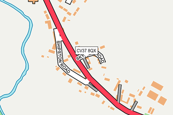
CV37 8QX is located in the Quinton electoral ward, within the local authority district of Stratford-on-Avon and the English Parliamentary constituency of Stratford-on-Avon. The Sub Integrated Care Board (ICB) Location is NHS Coventry and Warwickshire ICB - B2M3M and the police force is Warwickshire. This postcode has been in use since February 2017.


GetTheData
Source: OS OpenMap – Local (Ordnance Survey)
Source: OS VectorMap District (Ordnance Survey)
Licence: Open Government Licence (requires attribution)
| Easting | 423191 |
| Northing | 248413 |
| Latitude | 52.133550 |
| Longitude | -1.662593 |
GetTheData
Source: Open Postcode Geo
Licence: Open Government Licence
| Country | England |
| Postcode District | CV37 |
➜ See where CV37 is on a map ➜ Where is Alderminster? | |
GetTheData
Source: Land Registry Price Paid Data
Licence: Open Government Licence
| Ward | Quinton |
| Constituency | Stratford-on-avon |
GetTheData
Source: ONS Postcode Database
Licence: Open Government Licence
2022 8 JUN £600,000 |
2021 14 MAY £550,000 |
3, KINGFISHER DRIVE, ALDERMINSTER, STRATFORD-UPON-AVON, CV37 8QX 2017 27 OCT £600,000 |
2017 11 OCT £555,950 |
2017 27 SEP £549,950 |
GetTheData
Source: HM Land Registry Price Paid Data
Licence: Contains HM Land Registry data © Crown copyright and database right 2025. This data is licensed under the Open Government Licence v3.0.
| Tithe Farm (Shipston Road) | Alderminster | 225m |
| Tithe Farm (Shipston Road) | Alderminster | 231m |
| Church (Shipston Road) | Alderminster | 334m |
| Church (Shipston Road) | Alderminster | 357m |
| Bell (Shipston Road) | Alderminster | 541m |
GetTheData
Source: NaPTAN
Licence: Open Government Licence
| Percentage of properties with Next Generation Access | 100.0% |
| Percentage of properties with Superfast Broadband | 100.0% |
| Percentage of properties with Ultrafast Broadband | 0.0% |
| Percentage of properties with Full Fibre Broadband | 0.0% |
Superfast Broadband is between 30Mbps and 300Mbps
Ultrafast Broadband is > 300Mbps
| Percentage of properties unable to receive 2Mbps | 0.0% |
| Percentage of properties unable to receive 5Mbps | 0.0% |
| Percentage of properties unable to receive 10Mbps | 0.0% |
| Percentage of properties unable to receive 30Mbps | 0.0% |
GetTheData
Source: Ofcom
Licence: Ofcom Terms of Use (requires attribution)
GetTheData
Source: ONS Postcode Database
Licence: Open Government Licence


➜ Get more ratings from the Food Standards Agency
GetTheData
Source: Food Standards Agency
Licence: FSA terms & conditions
| Last Collection | |||
|---|---|---|---|
| Location | Mon-Fri | Sat | Distance |
| Alderminster | 16:30 | 09:00 | 399m |
| Crimscote | 15:45 | 10:45 | 1,088m |
| Wimpstone | 16:30 | 07:00 | 1,925m |
GetTheData
Source: Dracos
Licence: Creative Commons Attribution-ShareAlike
The below table lists the International Territorial Level (ITL) codes (formerly Nomenclature of Territorial Units for Statistics (NUTS) codes) and Local Administrative Units (LAU) codes for CV37 8QX:
| ITL 1 Code | Name |
|---|---|
| TLG | West Midlands (England) |
| ITL 2 Code | Name |
| TLG1 | Herefordshire, Worcestershire and Warwickshire |
| ITL 3 Code | Name |
| TLG13 | Warwickshire CC |
| LAU 1 Code | Name |
| E07000221 | Stratford-on-Avon |
GetTheData
Source: ONS Postcode Directory
Licence: Open Government Licence
The below table lists the Census Output Area (OA), Lower Layer Super Output Area (LSOA), and Middle Layer Super Output Area (MSOA) for CV37 8QX:
| Code | Name | |
|---|---|---|
| OA | E00159032 | |
| LSOA | E01031196 | Stratford-on-Avon 014A |
| MSOA | E02006517 | Stratford-on-Avon 014 |
GetTheData
Source: ONS Postcode Directory
Licence: Open Government Licence
| CV37 8NX | 83m | |
| CV37 8NY | 148m | |
| CV37 8PF | Church Cottages | 221m |
| CV37 8PA | Campden Lawns | 244m |
| CV37 8PE | New Road | 406m |
| CV37 8NZ | Sutcliffe Avenue | 407m |
| CV37 8PD | Whitchurch | 989m |
| CV37 8NU | 1047m | |
| CV37 8UE | 1107m | |
| CV37 8PG | 1155m |
GetTheData
Source: Open Postcode Geo; Land Registry Price Paid Data
Licence: Open Government Licence