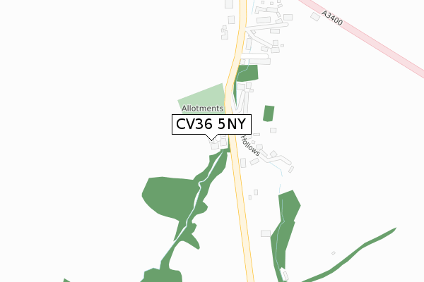
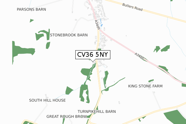
CV36 5NY is located in the Brailes & Compton electoral ward, within the local authority district of Stratford-on-Avon and the English Parliamentary constituency of Stratford-on-Avon. The Sub Integrated Care Board (ICB) Location is NHS Coventry and Warwickshire ICB - B2M3M and the police force is Warwickshire. This postcode has been in use since August 2018.


GetTheData
Source: OS Open Zoomstack (Ordnance Survey)
Licence: Open Government Licence (requires attribution)
Attribution: Contains OS data © Crown copyright and database right 2025
Source: Open Postcode Geo
Licence: Open Government Licence (requires attribution)
Attribution: Contains OS data © Crown copyright and database right 2025; Contains Royal Mail data © Royal Mail copyright and database right 2025; Source: Office for National Statistics licensed under the Open Government Licence v.3.0
| Easting | 428929 |
| Northing | 231642 |
| Latitude | 51.982500 |
| Longitude | -1.580177 |
GetTheData
Source: Open Postcode Geo
Licence: Open Government Licence
| Country | England |
| Postcode District | CV36 |
➜ See where CV36 is on a map ➜ Where is Long Compton? | |
GetTheData
Source: Land Registry Price Paid Data
Licence: Open Government Licence
| Ward | Brailes & Compton |
| Constituency | Stratford-on-avon |
GetTheData
Source: ONS Postcode Database
Licence: Open Government Licence
STOW HOUSE, PARK COURT, LONG COMPTON, SHIPSTON-ON-STOUR, CV36 5NY 2019 30 AUG £780,000 |
CAMPDEN HOUSE, PARK COURT, LONG COMPTON, SHIPSTON-ON-STOUR, CV36 5NY 2019 19 JUN £700,000 |
BOURTON HOUSE, PARK COURT, LONG COMPTON, SHIPSTON-ON-STOUR, CV36 5NY 2019 30 APR £600,000 |
NORTON HOUSE, PARK COURT, LONG COMPTON, SHIPSTON-ON-STOUR, CV36 5NY 2019 14 MAR £610,000 |
KINGHAM HOUSE, PARK COURT, LONG COMPTON, SHIPSTON-ON-STOUR, CV36 5NY 2018 28 SEP £850,000 |
GetTheData
Source: HM Land Registry Price Paid Data
Licence: Contains HM Land Registry data © Crown copyright and database right 2025. This data is licensed under the Open Government Licence v3.0.
| Butlers Close (Back Lane) | Long Compton | 923m |
| School Close (Shipston Road) | Long Compton | 924m |
| Butlers Close (Back Lane) | Long Compton | 924m |
| Church (Shipston Road) | Long Compton | 1,349m |
| Church (Shipston Road) | Long Compton | 1,351m |
GetTheData
Source: NaPTAN
Licence: Open Government Licence
| Percentage of properties with Next Generation Access | 100.0% |
| Percentage of properties with Superfast Broadband | 100.0% |
| Percentage of properties with Ultrafast Broadband | 100.0% |
| Percentage of properties with Full Fibre Broadband | 100.0% |
Superfast Broadband is between 30Mbps and 300Mbps
Ultrafast Broadband is > 300Mbps
| Percentage of properties unable to receive 2Mbps | 0.0% |
| Percentage of properties unable to receive 5Mbps | 0.0% |
| Percentage of properties unable to receive 10Mbps | 0.0% |
| Percentage of properties unable to receive 30Mbps | 0.0% |
GetTheData
Source: Ofcom
Licence: Ofcom Terms of Use (requires attribution)
GetTheData
Source: ONS Postcode Database
Licence: Open Government Licence


➜ Get more ratings from the Food Standards Agency
GetTheData
Source: Food Standards Agency
Licence: FSA terms & conditions
| Last Collection | |||
|---|---|---|---|
| Location | Mon-Fri | Sat | Distance |
| Long Compton - Southend | 15:45 | 09:30 | 590m |
| Long Compton Post Office | 15:40 | 09:30 | 1,189m |
| Long Compton - Northend | 15:45 | 09:30 | 1,586m |
GetTheData
Source: Dracos
Licence: Creative Commons Attribution-ShareAlike
The below table lists the International Territorial Level (ITL) codes (formerly Nomenclature of Territorial Units for Statistics (NUTS) codes) and Local Administrative Units (LAU) codes for CV36 5NY:
| ITL 1 Code | Name |
|---|---|
| TLG | West Midlands (England) |
| ITL 2 Code | Name |
| TLG1 | Herefordshire, Worcestershire and Warwickshire |
| ITL 3 Code | Name |
| TLG13 | Warwickshire CC |
| LAU 1 Code | Name |
| E07000221 | Stratford-on-Avon |
GetTheData
Source: ONS Postcode Directory
Licence: Open Government Licence
The below table lists the Census Output Area (OA), Lower Layer Super Output Area (LSOA), and Middle Layer Super Output Area (MSOA) for CV36 5NY:
| Code | Name | |
|---|---|---|
| OA | E00159109 | |
| LSOA | E01031209 | Stratford-on-Avon 015B |
| MSOA | E02006518 | Stratford-on-Avon 015 |
GetTheData
Source: ONS Postcode Directory
Licence: Open Government Licence
| CV36 5NX | The Hollows | 146m |
| CV36 5LN | Wheelwright Gardens | 222m |
| CV36 5LE | Old Road | 290m |
| CV36 5LF | College Lane | 323m |
| CV36 5LD | Oxford Road | 456m |
| CV36 5LB | Clarks Lane | 583m |
| CV36 5JG | Weavers Cottages | 621m |
| CV36 5JE | Barncroft | 694m |
| CV36 5JS | Main Street | 792m |
| CV36 5JZ | Butlers Road | 874m |
GetTheData
Source: Open Postcode Geo; Land Registry Price Paid Data
Licence: Open Government Licence