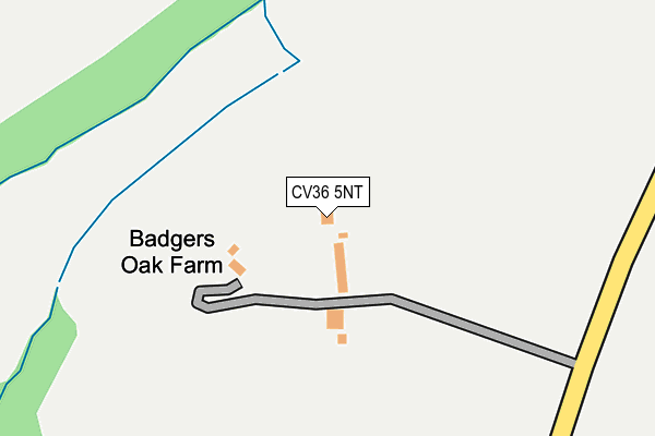
CV36 5NT is located in the Brailes & Compton electoral ward, within the local authority district of Stratford-on-Avon and the English Parliamentary constituency of Stratford-on-Avon. The Sub Integrated Care Board (ICB) Location is NHS Coventry and Warwickshire ICB - B2M3M and the police force is Warwickshire. This postcode has been in use since September 1991.


GetTheData
Source: OS OpenMap – Local (Ordnance Survey)
Source: OS VectorMap District (Ordnance Survey)
Licence: Open Government Licence (requires attribution)
| Easting | 424394 |
| Northing | 234208 |
| Latitude | 52.005776 |
| Longitude | -1.646039 |
GetTheData
Source: Open Postcode Geo
Licence: Open Government Licence
| Country | England |
| Postcode District | CV36 |
➜ See where CV36 is on a map | |
GetTheData
Source: Land Registry Price Paid Data
Licence: Open Government Licence
Elevation or altitude of CV36 5NT as distance above sea level:
| Metres | Feet | |
|---|---|---|
| Elevation | 110m | 361ft |
Elevation is measured from the approximate centre of the postcode, to the nearest point on an OS contour line from OS Terrain 50, which has contour spacing of ten vertical metres.
➜ How high above sea level am I? Find the elevation of your current position using your device's GPS.
GetTheData
Source: Open Postcode Elevation
Licence: Open Government Licence
| Ward | Brailes & Compton |
| Constituency | Stratford-on-avon |
GetTheData
Source: ONS Postcode Database
Licence: Open Government Licence
| Parsonage Farm (Barton On Heath Road) | Great Wolford | 642m |
| The Green (Wolford Road) | Great Wolford | 649m |
| The Green (Wolford Road) | Great Wolford | 662m |
| Church (The Green) | Great Wolford | 711m |
| Church (The Green) | Great Wolford | 723m |
| Moreton-in-Marsh Station | 4km |
GetTheData
Source: NaPTAN
Licence: Open Government Licence
GetTheData
Source: ONS Postcode Database
Licence: Open Government Licence
| Last Collection | |||
|---|---|---|---|
| Location | Mon-Fri | Sat | Distance |
| Todenham | 15:30 | 09:15 | 2,107m |
| Barton On The Heath | 16:00 | 09:45 | 2,211m |
| Todenham Road | 15:15 | 07:30 | 3,854m |
GetTheData
Source: Dracos
Licence: Creative Commons Attribution-ShareAlike
The below table lists the International Territorial Level (ITL) codes (formerly Nomenclature of Territorial Units for Statistics (NUTS) codes) and Local Administrative Units (LAU) codes for CV36 5NT:
| ITL 1 Code | Name |
|---|---|
| TLG | West Midlands (England) |
| ITL 2 Code | Name |
| TLG1 | Herefordshire, Worcestershire and Warwickshire |
| ITL 3 Code | Name |
| TLG13 | Warwickshire CC |
| LAU 1 Code | Name |
| E07000221 | Stratford-on-Avon |
GetTheData
Source: ONS Postcode Directory
Licence: Open Government Licence
The below table lists the Census Output Area (OA), Lower Layer Super Output Area (LSOA), and Middle Layer Super Output Area (MSOA) for CV36 5NT:
| Code | Name | |
|---|---|---|
| OA | E00172277 | |
| LSOA | E01031209 | Stratford-on-Avon 015B |
| MSOA | E02006518 | Stratford-on-Avon 015 |
GetTheData
Source: ONS Postcode Directory
Licence: Open Government Licence
| CV36 5NL | Ingram Close | 382m |
| CV36 5NJ | The Leys | 432m |
| CV36 5NS | Carters Leaze | 471m |
| CV36 5NP | Brook Cottages | 555m |
| CV36 5NQ | 601m | |
| CV36 5NW | Brook Hill | 691m |
| CV36 5NF | Nethercote | 1087m |
| CV36 5NE | 1092m | |
| GL56 9NZ | Wolford Road | 1582m |
| GL56 0PE | Great Wolford Road | 1697m |
GetTheData
Source: Open Postcode Geo; Land Registry Price Paid Data
Licence: Open Government Licence