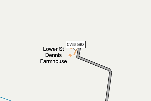
CV36 5BQ is located in the Tysoe electoral ward, within the local authority district of Stratford-on-Avon and the English Parliamentary constituency of Stratford-on-Avon. The Sub Integrated Care Board (ICB) Location is NHS Coventry and Warwickshire ICB - B2M3M and the police force is Warwickshire. This postcode has been in use since January 1980.


GetTheData
Source: OS OpenMap – Local (Ordnance Survey)
Source: OS VectorMap District (Ordnance Survey)
Licence: Open Government Licence (requires attribution)
| Easting | 429061 |
| Northing | 240968 |
| Latitude | 52.066340 |
| Longitude | -1.577467 |
GetTheData
Source: Open Postcode Geo
Licence: Open Government Licence
| Country | England |
| Postcode District | CV36 |
➜ See where CV36 is on a map | |
GetTheData
Source: Land Registry Price Paid Data
Licence: Open Government Licence
Elevation or altitude of CV36 5BQ as distance above sea level:
| Metres | Feet | |
|---|---|---|
| Elevation | 90m | 295ft |
Elevation is measured from the approximate centre of the postcode, to the nearest point on an OS contour line from OS Terrain 50, which has contour spacing of ten vertical metres.
➜ How high above sea level am I? Find the elevation of your current position using your device's GPS.
GetTheData
Source: Open Postcode Elevation
Licence: Open Government Licence
| Ward | Tysoe |
| Constituency | Stratford-on-avon |
GetTheData
Source: ONS Postcode Database
Licence: Open Government Licence
| Fountain (Fant Hill) | Upper Brailes | 1,534m |
| Castle Hill (Fant Hill) | Upper Brailes | 1,547m |
| The Gate (Main Road) | Upper Brailes | 1,823m |
| The Gate (Main Road) | Upper Brailes | 1,832m |
GetTheData
Source: NaPTAN
Licence: Open Government Licence
GetTheData
Source: ONS Postcode Database
Licence: Open Government Licence
| Last Collection | |||
|---|---|---|---|
| Location | Mon-Fri | Sat | Distance |
| Brailes Post Office | 16:15 | 09:30 | 2,868m |
| Honington | 16:00 | 07:15 | 2,952m |
| Stratford Road | 17:00 | 11:30 | 3,133m |
GetTheData
Source: Dracos
Licence: Creative Commons Attribution-ShareAlike
The below table lists the International Territorial Level (ITL) codes (formerly Nomenclature of Territorial Units for Statistics (NUTS) codes) and Local Administrative Units (LAU) codes for CV36 5BQ:
| ITL 1 Code | Name |
|---|---|
| TLG | West Midlands (England) |
| ITL 2 Code | Name |
| TLG1 | Herefordshire, Worcestershire and Warwickshire |
| ITL 3 Code | Name |
| TLG13 | Warwickshire CC |
| LAU 1 Code | Name |
| E07000221 | Stratford-on-Avon |
GetTheData
Source: ONS Postcode Directory
Licence: Open Government Licence
The below table lists the Census Output Area (OA), Lower Layer Super Output Area (LSOA), and Middle Layer Super Output Area (MSOA) for CV36 5BQ:
| Code | Name | |
|---|---|---|
| OA | E00159015 | |
| LSOA | E01031193 | Stratford-on-Avon 015A |
| MSOA | E02006518 | Stratford-on-Avon 015 |
GetTheData
Source: ONS Postcode Directory
Licence: Open Government Licence
| CV36 5EN | 632m | |
| CV36 5BG | 740m | |
| CV36 5EW | 1272m | |
| OX15 5AY | Fant Hill | 1485m |
| OX15 5AZ | Castle Hill | 1586m |
| OX15 5AX | 1704m | |
| OX15 5AU | Gilletts Lane | 1777m |
| CV36 5EJ | 1948m | |
| OX15 5AT | 1982m | |
| OX15 5AS | Castle Hill Lane | 2210m |
GetTheData
Source: Open Postcode Geo; Land Registry Price Paid Data
Licence: Open Government Licence