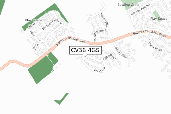
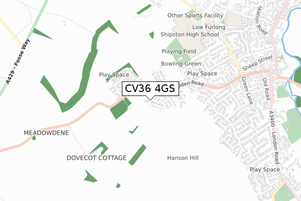
CV36 4GS is located in the Tredington electoral ward, within the local authority district of Stratford-on-Avon and the English Parliamentary constituency of Stratford-on-Avon. The Sub Integrated Care Board (ICB) Location is NHS Coventry and Warwickshire ICB - B2M3M and the police force is Warwickshire. This postcode has been in use since March 2019.


GetTheData
Source: OS Open Zoomstack (Ordnance Survey)
Licence: Open Government Licence (requires attribution)
Attribution: Contains OS data © Crown copyright and database right 2025
Source: Open Postcode Geo
Licence: Open Government Licence (requires attribution)
Attribution: Contains OS data © Crown copyright and database right 2025; Contains Royal Mail data © Royal Mail copyright and database right 2025; Source: Office for National Statistics licensed under the Open Government Licence v.3.0
| Easting | 425402 |
| Northing | 243872 |
| Latitude | 52.092628 |
| Longitude | -1.630628 |
GetTheData
Source: Open Postcode Geo
Licence: Open Government Licence
| Country | England |
| Postcode District | CV36 |
➜ See where CV36 is on a map ➜ Where is Tredington? | |
GetTheData
Source: Land Registry Price Paid Data
Licence: Open Government Licence
| Ward | Tredington |
| Constituency | Stratford-on-avon |
GetTheData
Source: ONS Postcode Database
Licence: Open Government Licence
1, BROOKSIDE, TREDINGTON, SHIPSTON-ON-STOUR, CV36 4GS 2021 12 FEB £600,000 |
3, BROOKSIDE, TREDINGTON, SHIPSTON-ON-STOUR, CV36 4GS 2020 18 SEP £655,000 |
2, BROOKSIDE, TREDINGTON, SHIPSTON-ON-STOUR, CV36 4GS 2019 20 DEC £647,000 |
5, BROOKSIDE, TREDINGTON, SHIPSTON-ON-STOUR, CV36 4GS 2019 16 DEC £720,000 |
4, BROOKSIDE, TREDINGTON, SHIPSTON-ON-STOUR, CV36 4GS 2019 21 OCT £625,000 |
GetTheData
Source: HM Land Registry Price Paid Data
Licence: Contains HM Land Registry data © Crown copyright and database right 2025. This data is licensed under the Open Government Licence v3.0.
| Bus Shelter (Shipston Road) | Tredington | 289m |
| Crossroads (A429) | Tredington | 315m |
| Crossroads (A429) | Tredington | 318m |
| White Lion (Shipston Road) | Tredington | 323m |
| Manor Farm Road (Blackwell Road) | Tredington | 442m |
GetTheData
Source: NaPTAN
Licence: Open Government Licence
| Percentage of properties with Next Generation Access | 100.0% |
| Percentage of properties with Superfast Broadband | 100.0% |
| Percentage of properties with Ultrafast Broadband | 0.0% |
| Percentage of properties with Full Fibre Broadband | 0.0% |
Superfast Broadband is between 30Mbps and 300Mbps
Ultrafast Broadband is > 300Mbps
| Percentage of properties unable to receive 2Mbps | 0.0% |
| Percentage of properties unable to receive 5Mbps | 0.0% |
| Percentage of properties unable to receive 10Mbps | 0.0% |
| Percentage of properties unable to receive 30Mbps | 0.0% |
GetTheData
Source: Ofcom
Licence: Ofcom Terms of Use (requires attribution)
GetTheData
Source: ONS Postcode Database
Licence: Open Government Licence


➜ Get more ratings from the Food Standards Agency
GetTheData
Source: Food Standards Agency
Licence: FSA terms & conditions
| Last Collection | |||
|---|---|---|---|
| Location | Mon-Fri | Sat | Distance |
| Tredington | 16:30 | 08:30 | 302m |
| Blackwell Business Park | 16:30 | 1,250m | |
| Armscote | 16:00 | 09:30 | 1,320m |
GetTheData
Source: Dracos
Licence: Creative Commons Attribution-ShareAlike
The below table lists the International Territorial Level (ITL) codes (formerly Nomenclature of Territorial Units for Statistics (NUTS) codes) and Local Administrative Units (LAU) codes for CV36 4GS:
| ITL 1 Code | Name |
|---|---|
| TLG | West Midlands (England) |
| ITL 2 Code | Name |
| TLG1 | Herefordshire, Worcestershire and Warwickshire |
| ITL 3 Code | Name |
| TLG13 | Warwickshire CC |
| LAU 1 Code | Name |
| E07000221 | Stratford-on-Avon |
GetTheData
Source: ONS Postcode Directory
Licence: Open Government Licence
The below table lists the Census Output Area (OA), Lower Layer Super Output Area (LSOA), and Middle Layer Super Output Area (MSOA) for CV36 4GS:
| Code | Name | |
|---|---|---|
| OA | E00159312 | |
| LSOA | E01031245 | Stratford-on-Avon 014C |
| MSOA | E02006517 | Stratford-on-Avon 014 |
GetTheData
Source: ONS Postcode Directory
Licence: Open Government Licence
| CV36 4NR | Cotswold Close | 107m |
| CV36 4ND | Shakesfield Close | 162m |
| CV36 4NP | Armscote Road | 173m |
| CV36 4NW | Stratford Road | 219m |
| CV36 4NY | Queens Road | 296m |
| CV36 4NZ | Manor Farm Road | 303m |
| CV36 4NX | Fosseway Crescent | 344m |
| CV36 4NN | Old Fosse Way | 351m |
| CV36 4NS | 390m | |
| CV36 4NU | Blackwell Road | 411m |
GetTheData
Source: Open Postcode Geo; Land Registry Price Paid Data
Licence: Open Government Licence