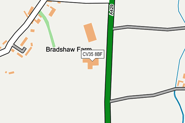
CV35 8BF is located in the Budbrooke electoral ward, within the local authority district of Warwick and the English Parliamentary constituency of Warwick and Leamington. The Sub Integrated Care Board (ICB) Location is NHS Coventry and Warwickshire ICB - B2M3M and the police force is Warwickshire. This postcode has been in use since April 2013.


GetTheData
Source: OS OpenMap – Local (Ordnance Survey)
Source: OS VectorMap District (Ordnance Survey)
Licence: Open Government Licence (requires attribution)
| Easting | 427024 |
| Northing | 258890 |
| Latitude | 52.227568 |
| Longitude | -1.605763 |
GetTheData
Source: Open Postcode Geo
Licence: Open Government Licence
| Country | England |
| Postcode District | CV35 |
➜ See where CV35 is on a map | |
GetTheData
Source: Land Registry Price Paid Data
Licence: Open Government Licence
Elevation or altitude of CV35 8BF as distance above sea level:
| Metres | Feet | |
|---|---|---|
| Elevation | 40m | 131ft |
Elevation is measured from the approximate centre of the postcode, to the nearest point on an OS contour line from OS Terrain 50, which has contour spacing of ten vertical metres.
➜ How high above sea level am I? Find the elevation of your current position using your device's GPS.
GetTheData
Source: Open Postcode Elevation
Licence: Open Government Licence
| Ward | Budbrooke |
| Constituency | Warwick And Leamington |
GetTheData
Source: ONS Postcode Database
Licence: Open Government Licence
| Turn (Wellesbourne Road) | Wasperton | 235m |
| Turn (Wellesbourne Road) | Wasperton | 244m |
| Thelsford Cottages (B4088) | Charlecote | 833m |
| Helsford Cottages (B4088) | Charlecote | 842m |
| Granville (Wellesbourne Road) | Barford | 1,448m |
GetTheData
Source: NaPTAN
Licence: Open Government Licence
GetTheData
Source: ONS Postcode Database
Licence: Open Government Licence


➜ Get more ratings from the Food Standards Agency
GetTheData
Source: Food Standards Agency
Licence: FSA terms & conditions
| Last Collection | |||
|---|---|---|---|
| Location | Mon-Fri | Sat | Distance |
| Wasperton | 17:15 | 07:45 | 412m |
| Barford Post Office | 17:30 | 10:00 | 1,864m |
| High Street | 15:30 | 11:00 | 2,165m |
GetTheData
Source: Dracos
Licence: Creative Commons Attribution-ShareAlike
The below table lists the International Territorial Level (ITL) codes (formerly Nomenclature of Territorial Units for Statistics (NUTS) codes) and Local Administrative Units (LAU) codes for CV35 8BF:
| ITL 1 Code | Name |
|---|---|
| TLG | West Midlands (England) |
| ITL 2 Code | Name |
| TLG1 | Herefordshire, Worcestershire and Warwickshire |
| ITL 3 Code | Name |
| TLG13 | Warwickshire CC |
| LAU 1 Code | Name |
| E07000222 | Warwick |
GetTheData
Source: ONS Postcode Directory
Licence: Open Government Licence
The below table lists the Census Output Area (OA), Lower Layer Super Output Area (LSOA), and Middle Layer Super Output Area (MSOA) for CV35 8BF:
| Code | Name | |
|---|---|---|
| OA | E00159438 | |
| LSOA | E01031269 | Warwick 014E |
| MSOA | E02006532 | Warwick 014 |
GetTheData
Source: ONS Postcode Directory
Licence: Open Government Licence
| CV35 8EB | 389m | |
| CV35 8EE | 711m | |
| CV35 8EA | 830m | |
| CV35 8AT | 990m | |
| CV35 8AQ | Wellesbourne Road | 1205m |
| CV35 8DE | Bremridge Close | 1332m |
| CV35 8DG | Bremridge Close | 1376m |
| CV35 8DY | Sandy Way | 1411m |
| CV35 8DS | Wellesbourne Road | 1417m |
| CV35 8DU | Wasperton Lane | 1447m |
GetTheData
Source: Open Postcode Geo; Land Registry Price Paid Data
Licence: Open Government Licence