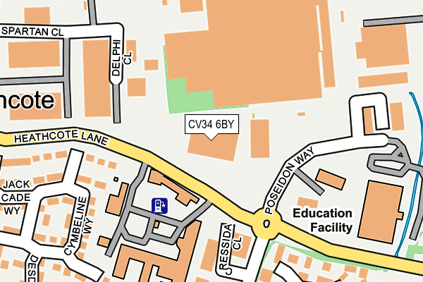
CV34 6BY is located in the Warwick Myton & Heathcote electoral ward, within the local authority district of Warwick and the English Parliamentary constituency of Warwick and Leamington. The Sub Integrated Care Board (ICB) Location is NHS Coventry and Warwickshire ICB - B2M3M and the police force is Warwickshire. This postcode has been in use since July 2013.


GetTheData
Source: OS OpenMap – Local (Ordnance Survey)
Source: OS VectorMap District (Ordnance Survey)
Licence: Open Government Licence (requires attribution)
| Easting | 431546 |
| Northing | 263646 |
| Latitude | 52.270071 |
| Longitude | -1.539130 |
GetTheData
Source: Open Postcode Geo
Licence: Open Government Licence
| Country | England |
| Postcode District | CV34 |
➜ See where CV34 is on a map ➜ Where is Warwick? | |
GetTheData
Source: Land Registry Price Paid Data
Licence: Open Government Licence
Elevation or altitude of CV34 6BY as distance above sea level:
| Metres | Feet | |
|---|---|---|
| Elevation | 70m | 230ft |
Elevation is measured from the approximate centre of the postcode, to the nearest point on an OS contour line from OS Terrain 50, which has contour spacing of ten vertical metres.
➜ How high above sea level am I? Find the elevation of your current position using your device's GPS.
GetTheData
Source: Open Postcode Elevation
Licence: Open Government Licence
| Ward | Warwick Myton & Heathcote |
| Constituency | Warwick And Leamington |
GetTheData
Source: ONS Postcode Database
Licence: Open Government Licence
| Heathcote Hospital (Heathcote Lane) | Warwick Gates | 76m |
| Heathcote Hospital (Heathcote Lane) | Warwick Gates | 86m |
| Trident Park (Poseidon Way) | Warwick Gates | 226m |
| Coriolanus Square (Othello Avenue) | Warwick Gates | 228m |
| Coriolanus Square (Othello Avenue) | Warwick Gates | 256m |
| Leamington Spa Station | 1.6km |
| Warwick Station | 3.4km |
| Warwick Parkway Station | 5.3km |
GetTheData
Source: NaPTAN
Licence: Open Government Licence
GetTheData
Source: ONS Postcode Database
Licence: Open Government Licence


➜ Get more ratings from the Food Standards Agency
GetTheData
Source: Food Standards Agency
Licence: FSA terms & conditions
| Last Collection | |||
|---|---|---|---|
| Location | Mon-Fri | Sat | Distance |
| Cressida Close | 17:00 | 10:00 | 195m |
| Romeo Arbour | 17:00 | 10:30 | 656m |
| Whitnash Post Office | 17:15 | 12:15 | 714m |
GetTheData
Source: Dracos
Licence: Creative Commons Attribution-ShareAlike
The below table lists the International Territorial Level (ITL) codes (formerly Nomenclature of Territorial Units for Statistics (NUTS) codes) and Local Administrative Units (LAU) codes for CV34 6BY:
| ITL 1 Code | Name |
|---|---|
| TLG | West Midlands (England) |
| ITL 2 Code | Name |
| TLG1 | Herefordshire, Worcestershire and Warwickshire |
| ITL 3 Code | Name |
| TLG13 | Warwickshire CC |
| LAU 1 Code | Name |
| E07000222 | Warwick |
GetTheData
Source: ONS Postcode Directory
Licence: Open Government Licence
The below table lists the Census Output Area (OA), Lower Layer Super Output Area (LSOA), and Middle Layer Super Output Area (MSOA) for CV34 6BY:
| Code | Name | |
|---|---|---|
| OA | E00172312 | |
| LSOA | E01031315 | Warwick 012A |
| MSOA | E02006530 | Warwick 012 |
GetTheData
Source: ONS Postcode Directory
Licence: Open Government Licence
| CV34 6GS | Hermione Close | 201m |
| CV34 6SW | Poseidon Way | 222m |
| CV34 6FQ | Cymbeline Way | 229m |
| CV34 6GR | Coriolanus Square | 259m |
| CV34 6FW | Chatillon Close | 270m |
| CV34 6FY | Portia Way | 273m |
| CV34 6GH | Jack Cade Way | 289m |
| CV34 6BJ | Portia Way | 303m |
| CV34 6FX | Desdemona Avenue | 324m |
| CV34 6BP | Costard Avenue | 334m |
GetTheData
Source: Open Postcode Geo; Land Registry Price Paid Data
Licence: Open Government Licence