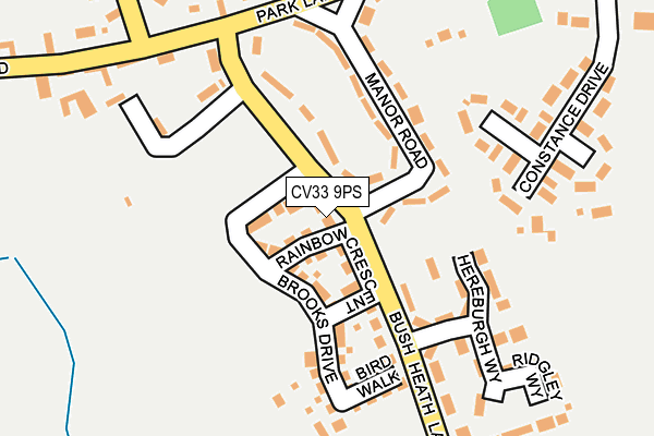
CV33 9PS is located in the Harbury electoral ward, within the local authority district of Stratford-on-Avon and the English Parliamentary constituency of Kenilworth and Southam. The Sub Integrated Care Board (ICB) Location is NHS Coventry and Warwickshire ICB - B2M3M and the police force is Warwickshire. This postcode has been in use since June 2017.


GetTheData
Source: OS OpenMap – Local (Ordnance Survey)
Source: OS VectorMap District (Ordnance Survey)
Licence: Open Government Licence (requires attribution)
| Easting | 437036 |
| Northing | 259536 |
| Latitude | 52.232796 |
| Longitude | -1.459119 |
GetTheData
Source: Open Postcode Geo
Licence: Open Government Licence
| Country | England |
| Postcode District | CV33 |
➜ See where CV33 is on a map | |
GetTheData
Source: Land Registry Price Paid Data
Licence: Open Government Licence
| Ward | Harbury |
| Constituency | Kenilworth And Southam |
GetTheData
Source: ONS Postcode Database
Licence: Open Government Licence
| Manor Road (Bush Heath Lane) | Harbury | 143m |
| Bush Heath Lane (Temple End) | Harbury | 249m |
| Bush Heath Lane (Park Lane) | Harbury | 265m |
| Old New Inn (Temple End) | Harbury | 287m |
| Ivy Lane (South Parade) | Harbury | 383m |
GetTheData
Source: NaPTAN
Licence: Open Government Licence
| Percentage of properties with Next Generation Access | 100.0% |
| Percentage of properties with Superfast Broadband | 100.0% |
| Percentage of properties with Ultrafast Broadband | 0.0% |
| Percentage of properties with Full Fibre Broadband | 0.0% |
Superfast Broadband is between 30Mbps and 300Mbps
Ultrafast Broadband is > 300Mbps
| Median download speed | 31.3Mbps |
| Average download speed | 43.6Mbps |
| Maximum download speed | 80.00Mbps |
| Median upload speed | 5.6Mbps |
| Average upload speed | 8.9Mbps |
| Maximum upload speed | 20.00Mbps |
| Percentage of properties unable to receive 2Mbps | 0.0% |
| Percentage of properties unable to receive 5Mbps | 0.0% |
| Percentage of properties unable to receive 10Mbps | 0.0% |
| Percentage of properties unable to receive 30Mbps | 0.0% |
GetTheData
Source: Ofcom
Licence: Ofcom Terms of Use (requires attribution)
GetTheData
Source: ONS Postcode Database
Licence: Open Government Licence


➜ Get more ratings from the Food Standards Agency
GetTheData
Source: Food Standards Agency
Licence: FSA terms & conditions
| Last Collection | |||
|---|---|---|---|
| Location | Mon-Fri | Sat | Distance |
| Farm Street | 16:50 | 10:15 | 313m |
| Harbury Post Office | 16:50 | 10:15 | 462m |
| Station End | 16:50 | 10:30 | 1,030m |
GetTheData
Source: Dracos
Licence: Creative Commons Attribution-ShareAlike
The below table lists the International Territorial Level (ITL) codes (formerly Nomenclature of Territorial Units for Statistics (NUTS) codes) and Local Administrative Units (LAU) codes for CV33 9PS:
| ITL 1 Code | Name |
|---|---|
| TLG | West Midlands (England) |
| ITL 2 Code | Name |
| TLG1 | Herefordshire, Worcestershire and Warwickshire |
| ITL 3 Code | Name |
| TLG13 | Warwickshire CC |
| LAU 1 Code | Name |
| E07000221 | Stratford-on-Avon |
GetTheData
Source: ONS Postcode Directory
Licence: Open Government Licence
The below table lists the Census Output Area (OA), Lower Layer Super Output Area (LSOA), and Middle Layer Super Output Area (MSOA) for CV33 9PS:
| Code | Name | |
|---|---|---|
| OA | E00159065 | |
| LSOA | E01031201 | Stratford-on-Avon 005E |
| MSOA | E02006508 | Stratford-on-Avon 005 |
GetTheData
Source: ONS Postcode Directory
Licence: Open Government Licence
| CV33 9NR | Hereburgh Way | 118m |
| CV33 9HY | Manor Road | 139m |
| CV33 9NF | Bush Heath Lane | 148m |
| CV33 9JD | Penelope Close | 164m |
| CV33 9NS | Ridgley Way | 177m |
| CV33 9JA | Constance Drive | 217m |
| CV33 9JB | Margaret Close | 253m |
| CV33 9HX | Park Lane | 281m |
| CV33 9ND | Wagstaffe Close | 328m |
| CV33 9HZ | South Parade | 349m |
GetTheData
Source: Open Postcode Geo; Land Registry Price Paid Data
Licence: Open Government Licence