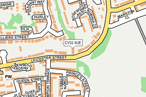
CV32 4UE is located in the Leamington Clarendon electoral ward, within the local authority district of Warwick and the English Parliamentary constituency of Warwick and Leamington. The Sub Integrated Care Board (ICB) Location is NHS Coventry and Warwickshire ICB - B2M3M and the police force is Warwickshire. This postcode has been in use since July 2017.


GetTheData
Source: OS OpenMap – Local (Ordnance Survey)
Source: OS VectorMap District (Ordnance Survey)
Licence: Open Government Licence (requires attribution)
| Easting | 432001 |
| Northing | 266200 |
| Latitude | 52.293020 |
| Longitude | -1.532210 |
GetTheData
Source: Open Postcode Geo
Licence: Open Government Licence
| Country | England |
| Postcode District | CV32 |
➜ See where CV32 is on a map ➜ Where is Royal Leamington Spa? | |
GetTheData
Source: Land Registry Price Paid Data
Licence: Open Government Licence
| Ward | Leamington Clarendon |
| Constituency | Warwick And Leamington |
GetTheData
Source: ONS Postcode Database
Licence: Open Government Licence
| Post Office (Clarendon Street) | Leamington Spa | 64m |
| Oxford Street (Clarendon Avenue) | Leamington Spa | 82m |
| Oxford Street (Clarendon Avenue) | Leamington Spa | 99m |
| Clarendon Street (Leicester Street) | Leamington Spa | 126m |
| Clarendon Street (Leicester Street) | Leamington Spa | 137m |
| Leamington Spa Station | 1km |
| Warwick Station | 3.5km |
GetTheData
Source: NaPTAN
Licence: Open Government Licence
| Percentage of properties with Next Generation Access | 100.0% |
| Percentage of properties with Superfast Broadband | 100.0% |
| Percentage of properties with Ultrafast Broadband | 0.0% |
| Percentage of properties with Full Fibre Broadband | 0.0% |
Superfast Broadband is between 30Mbps and 300Mbps
Ultrafast Broadband is > 300Mbps
| Median download speed | 52.3Mbps |
| Average download speed | 49.4Mbps |
| Maximum download speed | 80.00Mbps |
| Median upload speed | 9.9Mbps |
| Average upload speed | 9.3Mbps |
| Maximum upload speed | 20.00Mbps |
| Percentage of properties unable to receive 2Mbps | 0.0% |
| Percentage of properties unable to receive 5Mbps | 0.0% |
| Percentage of properties unable to receive 10Mbps | 0.0% |
| Percentage of properties unable to receive 30Mbps | 0.0% |
GetTheData
Source: Ofcom
Licence: Ofcom Terms of Use (requires attribution)
GetTheData
Source: ONS Postcode Database
Licence: Open Government Licence


➜ Get more ratings from the Food Standards Agency
GetTheData
Source: Food Standards Agency
Licence: FSA terms & conditions
| Last Collection | |||
|---|---|---|---|
| Location | Mon-Fri | Sat | Distance |
| Clarendon Street Post Office | 17:30 | 12:15 | 57m |
| The Parade | 18:30 | 12:30 | 248m |
| The Parade Post Office | 18:30 | 12:30 | 249m |
GetTheData
Source: Dracos
Licence: Creative Commons Attribution-ShareAlike
The below table lists the International Territorial Level (ITL) codes (formerly Nomenclature of Territorial Units for Statistics (NUTS) codes) and Local Administrative Units (LAU) codes for CV32 4UE:
| ITL 1 Code | Name |
|---|---|
| TLG | West Midlands (England) |
| ITL 2 Code | Name |
| TLG1 | Herefordshire, Worcestershire and Warwickshire |
| ITL 3 Code | Name |
| TLG13 | Warwickshire CC |
| LAU 1 Code | Name |
| E07000222 | Warwick |
GetTheData
Source: ONS Postcode Directory
Licence: Open Government Licence
The below table lists the Census Output Area (OA), Lower Layer Super Output Area (LSOA), and Middle Layer Super Output Area (MSOA) for CV32 4UE:
| Code | Name | |
|---|---|---|
| OA | E00159453 | |
| LSOA | E01031272 | Warwick 007B |
| MSOA | E02006525 | Warwick 007 |
GetTheData
Source: ONS Postcode Directory
Licence: Open Government Licence
| CV32 4RA | Oxford Street | 30m |
| CV32 4PG | Clarendon Street | 30m |
| CV32 4RE | Oxford Place | 36m |
| CV32 4SN | Clarendon Mews | 37m |
| CV32 4BE | The Mews | 54m |
| CV32 4SA | Clarendon Avenue | 72m |
| CV32 4PN | Clarendon Street | 74m |
| CV32 4QZ | Warwick Street | 78m |
| CV32 4PW | Clarendon Street | 80m |
| CV32 4SH | Farriers Yard | 82m |
GetTheData
Source: Open Postcode Geo; Land Registry Price Paid Data
Licence: Open Government Licence