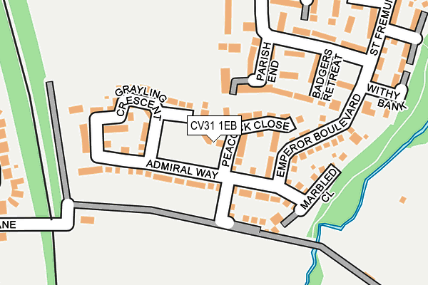
CV31 1EB is located in the Leamington Willes electoral ward, within the local authority district of Warwick and the English Parliamentary constituency of Warwick and Leamington. The Sub Integrated Care Board (ICB) Location is NHS Coventry and Warwickshire ICB - B2M3M and the police force is Warwickshire. This postcode has been in use since May 2017.


GetTheData
Source: OS OpenMap – Local (Ordnance Survey)
Source: OS VectorMap District (Ordnance Survey)
Licence: Open Government Licence (requires attribution)
| Easting | 433252 |
| Northing | 263858 |
| Latitude | 52.271891 |
| Longitude | -1.514098 |
GetTheData
Source: Open Postcode Geo
Licence: Open Government Licence
| Country | England |
| Postcode District | CV31 |
➜ See where CV31 is on a map | |
GetTheData
Source: Land Registry Price Paid Data
Licence: Open Government Licence
| Ward | Leamington Willes |
| Constituency | Warwick And Leamington |
GetTheData
Source: ONS Postcode Database
Licence: Open Government Licence
| Horsepool Hollow (St Fremund Way) | Sydenham | 220m |
| Withy Bank (St Fremund Way) | Sydenham | 247m |
| Cobden Avenue (Chesterton Drive) | Sydenham | 431m |
| Cobden Avenue (Chesterton Drive) | Sydenham | 439m |
| Church Lane (Whitnash Road) | Whitnash | 529m |
| Leamington Spa Station | 2.1km |
| Warwick Station | 4.9km |
GetTheData
Source: NaPTAN
Licence: Open Government Licence
| Percentage of properties with Next Generation Access | 100.0% |
| Percentage of properties with Superfast Broadband | 100.0% |
| Percentage of properties with Ultrafast Broadband | 0.0% |
| Percentage of properties with Full Fibre Broadband | 0.0% |
Superfast Broadband is between 30Mbps and 300Mbps
Ultrafast Broadband is > 300Mbps
| Percentage of properties unable to receive 2Mbps | 0.0% |
| Percentage of properties unable to receive 5Mbps | 0.0% |
| Percentage of properties unable to receive 10Mbps | 0.0% |
| Percentage of properties unable to receive 30Mbps | 0.0% |
GetTheData
Source: Ofcom
Licence: Ofcom Terms of Use (requires attribution)
GetTheData
Source: ONS Postcode Database
Licence: Open Government Licence


➜ Get more ratings from the Food Standards Agency
GetTheData
Source: Food Standards Agency
Licence: FSA terms & conditions
| Last Collection | |||
|---|---|---|---|
| Location | Mon-Fri | Sat | Distance |
| Halls Close | 16:30 | 12:30 | 735m |
| Berrington Road Business Box | 18:30 | 927m | |
| Whitnash Post Office | 17:15 | 12:15 | 1,057m |
GetTheData
Source: Dracos
Licence: Creative Commons Attribution-ShareAlike
The below table lists the International Territorial Level (ITL) codes (formerly Nomenclature of Territorial Units for Statistics (NUTS) codes) and Local Administrative Units (LAU) codes for CV31 1EB:
| ITL 1 Code | Name |
|---|---|
| TLG | West Midlands (England) |
| ITL 2 Code | Name |
| TLG1 | Herefordshire, Worcestershire and Warwickshire |
| ITL 3 Code | Name |
| TLG13 | Warwickshire CC |
| LAU 1 Code | Name |
| E07000222 | Warwick |
GetTheData
Source: ONS Postcode Directory
Licence: Open Government Licence
The below table lists the Census Output Area (OA), Lower Layer Super Output Area (LSOA), and Middle Layer Super Output Area (MSOA) for CV31 1EB:
| Code | Name | |
|---|---|---|
| OA | E00172306 | |
| LSOA | E01031328 | Warwick 015B |
| MSOA | E02006533 | Warwick 015 |
GetTheData
Source: ONS Postcode Directory
Licence: Open Government Licence
| CV31 1AU | Peacock Close | 55m |
| CV31 1AX | Admiral Way | 102m |
| CV31 1AJ | Parish End | 105m |
| CV31 1AT | Emperor Boulevard | 118m |
| CV31 1AY | Marbled Close | 128m |
| CV31 1AL | Littleworth Croft | 174m |
| CV31 1AH | Badgers Retreat | 174m |
| CV31 1AW | Horsepool Hollow | 222m |
| CV31 1AQ | Withy Bank | 242m |
| CV31 1AN | Red Hill Furrows | 262m |
GetTheData
Source: Open Postcode Geo; Land Registry Price Paid Data
Licence: Open Government Licence