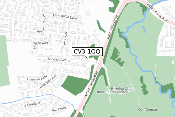
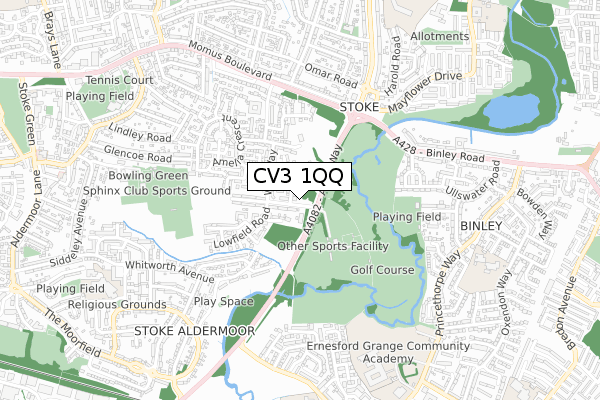
CV3 1QQ is located in the Lower Stoke electoral ward, within the metropolitan district of Coventry and the English Parliamentary constituency of Coventry North East. The Sub Integrated Care Board (ICB) Location is NHS Coventry and Warwickshire ICB - B2M3M and the police force is West Midlands. This postcode has been in use since April 2020.


GetTheData
Source: OS Open Zoomstack (Ordnance Survey)
Licence: Open Government Licence (requires attribution)
Attribution: Contains OS data © Crown copyright and database right 2025
Source: Open Postcode Geo
Licence: Open Government Licence (requires attribution)
Attribution: Contains OS data © Crown copyright and database right 2025; Contains Royal Mail data © Royal Mail copyright and database right 2025; Source: Office for National Statistics licensed under the Open Government Licence v.3.0
| Easting | 436568 |
| Northing | 278288 |
| Latitude | 52.401407 |
| Longitude | -1.463941 |
GetTheData
Source: Open Postcode Geo
Licence: Open Government Licence
| Country | England |
| Postcode District | CV3 |
➜ See where CV3 is on a map ➜ Where is Coventry? | |
GetTheData
Source: Land Registry Price Paid Data
Licence: Open Government Licence
| Ward | Lower Stoke |
| Constituency | Coventry North East |
GetTheData
Source: ONS Postcode Database
Licence: Open Government Licence
| Hipswell Highway (Binley Rd) | Stoke | 403m |
| Hipswell Highway (Binley Rd) | Stoke | 462m |
| Binley Rd (Hipswell Highway) | Stoke | 489m |
| Bromleigh Drive (Binley Rd) | Stoke | 519m |
| Bromleigh Drive (Binley Rd) | Stoke | 575m |
| Coventry Station | 3.4km |
GetTheData
Source: NaPTAN
Licence: Open Government Licence
GetTheData
Source: ONS Postcode Database
Licence: Open Government Licence


➜ Get more ratings from the Food Standards Agency
GetTheData
Source: Food Standards Agency
Licence: FSA terms & conditions
| Last Collection | |||
|---|---|---|---|
| Location | Mon-Fri | Sat | Distance |
| Bourne Road | 17:15 | 09:45 | 203m |
| Bromleigh Drive | 17:30 | 09:45 | 672m |
| Mayflower Drive | 16:30 | 10:45 | 763m |
GetTheData
Source: Dracos
Licence: Creative Commons Attribution-ShareAlike
The below table lists the International Territorial Level (ITL) codes (formerly Nomenclature of Territorial Units for Statistics (NUTS) codes) and Local Administrative Units (LAU) codes for CV3 1QQ:
| ITL 1 Code | Name |
|---|---|
| TLG | West Midlands (England) |
| ITL 2 Code | Name |
| TLG3 | West Midlands |
| ITL 3 Code | Name |
| TLG33 | Coventry |
| LAU 1 Code | Name |
| E08000026 | Coventry |
GetTheData
Source: ONS Postcode Directory
Licence: Open Government Licence
The below table lists the Census Output Area (OA), Lower Layer Super Output Area (LSOA), and Middle Layer Super Output Area (MSOA) for CV3 1QQ:
| Code | Name | |
|---|---|---|
| OA | E00172188 | |
| LSOA | E01009611 | Coventry 035E |
| MSOA | E02001992 | Coventry 035 |
GetTheData
Source: ONS Postcode Directory
Licence: Open Government Licence
| CV3 1LB | Longmoor Drive | 121m |
| CV3 1LE | Waterford Way | 242m |
| CV3 1JT | Marjorie Way | 259m |
| CV3 1JZ | Gwendolyn Drive | 287m |
| CV3 1JX | Angell Drive | 296m |
| CV3 1JR | Marjorie Way | 306m |
| CV3 1LA | Lowfield Road | 307m |
| CV3 1LF | Knotting Way | 327m |
| CV3 1LD | Riverslea Road | 330m |
| CV3 1FG | Yew Close | 342m |
GetTheData
Source: Open Postcode Geo; Land Registry Price Paid Data
Licence: Open Government Licence