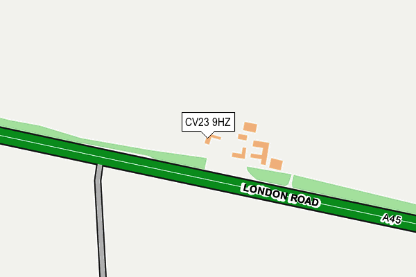
CV23 9HZ lies on London Road in Stretton On Dunsmore, Rugby. CV23 9HZ is located in the Dunsmore electoral ward, within the local authority district of Rugby and the English Parliamentary constituency of Kenilworth and Southam. The Sub Integrated Care Board (ICB) Location is NHS Coventry and Warwickshire ICB - B2M3M and the police force is Warwickshire. This postcode has been in use since January 1980.


GetTheData
Source: OS OpenMap – Local (Ordnance Survey)
Source: OS VectorMap District (Ordnance Survey)
Licence: Open Government Licence (requires attribution)
| Easting | 443178 |
| Northing | 272774 |
| Latitude | 52.351357 |
| Longitude | -1.367499 |
GetTheData
Source: Open Postcode Geo
Licence: Open Government Licence
| Street | London Road |
| Locality | Stretton On Dunsmore |
| Town/City | Rugby |
| Country | England |
| Postcode District | CV23 |
➜ See where CV23 is on a map ➜ Where is Dunsmore Heath? | |
GetTheData
Source: Land Registry Price Paid Data
Licence: Open Government Licence
Elevation or altitude of CV23 9HZ as distance above sea level:
| Metres | Feet | |
|---|---|---|
| Elevation | 110m | 361ft |
Elevation is measured from the approximate centre of the postcode, to the nearest point on an OS contour line from OS Terrain 50, which has contour spacing of ten vertical metres.
➜ How high above sea level am I? Find the elevation of your current position using your device's GPS.
GetTheData
Source: Open Postcode Elevation
Licence: Open Government Licence
| Ward | Dunsmore |
| Constituency | Kenilworth And Southam |
GetTheData
Source: ONS Postcode Database
Licence: Open Government Licence
| Percentage of properties with Next Generation Access | 100.0% |
| Percentage of properties with Superfast Broadband | 0.0% |
| Percentage of properties with Ultrafast Broadband | 0.0% |
| Percentage of properties with Full Fibre Broadband | 0.0% |
Superfast Broadband is between 30Mbps and 300Mbps
Ultrafast Broadband is > 300Mbps
| Percentage of properties unable to receive 2Mbps | 0.0% |
| Percentage of properties unable to receive 5Mbps | 100.0% |
| Percentage of properties unable to receive 10Mbps | 100.0% |
| Percentage of properties unable to receive 30Mbps | 100.0% |
GetTheData
Source: Ofcom
Licence: Ofcom Terms of Use (requires attribution)
GetTheData
Source: ONS Postcode Database
Licence: Open Government Licence


➜ Get more ratings from the Food Standards Agency
GetTheData
Source: Food Standards Agency
Licence: FSA terms & conditions
| Last Collection | |||
|---|---|---|---|
| Location | Mon-Fri | Sat | Distance |
| Lawford Heath | 16:30 | 11:00 | 3,282m |
| Little Lawford | 15:45 | 11:15 | 3,347m |
| Fir Tree Lane | 16:45 | 09:15 | 3,864m |
GetTheData
Source: Dracos
Licence: Creative Commons Attribution-ShareAlike
The below table lists the International Territorial Level (ITL) codes (formerly Nomenclature of Territorial Units for Statistics (NUTS) codes) and Local Administrative Units (LAU) codes for CV23 9HZ:
| ITL 1 Code | Name |
|---|---|
| TLG | West Midlands (England) |
| ITL 2 Code | Name |
| TLG1 | Herefordshire, Worcestershire and Warwickshire |
| ITL 3 Code | Name |
| TLG13 | Warwickshire CC |
| LAU 1 Code | Name |
| E07000220 | Rugby |
GetTheData
Source: ONS Postcode Directory
Licence: Open Government Licence
The below table lists the Census Output Area (OA), Lower Layer Super Output Area (LSOA), and Middle Layer Super Output Area (MSOA) for CV23 9HZ:
| Code | Name | |
|---|---|---|
| OA | E00168345 | |
| LSOA | E01031150 | Rugby 012D |
| MSOA | E02006503 | Rugby 012 |
GetTheData
Source: ONS Postcode Directory
Licence: Open Government Licence
| CV23 9JA | London Road | 727m |
| CV23 9JB | London Road | 775m |
| CV23 9HY | London Road | 816m |
| CV23 9HJ | 960m | |
| CV23 9HX | London Road | 1089m |
| CV23 9JJ | London Road | 1230m |
| CV23 9JD | Rugby Lane | 1568m |
| CV8 3GB | Coal Pit Lane | 1680m |
| CV23 9NL | Meadow Close | 1868m |
| CV23 9JH | Rugby Lane | 1901m |
GetTheData
Source: Open Postcode Geo; Land Registry Price Paid Data
Licence: Open Government Licence