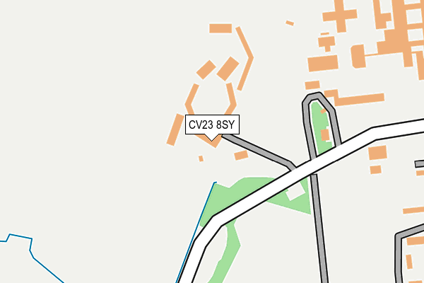
CV23 8SY is located in the Braunston and Crick electoral ward, within the unitary authority of West Northamptonshire and the English Parliamentary constituency of Daventry. The Sub Integrated Care Board (ICB) Location is NHS Northamptonshire ICB - 78H and the police force is Northamptonshire. This postcode has been in use since June 1999.


GetTheData
Source: OS OpenMap – Local (Ordnance Survey)
Source: OS VectorMap District (Ordnance Survey)
Licence: Open Government Licence (requires attribution)
| Easting | 451167 |
| Northing | 270027 |
| Latitude | 52.325961 |
| Longitude | -1.250649 |
GetTheData
Source: Open Postcode Geo
Licence: Open Government Licence
| Country | England |
| Postcode District | CV23 |
➜ See where CV23 is on a map ➜ Where is Onley? | |
GetTheData
Source: Land Registry Price Paid Data
Licence: Open Government Licence
Elevation or altitude of CV23 8SY as distance above sea level:
| Metres | Feet | |
|---|---|---|
| Elevation | 90m | 295ft |
Elevation is measured from the approximate centre of the postcode, to the nearest point on an OS contour line from OS Terrain 50, which has contour spacing of ten vertical metres.
➜ How high above sea level am I? Find the elevation of your current position using your device's GPS.
GetTheData
Source: Open Postcode Elevation
Licence: Open Government Licence
| Ward | Braunston And Crick |
| Constituency | Daventry |
GetTheData
Source: ONS Postcode Database
Licence: Open Government Licence
| Young Offenders Institute (Access Road) | Onley | 250m |
| Ryehill Hmp (Access Road) | Onley | 538m |
| Demand Responsive Area | Barby | 562m |
| Onley Prison Turn (Daventry Road) | Onley | 739m |
| Onley Prison Turn (Daventry Road) | Onley | 755m |
GetTheData
Source: NaPTAN
Licence: Open Government Licence
GetTheData
Source: ONS Postcode Database
Licence: Open Government Licence

➜ Get more ratings from the Food Standards Agency
GetTheData
Source: Food Standards Agency
Licence: FSA terms & conditions
| Last Collection | |||
|---|---|---|---|
| Location | Mon-Fri | Sat | Distance |
| Willoughby Post Office | 17:00 | 10:30 | 2,760m |
| Colledge Road | 17:00 | 10:15 | 2,886m |
| Dunchurch Post Office | 17:15 | 11:30 | 3,060m |
GetTheData
Source: Dracos
Licence: Creative Commons Attribution-ShareAlike
The below table lists the International Territorial Level (ITL) codes (formerly Nomenclature of Territorial Units for Statistics (NUTS) codes) and Local Administrative Units (LAU) codes for CV23 8SY:
| ITL 1 Code | Name |
|---|---|
| TLF | East Midlands (England) |
| ITL 2 Code | Name |
| TLF2 | Leicestershire, Rutland and Northamptonshire |
| ITL 3 Code | Name |
| TLF24 | West Northamptonshire |
| LAU 1 Code | Name |
| E07000151 | Daventry |
GetTheData
Source: ONS Postcode Directory
Licence: Open Government Licence
The below table lists the Census Output Area (OA), Lower Layer Super Output Area (LSOA), and Middle Layer Super Output Area (MSOA) for CV23 8SY:
| Code | Name | |
|---|---|---|
| OA | E00169204 | |
| LSOA | E01032968 | Daventry 003F |
| MSOA | E02005621 | Daventry 003 |
GetTheData
Source: ONS Postcode Directory
Licence: Open Government Licence
| CV23 8AL | Onley Park | 256m |
| CV23 8AW | Onley Park | 335m |
| CV23 8AN | Onley Park | 433m |
| CV23 8AH | 719m | |
| CV23 8DD | Lower Green | 2117m |
| CV23 8AG | Longdown Lane | 2220m |
| CV22 6QR | Vicarage Lane | 2290m |
| CV23 8BZ | Pye Court | 2344m |
| CV23 8DA | Woolscott Road | 2416m |
| CV23 8BY | Brooks Close | 2588m |
GetTheData
Source: Open Postcode Geo; Land Registry Price Paid Data
Licence: Open Government Licence