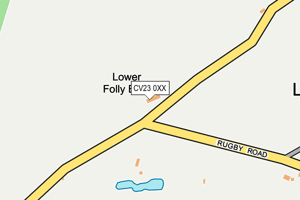
CV23 0XX is located in the Braunston and Crick electoral ward, within the unitary authority of West Northamptonshire and the English Parliamentary constituency of Daventry. The Sub Integrated Care Board (ICB) Location is NHS Northamptonshire ICB - 78H and the police force is Northamptonshire. This postcode has been in use since April 2017.


GetTheData
Source: OS OpenMap – Local (Ordnance Survey)
Source: OS VectorMap District (Ordnance Survey)
Licence: Open Government Licence (requires attribution)
| Easting | 455812 |
| Northing | 277146 |
| Latitude | 52.389520 |
| Longitude | -1.181305 |
GetTheData
Source: Open Postcode Geo
Licence: Open Government Licence
| Country | England |
| Postcode District | CV23 |
➜ See where CV23 is on a map | |
GetTheData
Source: Land Registry Price Paid Data
Licence: Open Government Licence
| Ward | Braunston And Crick |
| Constituency | Daventry |
GetTheData
Source: ONS Postcode Database
Licence: Open Government Licence
| Phone Box (The Green) | Lilbourne | 439m |
| Phone Box (The Green) | Lilbourne | 443m |
| Cherry Tree (Main Street) | Catthorpe | 1,110m |
| Cherry Tree (Main Street) | Catthorpe | 1,121m |
| Dunsmore House (Lilbourne Road) | Clifton Upon Dunsmore | 1,458m |
| Rugby Station | 4.8km |
GetTheData
Source: NaPTAN
Licence: Open Government Licence
GetTheData
Source: ONS Postcode Database
Licence: Open Government Licence


➜ Get more ratings from the Food Standards Agency
GetTheData
Source: Food Standards Agency
Licence: FSA terms & conditions
| Last Collection | |||
|---|---|---|---|
| Location | Mon-Fri | Sat | Distance |
| Swinford Rso | 17:00 | 11:30 | 2,652m |
| Stanford On Avon | 16:30 | 10:30 | 3,503m |
| School Street | 16:30 | 11:30 | 3,785m |
GetTheData
Source: Dracos
Licence: Creative Commons Attribution-ShareAlike
The below table lists the International Territorial Level (ITL) codes (formerly Nomenclature of Territorial Units for Statistics (NUTS) codes) and Local Administrative Units (LAU) codes for CV23 0XX:
| ITL 1 Code | Name |
|---|---|
| TLF | East Midlands (England) |
| ITL 2 Code | Name |
| TLF2 | Leicestershire, Rutland and Northamptonshire |
| ITL 3 Code | Name |
| TLF24 | West Northamptonshire |
| LAU 1 Code | Name |
| E07000151 | Daventry |
GetTheData
Source: ONS Postcode Directory
Licence: Open Government Licence
The below table lists the Census Output Area (OA), Lower Layer Super Output Area (LSOA), and Middle Layer Super Output Area (MSOA) for CV23 0XX:
| Code | Name | |
|---|---|---|
| OA | E00137480 | |
| LSOA | E01027030 | Daventry 001C |
| MSOA | E02005619 | Daventry 001 |
GetTheData
Source: ONS Postcode Directory
Licence: Open Government Licence
| CV23 0SP | Rugby Road | 379m |
| CV23 0SR | The Green | 425m |
| CV23 0TE | Green Farm Close | 449m |
| CV23 0SU | The Horsepool | 456m |
| CV23 0TF | Old Inn Court | 475m |
| CV23 0SS | Hillmorton Lane | 504m |
| CV23 0SX | Station Road | 511m |
| CV23 0PG | Tower Cottages | 529m |
| CV23 0ST | Chapel Lane | 535m |
| CV23 0TG | Stonehouse Court | 571m |
GetTheData
Source: Open Postcode Geo; Land Registry Price Paid Data
Licence: Open Government Licence