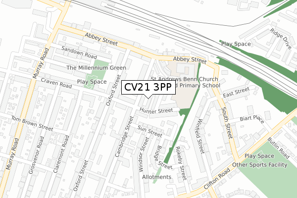
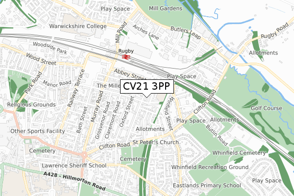
CV21 3PP is located in the Benn electoral ward, within the local authority district of Rugby and the English Parliamentary constituency of Rugby. The Sub Integrated Care Board (ICB) Location is NHS Coventry and Warwickshire ICB - B2M3M and the police force is Warwickshire. This postcode has been in use since September 2017.


GetTheData
Source: OS Open Zoomstack (Ordnance Survey)
Licence: Open Government Licence (requires attribution)
Attribution: Contains OS data © Crown copyright and database right 2025
Source: Open Postcode Geo
Licence: Open Government Licence (requires attribution)
Attribution: Contains OS data © Crown copyright and database right 2025; Contains Royal Mail data © Royal Mail copyright and database right 2025; Source: Office for National Statistics licensed under the Open Government Licence v.3.0
| Easting | 451403 |
| Northing | 275578 |
| Latitude | 52.375856 |
| Longitude | -1.246325 |
GetTheData
Source: Open Postcode Geo
Licence: Open Government Licence
| Country | England |
| Postcode District | CV21 |
➜ See where CV21 is on a map ➜ Where is Rugby? | |
GetTheData
Source: Land Registry Price Paid Data
Licence: Open Government Licence
| Ward | Benn |
| Constituency | Rugby |
GetTheData
Source: ONS Postcode Database
Licence: Open Government Licence
| Windsor Street (Sun Street) | Rugby | 103m |
| Winfield Street (Clifton Road) | Rugby | 347m |
| Rokeby Street (Clifton Road) | Rugby | 365m |
| Clifton Road (Eastlands Road) | Rugby | 376m |
| Windsor Street (Clifton Road) | Rugby | 379m |
| Rugby Station | 0.5km |
GetTheData
Source: NaPTAN
Licence: Open Government Licence
| Percentage of properties with Next Generation Access | 100.0% |
| Percentage of properties with Superfast Broadband | 100.0% |
| Percentage of properties with Ultrafast Broadband | 0.0% |
| Percentage of properties with Full Fibre Broadband | 0.0% |
Superfast Broadband is between 30Mbps and 300Mbps
Ultrafast Broadband is > 300Mbps
| Percentage of properties unable to receive 2Mbps | 0.0% |
| Percentage of properties unable to receive 5Mbps | 0.0% |
| Percentage of properties unable to receive 10Mbps | 0.0% |
| Percentage of properties unable to receive 30Mbps | 0.0% |
GetTheData
Source: Ofcom
Licence: Ofcom Terms of Use (requires attribution)
GetTheData
Source: ONS Postcode Database
Licence: Open Government Licence


➜ Get more ratings from the Food Standards Agency
GetTheData
Source: Food Standards Agency
Licence: FSA terms & conditions
| Last Collection | |||
|---|---|---|---|
| Location | Mon-Fri | Sat | Distance |
| Cambridge Street | 17:00 | 12:00 | 141m |
| Clifton Road Post Office | 17:15 | 12:10 | 384m |
| Murray Road | 17:15 | 12:15 | 389m |
GetTheData
Source: Dracos
Licence: Creative Commons Attribution-ShareAlike
The below table lists the International Territorial Level (ITL) codes (formerly Nomenclature of Territorial Units for Statistics (NUTS) codes) and Local Administrative Units (LAU) codes for CV21 3PP:
| ITL 1 Code | Name |
|---|---|
| TLG | West Midlands (England) |
| ITL 2 Code | Name |
| TLG1 | Herefordshire, Worcestershire and Warwickshire |
| ITL 3 Code | Name |
| TLG13 | Warwickshire CC |
| LAU 1 Code | Name |
| E07000220 | Rugby |
GetTheData
Source: ONS Postcode Directory
Licence: Open Government Licence
The below table lists the Census Output Area (OA), Lower Layer Super Output Area (LSOA), and Middle Layer Super Output Area (MSOA) for CV21 3PP:
| Code | Name | |
|---|---|---|
| OA | E00158686 | |
| LSOA | E01031130 | Rugby 005A |
| MSOA | E02006496 | Rugby 005 |
GetTheData
Source: ONS Postcode Directory
Licence: Open Government Licence
| CV21 3NT | Corbett Street | 35m |
| CV21 3NP | Cambridge Street | 46m |
| CV21 3NS | Hunter Street | 53m |
| CV21 3FH | Cambridge Street | 54m |
| CV21 3LT | Hunter Street | 57m |
| CV21 3NJ | Cambridge Street | 77m |
| CV21 3ND | Cross Street | 81m |
| CV21 3NN | Sun Street | 88m |
| CV21 3NX | Chester Street | 108m |
| CV21 3NW | Sun Street | 112m |
GetTheData
Source: Open Postcode Geo; Land Registry Price Paid Data
Licence: Open Government Licence