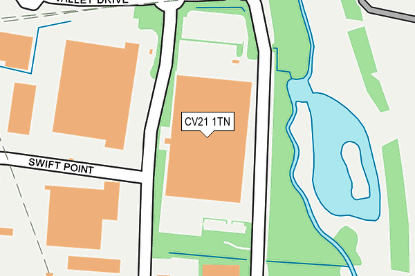
CV21 1TN is located in the Newbold and Brownsover electoral ward, within the local authority district of Rugby and the English Parliamentary constituency of Rugby. The Sub Integrated Care Board (ICB) Location is NHS Coventry and Warwickshire ICB - B2M3M and the police force is Warwickshire. This postcode has been in use since December 1998.


GetTheData
Source: OS OpenMap – Local (Ordnance Survey)
Source: OS VectorMap District (Ordnance Survey)
Licence: Open Government Licence (requires attribution)
| Easting | 450095 |
| Northing | 278178 |
| Latitude | 52.399332 |
| Longitude | -1.265162 |
GetTheData
Source: Open Postcode Geo
Licence: Open Government Licence
| Country | England |
| Postcode District | CV21 |
➜ See where CV21 is on a map ➜ Where is Rugby? | |
GetTheData
Source: Land Registry Price Paid Data
Licence: Open Government Licence
Elevation or altitude of CV21 1TN as distance above sea level:
| Metres | Feet | |
|---|---|---|
| Elevation | 90m | 295ft |
Elevation is measured from the approximate centre of the postcode, to the nearest point on an OS contour line from OS Terrain 50, which has contour spacing of ten vertical metres.
➜ How high above sea level am I? Find the elevation of your current position using your device's GPS.
GetTheData
Source: Open Postcode Elevation
Licence: Open Government Licence
| Ward | Newbold And Brownsover |
| Constituency | Rugby |
GetTheData
Source: ONS Postcode Database
Licence: Open Government Licence
| Cosford Lane (Valley Lane) | Swift Valley | 127m |
| Valley Drive (Cosford Lane) | Swift Valley | 130m |
| Coates Distribution (Cosford Lane) | Swift Valley | 271m |
| Coates Distribution (Cosford Lane) | Swift Valley | 275m |
| Brownsover Road (Valley Drive) | Swift Valley | 584m |
| Rugby Station | 2.5km |
GetTheData
Source: NaPTAN
Licence: Open Government Licence
GetTheData
Source: ONS Postcode Database
Licence: Open Government Licence

➜ Get more ratings from the Food Standards Agency
GetTheData
Source: Food Standards Agency
Licence: FSA terms & conditions
| Last Collection | |||
|---|---|---|---|
| Location | Mon-Fri | Sat | Distance |
| Glebe Farm Road Business Box | 982m | ||
| Star Farm | 17:30 | 12:30 | 1,036m |
| Hollowell Way | 17:00 | 12:00 | 1,366m |
GetTheData
Source: Dracos
Licence: Creative Commons Attribution-ShareAlike
| Risk of CV21 1TN flooding from rivers and sea | Low |
| ➜ CV21 1TN flood map | |
GetTheData
Source: Open Flood Risk by Postcode
Licence: Open Government Licence
The below table lists the International Territorial Level (ITL) codes (formerly Nomenclature of Territorial Units for Statistics (NUTS) codes) and Local Administrative Units (LAU) codes for CV21 1TN:
| ITL 1 Code | Name |
|---|---|
| TLG | West Midlands (England) |
| ITL 2 Code | Name |
| TLG1 | Herefordshire, Worcestershire and Warwickshire |
| ITL 3 Code | Name |
| TLG13 | Warwickshire CC |
| LAU 1 Code | Name |
| E07000220 | Rugby |
GetTheData
Source: ONS Postcode Directory
Licence: Open Government Licence
The below table lists the Census Output Area (OA), Lower Layer Super Output Area (LSOA), and Middle Layer Super Output Area (MSOA) for CV21 1TN:
| Code | Name | |
|---|---|---|
| OA | E00168343 | |
| LSOA | E01032892 | Rugby 001G |
| MSOA | E02006492 | Rugby 001 |
GetTheData
Source: ONS Postcode Directory
Licence: Open Government Licence
| CV21 1QN | Cosford Lane | 292m |
| CV21 1TQ | Valley Drive | 422m |
| CV21 1DS | Leigh Road | 496m |
| CV21 1TF | Prospect Park | 644m |
| CV21 1UF | Magnolia Avenue | 786m |
| CV21 1ST | Hadrians Way | 843m |
| CV21 1SA | Cypress Road | 883m |
| CV21 1HU | Brownsover Lane | 896m |
| CV21 1RF | Hawthorn Close | 908m |
| CV21 1HS | Trusteel Houses | 920m |
GetTheData
Source: Open Postcode Geo; Land Registry Price Paid Data
Licence: Open Government Licence