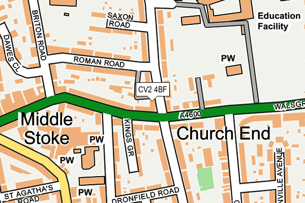
CV2 4BF is located in the St Michael's electoral ward, within the metropolitan district of Coventry and the English Parliamentary constituency of Coventry South. The Sub Integrated Care Board (ICB) Location is NHS Coventry and Warwickshire ICB - B2M3M and the police force is West Midlands. This postcode has been in use since June 2017.


GetTheData
Source: OS OpenMap – Local (Ordnance Survey)
Source: OS VectorMap District (Ordnance Survey)
Licence: Open Government Licence (requires attribution)
| Easting | 434663 |
| Northing | 279144 |
| Latitude | 52.409225 |
| Longitude | -1.491851 |
GetTheData
Source: Open Postcode Geo
Licence: Open Government Licence
| Country | England |
| Postcode District | CV2 |
➜ See where CV2 is on a map ➜ Where is Coventry? | |
GetTheData
Source: Land Registry Price Paid Data
Licence: Open Government Licence
| Ward | St Michael's |
| Constituency | Coventry South |
GetTheData
Source: ONS Postcode Database
Licence: Open Government Licence
| Gosford Green (Sky Blue Way) | Gosford Green | 102m |
| All Saints Lane (Oxford St) | Gosford Green | 106m |
| Gosford Green (Sky Blue Way) | Gosford Green | 115m |
| Gosford Green (Far Gosford St) | Gosford Green | 126m |
| All Saints Lane (Oxford St) | Gosford Green | 127m |
| Coventry Station | 1.7km |
| Canley Station | 3.9km |
| Coventry Arena Station | 4.3km |
GetTheData
Source: NaPTAN
Licence: Open Government Licence
GetTheData
Source: ONS Postcode Database
Licence: Open Government Licence

➜ Get more ratings from the Food Standards Agency
GetTheData
Source: Food Standards Agency
Licence: FSA terms & conditions
| Last Collection | |||
|---|---|---|---|
| Location | Mon-Fri | Sat | Distance |
| Grafton Street | 19:00 | 10:00 | 152m |
| Paynes Lane | 18:45 | 09:45 | 171m |
| Swan Lane | 16:30 | 09:45 | 207m |
GetTheData
Source: Dracos
Licence: Creative Commons Attribution-ShareAlike
The below table lists the International Territorial Level (ITL) codes (formerly Nomenclature of Territorial Units for Statistics (NUTS) codes) and Local Administrative Units (LAU) codes for CV2 4BF:
| ITL 1 Code | Name |
|---|---|
| TLG | West Midlands (England) |
| ITL 2 Code | Name |
| TLG3 | West Midlands |
| ITL 3 Code | Name |
| TLG33 | Coventry |
| LAU 1 Code | Name |
| E08000026 | Coventry |
GetTheData
Source: ONS Postcode Directory
Licence: Open Government Licence
The below table lists the Census Output Area (OA), Lower Layer Super Output Area (LSOA), and Middle Layer Super Output Area (MSOA) for CV2 4BF:
| Code | Name | |
|---|---|---|
| OA | E00048791 | |
| LSOA | E01009635 | Coventry 028C |
| MSOA | E02001985 | Coventry 028 |
GetTheData
Source: ONS Postcode Directory
Licence: Open Government Licence
| CV2 4FN | Lansdowne Street | 44m |
| CV2 4RJ | Brunel Close | 51m |
| CV1 5LN | Paynes Lane | 80m |
| CV2 4FR | Britannia Street | 87m |
| CV2 4FU | King Richard Street | 94m |
| CV2 4FS | Britannia Street | 135m |
| CV2 4HE | Walsgrave Road | 144m |
| CV2 4FP | Grantham Street | 166m |
| CV1 5EH | Oxford Street | 172m |
| CV3 1HZ | Binley Road | 176m |
GetTheData
Source: Open Postcode Geo; Land Registry Price Paid Data
Licence: Open Government Licence