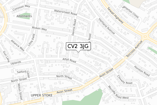
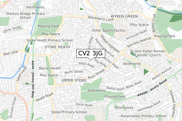
CV2 3JG is in Alfred Road, Coventry. CV2 3JG is located in the Upper Stoke electoral ward, within the metropolitan district of Coventry and the English Parliamentary constituency of Coventry North East. The Sub Integrated Care Board (ICB) Location is NHS Coventry and Warwickshire ICB - B2M3M and the police force is West Midlands. This postcode has been in use since January 2019.


GetTheData
Source: OS Open Zoomstack (Ordnance Survey)
Licence: Open Government Licence (requires attribution)
Attribution: Contains OS data © Crown copyright and database right 2025
Source: Open Postcode Geo
Licence: Open Government Licence (requires attribution)
Attribution: Contains OS data © Crown copyright and database right 2025; Contains Royal Mail data © Royal Mail copyright and database right 2025; Source: Office for National Statistics licensed under the Open Government Licence v.3.0
| Easting | 435781 |
| Northing | 280302 |
| Latitude | 52.419564 |
| Longitude | -1.475294 |
GetTheData
Source: Open Postcode Geo
Licence: Open Government Licence
| Locality | Alfred Road |
| Town/City | Coventry |
| Country | England |
| Postcode District | CV2 |
➜ See where CV2 is on a map ➜ Where is Coventry? | |
GetTheData
Source: Land Registry Price Paid Data
Licence: Open Government Licence
| Ward | Upper Stoke |
| Constituency | Coventry North East |
GetTheData
Source: ONS Postcode Database
Licence: Open Government Licence
4, FREDERICK FELL WALK, COVENTRY, CV2 3JG 2019 18 JUL £220,000 |
1, FREDERICK FELL WALK, COVENTRY, CV2 3JG 2019 10 MAY £220,000 |
GetTheData
Source: HM Land Registry Price Paid Data
Licence: Contains HM Land Registry data © Crown copyright and database right 2025. This data is licensed under the Open Government Licence v3.0.
| Dennis Rd (Alfall Rd) | Upper Stoke | 47m |
| Dennis Rd (Alfall Rd) | Upper Stoke | 108m |
| Stubbs Grove (Alfall Rd) | Upper Stoke | 180m |
| Alfall Rd (Avon St) | Upper Stoke | 212m |
| Stubbs Grove (Alfall Rd) | Upper Stoke | 220m |
| Coventry Station | 3.3km |
| Coventry Arena Station | 3.4km |
| Canley Station | 5.4km |
GetTheData
Source: NaPTAN
Licence: Open Government Licence
| Percentage of properties with Next Generation Access | 100.0% |
| Percentage of properties with Superfast Broadband | 100.0% |
| Percentage of properties with Ultrafast Broadband | 0.0% |
| Percentage of properties with Full Fibre Broadband | 0.0% |
Superfast Broadband is between 30Mbps and 300Mbps
Ultrafast Broadband is > 300Mbps
| Percentage of properties unable to receive 2Mbps | 0.0% |
| Percentage of properties unable to receive 5Mbps | 0.0% |
| Percentage of properties unable to receive 10Mbps | 0.0% |
| Percentage of properties unable to receive 30Mbps | 0.0% |
GetTheData
Source: Ofcom
Licence: Ofcom Terms of Use (requires attribution)
GetTheData
Source: ONS Postcode Database
Licence: Open Government Licence


➜ Get more ratings from the Food Standards Agency
GetTheData
Source: Food Standards Agency
Licence: FSA terms & conditions
| Last Collection | |||
|---|---|---|---|
| Location | Mon-Fri | Sat | Distance |
| Wykley Road | 17:30 | 11:15 | 501m |
| Powell Road | 17:30 | 10:00 | 831m |
| Sewell Highway/Wyken Grange | 17:30 | 11:15 | 887m |
GetTheData
Source: Dracos
Licence: Creative Commons Attribution-ShareAlike
The below table lists the International Territorial Level (ITL) codes (formerly Nomenclature of Territorial Units for Statistics (NUTS) codes) and Local Administrative Units (LAU) codes for CV2 3JG:
| ITL 1 Code | Name |
|---|---|
| TLG | West Midlands (England) |
| ITL 2 Code | Name |
| TLG3 | West Midlands |
| ITL 3 Code | Name |
| TLG33 | Coventry |
| LAU 1 Code | Name |
| E08000026 | Coventry |
GetTheData
Source: ONS Postcode Directory
Licence: Open Government Licence
The below table lists the Census Output Area (OA), Lower Layer Super Output Area (LSOA), and Middle Layer Super Output Area (MSOA) for CV2 3JG:
| Code | Name | |
|---|---|---|
| OA | E00048868 | |
| LSOA | E01009658 | Coventry 021C |
| MSOA | E02001978 | Coventry 021 |
GetTheData
Source: ONS Postcode Directory
Licence: Open Government Licence
| CV2 3HN | Dennis Road | 55m |
| CV2 3HL | Dennis Road | 81m |
| CV2 3GX | Clovelly Road | 86m |
| CV2 3GG | Alfall Road | 98m |
| CV2 3GF | Alfall Road | 104m |
| CV2 3HJ | Wyken Way | 118m |
| CV2 3GT | Clovelly Road | 128m |
| CV2 3GE | Geoffrey Close | 141m |
| CV2 3GW | Clovelly Road | 155m |
| CV2 3GB | Alfall Road | 156m |
GetTheData
Source: Open Postcode Geo; Land Registry Price Paid Data
Licence: Open Government Licence