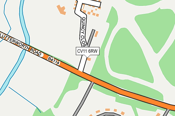
CV11 6RW is located in the Bulkington electoral ward, within the local authority district of Nuneaton and Bedworth and the English Parliamentary constituency of Rugby. The Sub Integrated Care Board (ICB) Location is NHS Coventry and Warwickshire ICB - B2M3M and the police force is Warwickshire. This postcode has been in use since January 1993.


GetTheData
Source: OS OpenMap – Local (Ordnance Survey)
Source: OS VectorMap District (Ordnance Survey)
Licence: Open Government Licence (requires attribution)
| Easting | 440334 |
| Northing | 289091 |
| Latitude | 52.498239 |
| Longitude | -1.407299 |
GetTheData
Source: Open Postcode Geo
Licence: Open Government Licence
| Country | England |
| Postcode District | CV11 |
➜ See where CV11 is on a map ➜ Where is Bramcote? | |
GetTheData
Source: Land Registry Price Paid Data
Licence: Open Government Licence
Elevation or altitude of CV11 6RW as distance above sea level:
| Metres | Feet | |
|---|---|---|
| Elevation | 100m | 328ft |
Elevation is measured from the approximate centre of the postcode, to the nearest point on an OS contour line from OS Terrain 50, which has contour spacing of ten vertical metres.
➜ How high above sea level am I? Find the elevation of your current position using your device's GPS.
GetTheData
Source: Open Postcode Elevation
Licence: Open Government Licence
| Ward | Bulkington |
| Constituency | Rugby |
GetTheData
Source: ONS Postcode Database
Licence: Open Government Licence
| Bramcote Hospital (Lutterworth Road) | Bramcote | 53m |
| Bramcote Hospital (Lutterworth Road) | Bramcote | 69m |
| Bramcote Barracks (Buzzard Road) | Bramcote | 732m |
| Bramcote Barracks (Bazzard Road) | Bramcote | 732m |
| Cicey Lane (Hinckley Road) | Burton Hastings | 1,081m |
| Bermuda Park Station | 4.4km |
| Bedworth Station | 4.6km |
| Hinckley Station | 4.7km |
GetTheData
Source: NaPTAN
Licence: Open Government Licence
GetTheData
Source: ONS Postcode Database
Licence: Open Government Licence


➜ Get more ratings from the Food Standards Agency
GetTheData
Source: Food Standards Agency
Licence: FSA terms & conditions
| Last Collection | |||
|---|---|---|---|
| Location | Mon-Fri | Sat | Distance |
| Burton Hastings Post Office | 16:00 | 09:00 | 1,099m |
| Whitestone Post Office | 17:00 | 11:30 | 2,116m |
| Gypsy Lane | 17:30 | 11:30 | 2,204m |
GetTheData
Source: Dracos
Licence: Creative Commons Attribution-ShareAlike
The below table lists the International Territorial Level (ITL) codes (formerly Nomenclature of Territorial Units for Statistics (NUTS) codes) and Local Administrative Units (LAU) codes for CV11 6RW:
| ITL 1 Code | Name |
|---|---|
| TLG | West Midlands (England) |
| ITL 2 Code | Name |
| TLG1 | Herefordshire, Worcestershire and Warwickshire |
| ITL 3 Code | Name |
| TLG13 | Warwickshire CC |
| LAU 1 Code | Name |
| E07000219 | Nuneaton and Bedworth |
GetTheData
Source: ONS Postcode Directory
Licence: Open Government Licence
The below table lists the Census Output Area (OA), Lower Layer Super Output Area (LSOA), and Middle Layer Super Output Area (MSOA) for CV11 6RW:
| Code | Name | |
|---|---|---|
| OA | E00158385 | |
| LSOA | E01031069 | Nuneaton and Bedworth 014C |
| MSOA | E02006488 | Nuneaton and Bedworth 014 |
GetTheData
Source: ONS Postcode Directory
Licence: Open Government Licence
| CV11 6RA | Lutterworth Road | 622m |
| CV11 6RB | Lutterworth Road | 1047m |
| CV11 6RJ | 1073m | |
| CV11 6UW | Slade Close | 1179m |
| CV11 6GE | Cavendish Walk | 1194m |
| CV11 6RG | Hinckley Road | 1214m |
| CV11 6GP | Lavenham Close | 1257m |
| CV11 6RQ | Townsends Close | 1291m |
| CV11 6PW | Lutterworth Road | 1303m |
| CV11 6XG | Thornhill Drive | 1304m |
GetTheData
Source: Open Postcode Geo; Land Registry Price Paid Data
Licence: Open Government Licence