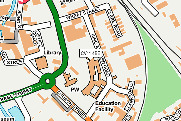
CV11 4BE is located in the Abbey electoral ward, within the local authority district of Nuneaton and Bedworth and the English Parliamentary constituency of Nuneaton. The Sub Integrated Care Board (ICB) Location is NHS Coventry and Warwickshire ICB - B2M3M and the police force is Warwickshire. This postcode has been in use since January 1980.


GetTheData
Source: OS OpenMap – Local (Ordnance Survey)
Source: OS VectorMap District (Ordnance Survey)
Licence: Open Government Licence (requires attribution)
| Easting | 436624 |
| Northing | 291724 |
| Latitude | 52.522170 |
| Longitude | -1.461657 |
GetTheData
Source: Open Postcode Geo
Licence: Open Government Licence
| Country | England |
| Postcode District | CV11 |
➜ See where CV11 is on a map ➜ Where is Nuneaton? | |
GetTheData
Source: Land Registry Price Paid Data
Licence: Open Government Licence
Elevation or altitude of CV11 4BE as distance above sea level:
| Metres | Feet | |
|---|---|---|
| Elevation | 80m | 262ft |
Elevation is measured from the approximate centre of the postcode, to the nearest point on an OS contour line from OS Terrain 50, which has contour spacing of ten vertical metres.
➜ How high above sea level am I? Find the elevation of your current position using your device's GPS.
GetTheData
Source: Open Postcode Elevation
Licence: Open Government Licence
| Ward | Abbey |
| Constituency | Nuneaton |
GetTheData
Source: ONS Postcode Database
Licence: Open Government Licence
| Vicarage Street (Church Street) | Nuneaton | 144m |
| Mill Street (Church Street) | Nuneaton | 204m |
| Anker Street (Attleborough Road) | Nuneaton | 263m |
| Bus Station (Harefield Road) | Nuneaton | 404m |
| Riversley Road (Coton Road) | Nuneaton | 421m |
| Nuneaton Station | 0.5km |
| Bermuda Park Station | 2.4km |
| Bedworth Station | 4.8km |
GetTheData
Source: NaPTAN
Licence: Open Government Licence
GetTheData
Source: ONS Postcode Database
Licence: Open Government Licence


➜ Get more ratings from the Food Standards Agency
GetTheData
Source: Food Standards Agency
Licence: FSA terms & conditions
| Last Collection | |||
|---|---|---|---|
| Location | Mon-Fri | Sat | Distance |
| Stockingford Post Office | 17:00 | 12:00 | 400m |
| Coventry Street | 17:30 | 11:45 | 414m |
| Harefield Road | 17:15 | 11:30 | 440m |
GetTheData
Source: Dracos
Licence: Creative Commons Attribution-ShareAlike
The below table lists the International Territorial Level (ITL) codes (formerly Nomenclature of Territorial Units for Statistics (NUTS) codes) and Local Administrative Units (LAU) codes for CV11 4BE:
| ITL 1 Code | Name |
|---|---|
| TLG | West Midlands (England) |
| ITL 2 Code | Name |
| TLG1 | Herefordshire, Worcestershire and Warwickshire |
| ITL 3 Code | Name |
| TLG13 | Warwickshire CC |
| LAU 1 Code | Name |
| E07000219 | Nuneaton and Bedworth |
GetTheData
Source: ONS Postcode Directory
Licence: Open Government Licence
The below table lists the Census Output Area (OA), Lower Layer Super Output Area (LSOA), and Middle Layer Super Output Area (MSOA) for CV11 4BE:
| Code | Name | |
|---|---|---|
| OA | E00158266 | |
| LSOA | E01031043 | Nuneaton and Bedworth 005A |
| MSOA | E02006479 | Nuneaton and Bedworth 005 |
GetTheData
Source: ONS Postcode Directory
Licence: Open Government Licence
| CV11 4BQ | King Edward Road | 73m |
| CV11 4BB | King Edward Road | 143m |
| CV11 4BJ | Glebe Road | 148m |
| CV11 4BA | Clarkson Close | 168m |
| CV11 4BH | Wheat Street | 179m |
| CV11 4AT | Church Street | 184m |
| CV11 4BT | Orchard Street | 211m |
| CV11 4BP | Cooper Street | 231m |
| CV11 4HY | Attleborough Road | 232m |
| CV11 4BS | Orchard Street | 238m |
GetTheData
Source: Open Postcode Geo; Land Registry Price Paid Data
Licence: Open Government Licence