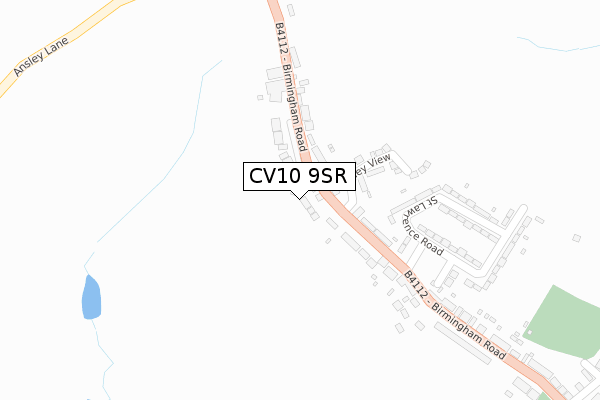
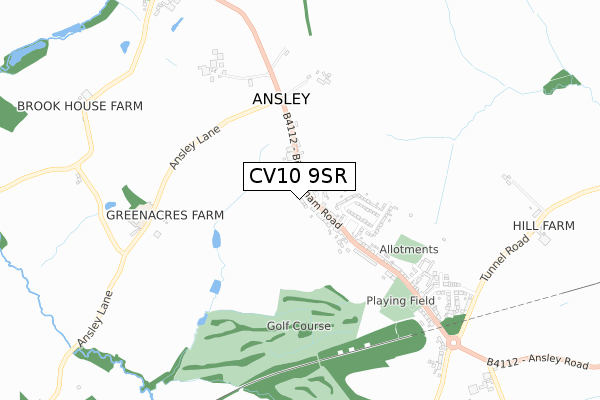
CV10 9SR is located in the Arley and Whitacre electoral ward, within the local authority district of North Warwickshire and the English Parliamentary constituency of Nuneaton. The Sub Integrated Care Board (ICB) Location is NHS Coventry and Warwickshire ICB - B2M3M and the police force is Warwickshire. This postcode has been in use since February 2020.


GetTheData
Source: OS Open Zoomstack (Ordnance Survey)
Licence: Open Government Licence (requires attribution)
Attribution: Contains OS data © Crown copyright and database right 2025
Source: Open Postcode Geo
Licence: Open Government Licence (requires attribution)
Attribution: Contains OS data © Crown copyright and database right 2025; Contains Royal Mail data © Royal Mail copyright and database right 2025; Source: Office for National Statistics licensed under the Open Government Licence v.3.0
| Easting | 429659 |
| Northing | 291723 |
| Latitude | 52.522600 |
| Longitude | -1.564296 |
GetTheData
Source: Open Postcode Geo
Licence: Open Government Licence
| Country | England |
| Postcode District | CV10 |
➜ See where CV10 is on a map ➜ Where is Ansley? | |
GetTheData
Source: Land Registry Price Paid Data
Licence: Open Government Licence
| Ward | Arley And Whitacre |
| Constituency | Nuneaton |
GetTheData
Source: ONS Postcode Database
Licence: Open Government Licence
2022 28 JAN £350,000 |
4, MARY CARROLL CLOSE, ANSLEY, NUNEATON, CV10 9SR 2020 4 DEC £352,500 |
1, MARY CARROLL CLOSE, ANSLEY, NUNEATON, CV10 9SR 2020 30 OCT £380,000 |
2020 24 JUL £337,000 |
2020 3 JUL £355,000 |
6, MARY CARROLL CLOSE, ANSLEY, NUNEATON, CV10 9SR 2020 29 MAY £330,000 |
5, MARY CARROLL CLOSE, ANSLEY, NUNEATON, CV10 9SR 2020 28 FEB £324,000 |
GetTheData
Source: HM Land Registry Price Paid Data
Licence: Contains HM Land Registry data © Crown copyright and database right 2025. This data is licensed under the Open Government Licence v3.0.
| Village Farm (Birmingham Road) | Ansley | 125m |
| Village Farm (Birmingham Road) | Ansley | 131m |
| Ludford Close (Birmingham Road) | Ansley | 161m |
| Ludford Close (Birmingham Road) | Ansley | 182m |
| Ansley Lane (Birmingham Road) | Ansley | 392m |
GetTheData
Source: NaPTAN
Licence: Open Government Licence
GetTheData
Source: ONS Postcode Database
Licence: Open Government Licence


➜ Get more ratings from the Food Standards Agency
GetTheData
Source: Food Standards Agency
Licence: FSA terms & conditions
| Last Collection | |||
|---|---|---|---|
| Location | Mon-Fri | Sat | Distance |
| Church End | 16:00 | 09:30 | 1,062m |
| Ansley Lane | 16:45 | 10:15 | 1,507m |
| Galley Common Post Office | 16:15 | 10:30 | 1,813m |
GetTheData
Source: Dracos
Licence: Creative Commons Attribution-ShareAlike
The below table lists the International Territorial Level (ITL) codes (formerly Nomenclature of Territorial Units for Statistics (NUTS) codes) and Local Administrative Units (LAU) codes for CV10 9SR:
| ITL 1 Code | Name |
|---|---|
| TLG | West Midlands (England) |
| ITL 2 Code | Name |
| TLG1 | Herefordshire, Worcestershire and Warwickshire |
| ITL 3 Code | Name |
| TLG13 | Warwickshire CC |
| LAU 1 Code | Name |
| E07000218 | North Warwickshire |
GetTheData
Source: ONS Postcode Directory
Licence: Open Government Licence
The below table lists the Census Output Area (OA), Lower Layer Super Output Area (LSOA), and Middle Layer Super Output Area (MSOA) for CV10 9SR:
| Code | Name | |
|---|---|---|
| OA | E00158055 | |
| LSOA | E01031005 | North Warwickshire 005A |
| MSOA | E02006472 | North Warwickshire 005 |
GetTheData
Source: ONS Postcode Directory
Licence: Open Government Licence
| CV10 9PS | Birmingham Road | 63m |
| CV10 9PN | St Lawrence Road | 246m |
| CV10 9PR | Malthouse Close | 278m |
| CV10 9PW | St Lawrence Road | 305m |
| CV10 9PL | Birmingham Road | 321m |
| CV10 9PY | Wyatts Way | 397m |
| CV10 9PT | Goldsby Croft | 513m |
| CV10 9PQ | Birmingham Road | 513m |
| CV10 9PU | Cloverfield Cottages | 542m |
| CV10 9PX | Croft Mead | 565m |
GetTheData
Source: Open Postcode Geo; Land Registry Price Paid Data
Licence: Open Government Licence