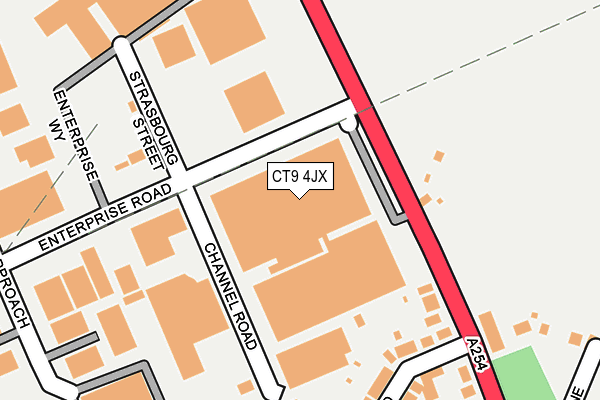
CT9 4JX is located in the Salmestone electoral ward, within the local authority district of Thanet and the English Parliamentary constituency of North Thanet. The Sub Integrated Care Board (ICB) Location is NHS Kent and Medway ICB - 91Q and the police force is Kent. This postcode has been in use since March 2017.


GetTheData
Source: OS OpenMap – Local (Ordnance Survey)
Source: OS VectorMap District (Ordnance Survey)
Licence: Open Government Licence (requires attribution)
| Easting | 636219 |
| Northing | 168604 |
| Latitude | 51.367346 |
| Longitude | 1.392240 |
GetTheData
Source: Open Postcode Geo
Licence: Open Government Licence
| Country | England |
| Postcode District | CT9 |
➜ See where CT9 is on a map ➜ Where is Margate? | |
GetTheData
Source: Land Registry Price Paid Data
Licence: Open Government Licence
| Ward | Salmestone |
| Constituency | North Thanet |
GetTheData
Source: ONS Postcode Database
Licence: Open Government Licence
| B And Q (Ramsgate Road) | Westwood | 104m |
| Gordon Road (Margate Road) | Westwood | 188m |
| B And Q (Ramsgate Road) | Westwood | 192m |
| Gordon Road (Margate Road) | Westwood | 240m |
| Star Inn (Margate Road) | Westwood | 494m |
| Margate Station | 2.5km |
| Broadstairs Station | 3km |
| Ramsgate Station | 3.1km |
GetTheData
Source: NaPTAN
Licence: Open Government Licence
GetTheData
Source: ONS Postcode Database
Licence: Open Government Licence


➜ Get more ratings from the Food Standards Agency
GetTheData
Source: Food Standards Agency
Licence: FSA terms & conditions
| Last Collection | |||
|---|---|---|---|
| Location | Mon-Fri | Sat | Distance |
| Westwood Industrial Estate | 18:00 | 11:00 | 104m |
| Star | 16:00 | 11:30 | 401m |
| Chapel Hill | 16:00 | 11:00 | 513m |
GetTheData
Source: Dracos
Licence: Creative Commons Attribution-ShareAlike
The below table lists the International Territorial Level (ITL) codes (formerly Nomenclature of Territorial Units for Statistics (NUTS) codes) and Local Administrative Units (LAU) codes for CT9 4JX:
| ITL 1 Code | Name |
|---|---|
| TLJ | South East (England) |
| ITL 2 Code | Name |
| TLJ4 | Kent |
| ITL 3 Code | Name |
| TLJ44 | East Kent |
| LAU 1 Code | Name |
| E07000114 | Thanet |
GetTheData
Source: ONS Postcode Directory
Licence: Open Government Licence
The below table lists the Census Output Area (OA), Lower Layer Super Output Area (LSOA), and Middle Layer Super Output Area (MSOA) for CT9 4JX:
| Code | Name | |
|---|---|---|
| OA | E00125347 | |
| LSOA | E01024696 | Thanet 004E |
| MSOA | E02005135 | Thanet 004 |
GetTheData
Source: ONS Postcode Directory
Licence: Open Government Licence
| CT9 4EJ | Ramsgate Road | 164m |
| CT9 4DZ | Gordon Road | 217m |
| CT9 4DU | Ramsgate Road | 220m |
| CT9 4DY | Ramsgate Road | 330m |
| CT9 4JY | Ramsgate Road | 343m |
| CT9 4EH | Clive Road | 350m |
| CT9 4DX | Sloe Lane | 356m |
| CT9 4EB | Crossways Avenue | 357m |
| CT9 4EA | Gordon Road | 373m |
| CT9 4ES | Elmley Way | 374m |
GetTheData
Source: Open Postcode Geo; Land Registry Price Paid Data
Licence: Open Government Licence