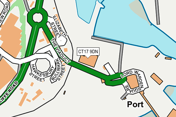
CT17 9DN is located in the Town & Castle electoral ward, within the local authority district of Dover and the English Parliamentary constituency of Dover. The Sub Integrated Care Board (ICB) Location is NHS Kent and Medway ICB - 91Q and the police force is Kent. This postcode has been in use since June 1999.


GetTheData
Source: OS OpenMap – Local (Ordnance Survey)
Source: OS VectorMap District (Ordnance Survey)
Licence: Open Government Licence (requires attribution)
| Easting | 631742 |
| Northing | 140408 |
| Latitude | 51.116073 |
| Longitude | 1.309780 |
GetTheData
Source: Open Postcode Geo
Licence: Open Government Licence
| Country | England |
| Postcode District | CT17 |
➜ See where CT17 is on a map ➜ Where is Dover? | |
GetTheData
Source: Land Registry Price Paid Data
Licence: Open Government Licence
Elevation or altitude of CT17 9DN as distance above sea level:
| Metres | Feet | |
|---|---|---|
| Elevation | 0m | 0ft |
Elevation is measured from the approximate centre of the postcode, to the nearest point on an OS contour line from OS Terrain 50, which has contour spacing of ten vertical metres.
➜ How high above sea level am I? Find the elevation of your current position using your device's GPS.
GetTheData
Source: Open Postcode Elevation
Licence: Open Government Licence
| Ward | Town & Castle |
| Constituency | Dover |
GetTheData
Source: ONS Postcode Database
Licence: Open Government Licence
| Cruise Liner Terminal (Admiralty Pier) | Dover | 221m |
| Hammond's Garage (Limekiln Street) | Dover | 262m |
| Hammond's Garage (Limekiln Street) | Dover | 282m |
| Megger Factory (Archcliffe Road) | Western Heights | 351m |
| Knights Templars (Citadel Road) | Western Heights | 537m |
| Dover Priory Station | 1.1km |
| Kearsney Station | 4.6km |
GetTheData
Source: NaPTAN
Licence: Open Government Licence
GetTheData
Source: ONS Postcode Database
Licence: Open Government Licence


➜ Get more ratings from the Food Standards Agency
GetTheData
Source: Food Standards Agency
Licence: FSA terms & conditions
| Last Collection | |||
|---|---|---|---|
| Location | Mon-Fri | Sat | Distance |
| Cross Wall Quay | 18:00 | 11:30 | 367m |
| Snargate Street | 18:00 | 11:30 | 520m |
| Citadel Barracks | 18:00 | 09:15 | 749m |
GetTheData
Source: Dracos
Licence: Creative Commons Attribution-ShareAlike
The below table lists the International Territorial Level (ITL) codes (formerly Nomenclature of Territorial Units for Statistics (NUTS) codes) and Local Administrative Units (LAU) codes for CT17 9DN:
| ITL 1 Code | Name |
|---|---|
| TLJ | South East (England) |
| ITL 2 Code | Name |
| TLJ4 | Kent |
| ITL 3 Code | Name |
| TLJ44 | East Kent |
| LAU 1 Code | Name |
| E07000108 | Dover |
GetTheData
Source: ONS Postcode Directory
Licence: Open Government Licence
The below table lists the Census Output Area (OA), Lower Layer Super Output Area (LSOA), and Middle Layer Super Output Area (MSOA) for CT17 9DN:
| Code | Name | |
|---|---|---|
| OA | E00123108 | |
| LSOA | E01024249 | Dover 013E |
| MSOA | E02005053 | Dover 013 |
GetTheData
Source: ONS Postcode Directory
Licence: Open Government Licence
| CT17 9DX | Knights Templars | 567m |
| CT17 9DA | Snargate Street | 567m |
| CT17 9DW | Western Close | 596m |
| CT17 9ES | Gloster Ropewalk | 646m |
| CT17 9DU | Heights Terrace | 715m |
| CT17 9BZ | Snargate Street | 723m |
| CT17 9DP | Citadel Road | 745m |
| CT17 9DS | Citadel Heights | 758m |
| CT17 9AT | Adrian Street | 824m |
| CT16 1JT | Cambridge Terrace | 845m |
GetTheData
Source: Open Postcode Geo; Land Registry Price Paid Data
Licence: Open Government Licence