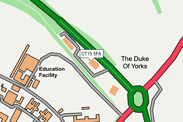
CT15 5FA is located in the Guston, Kingsdown & St Margaret's-at-Cliffe electoral ward, within the local authority district of Dover and the English Parliamentary constituency of Dover. The Sub Integrated Care Board (ICB) Location is NHS Kent and Medway ICB - 91Q and the police force is Kent. This postcode has been in use since December 1995.


GetTheData
Source: OS OpenMap – Local (Ordnance Survey)
Source: OS VectorMap District (Ordnance Survey)
Licence: Open Government Licence (requires attribution)
| Easting | 632968 |
| Northing | 143719 |
| Latitude | 51.145298 |
| Longitude | 1.329404 |
GetTheData
Source: Open Postcode Geo
Licence: Open Government Licence
| Country | England |
| Postcode District | CT15 |
➜ See where CT15 is on a map | |
GetTheData
Source: Land Registry Price Paid Data
Licence: Open Government Licence
Elevation or altitude of CT15 5FA as distance above sea level:
| Metres | Feet | |
|---|---|---|
| Elevation | 120m | 394ft |
Elevation is measured from the approximate centre of the postcode, to the nearest point on an OS contour line from OS Terrain 50, which has contour spacing of ten vertical metres.
➜ How high above sea level am I? Find the elevation of your current position using your device's GPS.
GetTheData
Source: Open Postcode Elevation
Licence: Open Government Licence
| Ward | Guston, Kingsdown & St Margaret's-at-cliffe |
| Constituency | Dover |
GetTheData
Source: ONS Postcode Database
Licence: Open Government Licence
| Duke Of York School (A258) | Guston | 393m |
| Duke Of York School (A258) | Guston | 424m |
| Swingate Inn (A258) | Guston | 674m |
| Swingate Inn (A258 To Dover) | Guston | 675m |
| Lucklow Close (Burgoyne Heights) | Dover | 779m |
| Dover Priory Station | 2.8km |
| Martin Mill Station | 3.1km |
| Kearsney Station | 4km |
GetTheData
Source: NaPTAN
Licence: Open Government Licence
GetTheData
Source: ONS Postcode Database
Licence: Open Government Licence


➜ Get more ratings from the Food Standards Agency
GetTheData
Source: Food Standards Agency
Licence: FSA terms & conditions
| Last Collection | |||
|---|---|---|---|
| Location | Mon-Fri | Sat | Distance |
| Guston Road | 16:00 | 09:00 | 749m |
| Burgoyne Road | 16:00 | 09:30 | 769m |
| Guston | 16:00 | 09:00 | 1,039m |
GetTheData
Source: Dracos
Licence: Creative Commons Attribution-ShareAlike
The below table lists the International Territorial Level (ITL) codes (formerly Nomenclature of Territorial Units for Statistics (NUTS) codes) and Local Administrative Units (LAU) codes for CT15 5FA:
| ITL 1 Code | Name |
|---|---|
| TLJ | South East (England) |
| ITL 2 Code | Name |
| TLJ4 | Kent |
| ITL 3 Code | Name |
| TLJ44 | East Kent |
| LAU 1 Code | Name |
| E07000108 | Dover |
GetTheData
Source: ONS Postcode Directory
Licence: Open Government Licence
The below table lists the Census Output Area (OA), Lower Layer Super Output Area (LSOA), and Middle Layer Super Output Area (MSOA) for CT15 5FA:
| Code | Name | |
|---|---|---|
| OA | E00171557 | |
| LSOA | E01024238 | Dover 012B |
| MSOA | E02005052 | Dover 012 |
GetTheData
Source: ONS Postcode Directory
Licence: Open Government Licence
| CT15 5ES | Brickfield Cottages | 660m |
| CT15 5DP | Swingate Cottages | 676m |
| CT15 5LX | Namur Place | 714m |
| CT15 5LU | Dunkirk Square | 721m |
| CT15 5LH | Lucknow Close | 725m |
| CT15 5EJ | Dover Road | 774m |
| CT15 5EH | Dover Road | 786m |
| CT15 5LJ | Kohima Place | 811m |
| CT15 5EN | Dover Road | 839m |
| CT15 5LZ | Anzio Crescent | 922m |
GetTheData
Source: Open Postcode Geo; Land Registry Price Paid Data
Licence: Open Government Licence