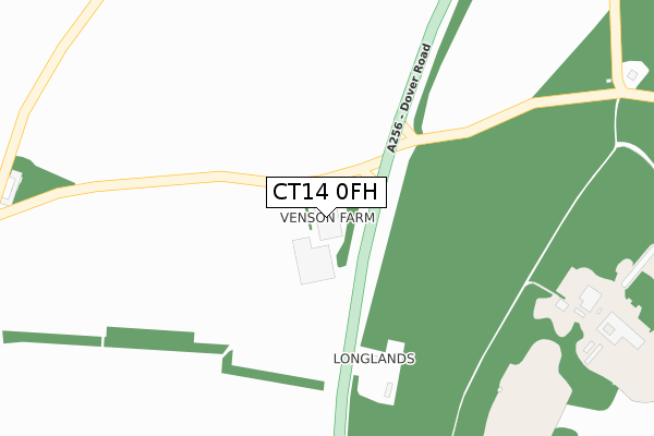
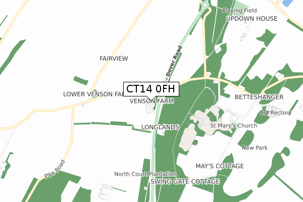
CT14 0FH is located in the Eastry Rural electoral ward, within the local authority district of Dover and the English Parliamentary constituency of Dover. The Sub Integrated Care Board (ICB) Location is NHS Kent and Medway ICB - 91Q and the police force is Kent. This postcode has been in use since November 2017.


GetTheData
Source: OS Open Zoomstack (Ordnance Survey)
Licence: Open Government Licence (requires attribution)
Attribution: Contains OS data © Crown copyright and database right 2024
Source: Open Postcode Geo
Licence: Open Government Licence (requires attribution)
Attribution: Contains OS data © Crown copyright and database right 2024; Contains Royal Mail data © Royal Mail copyright and database right 2024; Source: Office for National Statistics licensed under the Open Government Licence v.3.0
| Easting | 630593 |
| Northing | 152713 |
| Latitude | 51.227005 |
| Longitude | 1.301307 |
GetTheData
Source: Open Postcode Geo
Licence: Open Government Licence
| Country | England |
| Postcode District | CT14 |
➜ See where CT14 is on a map | |
GetTheData
Source: Land Registry Price Paid Data
Licence: Open Government Licence
| Ward | Eastry Rural |
| Constituency | Dover |
GetTheData
Source: ONS Postcode Database
Licence: Open Government Licence
| Betteshanger Turn (A259 Dover Road) | Betteshanger | 102m |
| Betteshanger Turn (A256 Dover Road) | Betteshanger | 175m |
| Doves Corner (Dover Road) | Tilmanstone | 1,164m |
| Doves Corner (Dover Road) | Tilmanstone | 1,179m |
| Updown Lane (Northbourne Road) | Betteshanger | 1,282m |
| Sandwich Station | 5.6km |
| Shepherds Well Station | 6.6km |
GetTheData
Source: NaPTAN
Licence: Open Government Licence
GetTheData
Source: ONS Postcode Database
Licence: Open Government Licence


➜ Get more ratings from the Food Standards Agency
GetTheData
Source: Food Standards Agency
Licence: FSA terms & conditions
| Last Collection | |||
|---|---|---|---|
| Location | Mon-Fri | Sat | Distance |
| Betteshanger Park | 16:00 | 10:00 | 893m |
| Doves Corner | 16:15 | 09:00 | 1,193m |
| Upper Tilmanstone | 16:00 | 09:00 | 1,464m |
GetTheData
Source: Dracos
Licence: Creative Commons Attribution-ShareAlike
The below table lists the International Territorial Level (ITL) codes (formerly Nomenclature of Territorial Units for Statistics (NUTS) codes) and Local Administrative Units (LAU) codes for CT14 0FH:
| ITL 1 Code | Name |
|---|---|
| TLJ | South East (England) |
| ITL 2 Code | Name |
| TLJ4 | Kent |
| ITL 3 Code | Name |
| TLJ44 | East Kent |
| LAU 1 Code | Name |
| E07000108 | Dover |
GetTheData
Source: ONS Postcode Directory
Licence: Open Government Licence
The below table lists the Census Output Area (OA), Lower Layer Super Output Area (LSOA), and Middle Layer Super Output Area (MSOA) for CT14 0FH:
| Code | Name | |
|---|---|---|
| OA | E00122857 | |
| LSOA | E01024200 | Dover 008A |
| MSOA | E02005048 | Dover 008 |
GetTheData
Source: ONS Postcode Directory
Licence: Open Government Licence
| CT14 0JX | Dover Road | 225m |
| CT14 0NL | 514m | |
| CT14 0JU | Dover Road | 1058m |
| CT14 0JS | St Marys Grove | 1191m |
| CT14 0JL | School Road | 1316m |
| CT14 0EF | Updown | 1320m |
| CT14 0JW | Upper Street | 1334m |
| CT14 0JJ | School Road | 1366m |
| CT13 0JN | Dover Road | 1366m |
| CT13 0JJ | Pond Cottages | 1399m |
GetTheData
Source: Open Postcode Geo; Land Registry Price Paid Data
Licence: Open Government Licence