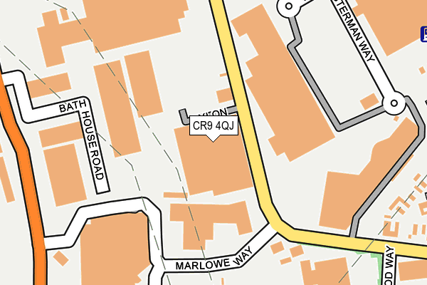
CR9 4QJ lies on Beddington Farm Road in Croydon. CR9 4QJ is located in the Beddington electoral ward, within the London borough of Sutton and the English Parliamentary constituency of Carshalton and Wallington. The Sub Integrated Care Board (ICB) Location is NHS South West London ICB - 36L and the police force is Metropolitan Police. This postcode has been in use since February 1990.


GetTheData
Source: OS OpenMap – Local (Ordnance Survey)
Source: OS VectorMap District (Ordnance Survey)
Licence: Open Government Licence (requires attribution)
| Easting | 530376 |
| Northing | 166012 |
| Latitude | 51.378198 |
| Longitude | -0.128087 |
GetTheData
Source: Open Postcode Geo
Licence: Open Government Licence
| Street | Beddington Farm Road |
| Town/City | Croydon |
| Country | England |
| Postcode District | CR9 |
➜ Where is London? | |
GetTheData
Source: Land Registry Price Paid Data
Licence: Open Government Licence
Elevation or altitude of CR9 4QJ as distance above sea level:
| Metres | Feet | |
|---|---|---|
| Elevation | 40m | 131ft |
Elevation is measured from the approximate centre of the postcode, to the nearest point on an OS contour line from OS Terrain 50, which has contour spacing of ten vertical metres.
➜ How high above sea level am I? Find the elevation of your current position using your device's GPS.
GetTheData
Source: Open Postcode Elevation
Licence: Open Government Licence
| Ward | Beddington |
| Constituency | Carshalton And Wallington |
GetTheData
Source: ONS Postcode Database
Licence: Open Government Licence
| Marlowe Way (Beddington Farm Road) | Waddon | 60m |
| Marlowe Way (Beddington Farm Road) | Waddon | 84m |
| Valley Park Retail Park | Waddon | 171m |
| Valley Park Retail Park | Waddon | 179m |
| Beddington Asda (Marlowe Way) | Beddington | 272m |
| Ampere Way Tram Stop (Ampere Way) | Broad Green | 551m |
| Waddon Marsh Tram Stop (Off Gurney Crescent) | Waddon | 712m |
| Therapia Lane Tram Stop (Off Alfriston Ave) | Broad Green | 837m |
| Wandle Park Tram Stop (Vicarage Road) | Waddon | 1,161m |
| Beddington Lane Tram Stop (Off Beddington Lane) | Beddington Corner | 1,571m |
| Waddon Station | 1.4km |
| West Croydon Station | 1.8km |
| Hackbridge Station | 1.8km |
GetTheData
Source: NaPTAN
Licence: Open Government Licence
GetTheData
Source: ONS Postcode Database
Licence: Open Government Licence


➜ Get more ratings from the Food Standards Agency
GetTheData
Source: Food Standards Agency
Licence: FSA terms & conditions
| Last Collection | |||
|---|---|---|---|
| Location | Mon-Fri | Sat | Distance |
| Croydon Mail Centre | 19:30 | 13:00 | 216m |
| Croydon Mail Centre | 19:15 | 13:00 | 219m |
| Asda Instore Box | 18:15 | 12:00 | 256m |
GetTheData
Source: Dracos
Licence: Creative Commons Attribution-ShareAlike
The below table lists the International Territorial Level (ITL) codes (formerly Nomenclature of Territorial Units for Statistics (NUTS) codes) and Local Administrative Units (LAU) codes for CR9 4QJ:
| ITL 1 Code | Name |
|---|---|
| TLI | London |
| ITL 2 Code | Name |
| TLI6 | Outer London - South |
| ITL 3 Code | Name |
| TLI63 | Merton, Kingston upon Thames and Sutton |
| LAU 1 Code | Name |
| E09000029 | Sutton |
GetTheData
Source: ONS Postcode Directory
Licence: Open Government Licence
The below table lists the Census Output Area (OA), Lower Layer Super Output Area (LSOA), and Middle Layer Super Output Area (MSOA) for CR9 4QJ:
| Code | Name | |
|---|---|---|
| OA | E00020536 | |
| LSOA | E01004076 | Sutton 011A |
| MSOA | E02000850 | Sutton 011 |
GetTheData
Source: ONS Postcode Directory
Licence: Open Government Licence
| CR0 4YA | Hesterman Way | 248m |
| CR0 4TH | Beddington Lane | 310m |
| CR0 4XR | Broadfield Close | 503m |
| CR0 4UN | Harrington Close | 523m |
| CR0 4XQ | Brazil Close | 529m |
| CR0 4XB | Beddington Farm Road | 540m |
| CR0 4WT | Ampere Way | 573m |
| CR0 4TB | Beddington Lane | 594m |
| CR0 4TJ | Beddington Lane | 600m |
| CR0 4UR | Kelvin Gardens | 607m |
GetTheData
Source: Open Postcode Geo; Land Registry Price Paid Data
Licence: Open Government Licence