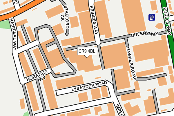
CR9 4DL is located in the Waddon electoral ward, within the London borough of Croydon and the English Parliamentary constituency of Croydon South. The Sub Integrated Care Board (ICB) Location is NHS South West London ICB - 36L and the police force is Metropolitan Police. This postcode has been in use since January 1980.


GetTheData
Source: OS OpenMap – Local (Ordnance Survey)
Source: OS VectorMap District (Ordnance Survey)
Licence: Open Government Licence (requires attribution)
| Easting | 530881 |
| Northing | 163951 |
| Latitude | 51.359559 |
| Longitude | -0.121567 |
GetTheData
Source: Open Postcode Geo
Licence: Open Government Licence
| Country | England |
| Postcode District | CR9 |
➜ Where is London? | |
GetTheData
Source: Land Registry Price Paid Data
Licence: Open Government Licence
Elevation or altitude of CR9 4DL as distance above sea level:
| Metres | Feet | |
|---|---|---|
| Elevation | 60m | 197ft |
Elevation is measured from the approximate centre of the postcode, to the nearest point on an OS contour line from OS Terrain 50, which has contour spacing of ten vertical metres.
➜ How high above sea level am I? Find the elevation of your current position using your device's GPS.
GetTheData
Source: Open Postcode Elevation
Licence: Open Government Licence
| Ward | Waddon |
| Constituency | Croydon South |
GetTheData
Source: ONS Postcode Database
Licence: Open Government Licence
| The Chase Stafford Road (Stafford Road) | Beddington | 266m |
| The Chase Stafford Road (Stafford Road) | Beddington | 271m |
| Imperial Way (Purley Way) | Waddon | 303m |
| Hannibal Way (Stafford Road) | South Beddington | 315m |
| Coldharbour Road | Waddon | 320m |
| Waddon Station | 0.9km |
| South Croydon Station | 2km |
| Wallington Station | 2km |
GetTheData
Source: NaPTAN
Licence: Open Government Licence
GetTheData
Source: ONS Postcode Database
Licence: Open Government Licence
➜ Get more ratings from the Food Standards Agency
GetTheData
Source: Food Standards Agency
Licence: FSA terms & conditions
| Last Collection | |||
|---|---|---|---|
| Location | Mon-Fri | Sat | Distance |
| High View Tso | 18:30 | 12:00 | 281m |
| Imperial Way | 19:00 | 284m | |
| Coldharbour Road (132) | 19:00 | 12:00 | 351m |
GetTheData
Source: Dracos
Licence: Creative Commons Attribution-ShareAlike
The below table lists the International Territorial Level (ITL) codes (formerly Nomenclature of Territorial Units for Statistics (NUTS) codes) and Local Administrative Units (LAU) codes for CR9 4DL:
| ITL 1 Code | Name |
|---|---|
| TLI | London |
| ITL 2 Code | Name |
| TLI6 | Outer London - South |
| ITL 3 Code | Name |
| TLI62 | Croydon |
| LAU 1 Code | Name |
| E09000008 | Croydon |
GetTheData
Source: ONS Postcode Directory
Licence: Open Government Licence
The below table lists the Census Output Area (OA), Lower Layer Super Output Area (LSOA), and Middle Layer Super Output Area (MSOA) for CR9 4DL:
| Code | Name | |
|---|---|---|
| OA | E00005843 | |
| LSOA | E01001172 | Croydon 028D |
| MSOA | E02000221 | Croydon 028 |
GetTheData
Source: ONS Postcode Directory
Licence: Open Government Licence
| CR0 4GE | Kings Way | 253m |
| CR0 4RR | Imperial Way | 274m |
| SM6 8PN | Stafford Road | 278m |
| CR0 4NH | Stafford Road | 300m |
| CR0 4RF | Purley Way | 320m |
| CR0 4RJ | Purley Way | 320m |
| SM6 8ND | The Parade | 331m |
| SM6 8PL | East Avenue | 334m |
| SM6 8NB | The Chase | 335m |
| SM6 8PQ | Highview Avenue | 357m |
GetTheData
Source: Open Postcode Geo; Land Registry Price Paid Data
Licence: Open Government Licence